
Chiang Dao is a limestone mountain district about 72 kilometres north of Chiang Mai, roughly two hours by road, worth visiting for its caves, forest temples, quiet valleys, and the country’s highest limestone peak. The name carries a piece of local legend: the mountain was said to stand “phiang dao”, as high as the stars, and the old town of Phiang Dao that grew below it later softened in speech to Chiang Dao. A practical first trip is two days and one night. Spend the first day around Ban Tham, where Chiang Dao Cave, Wat Tham Pha Plong, mountain views, and a handful of small farms and workshops share one valley. Use the second day for a single northern direction, usually Pha Daeng National Park, Arunothai, or Mueang Khong.
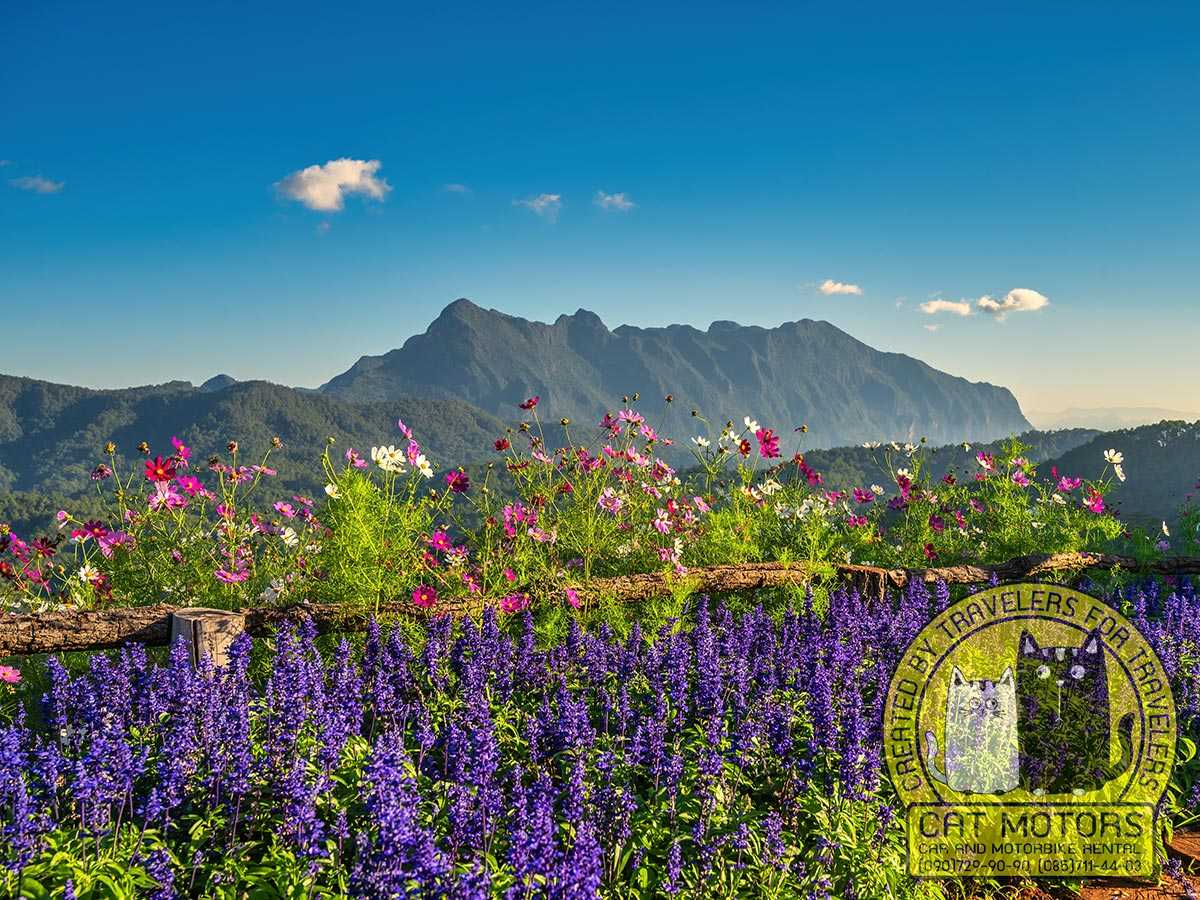
Highway 107 runs north out of Chiang Mai and takes you straight there: 72 kilometres to Chiang Dao Town, another five or six west to Ban Tham and the cave, and about two hours in the saddle before you start stopping to look at things.
A focused day trip from Chiang Mai works when it stays in the main valley. Three days or more open up San Pa Kia, Ban Na Lao Mai, Mueang Khong, or a longer push north. The Doi Luang Chiang Dao trek is a separate protected programme with its own registration and season, not something you add to a sightseeing day.
One thing to understand before you plan anything: Chiang Dao is not a town you walk around. It is a district of separate valleys and roads, and the mistake that wastes a day is treating scattered places as if they sat next to each other.
Our advice: we have rented motorbikes and scooters in Chiang Mai for years, and Chiang Dao is one of the routes our riders take most. The single most useful thing we tell them is to pick one zone per day and commit to it. Chiang Dao punishes the itinerary that tries to reach the cave, a northern hot spring, and a highland viewpoint in the same afternoon: you spend the day on Highway 107 instead of in the places you came for.
Contents
show
Is Chiang Dao Worth Visiting?
Yes. Chiang Dao is a quiet limestone district in the far north of Chiang Mai province, built around Doi Luang Chiang Dao, the third-highest mountain in Thailand and its highest limestone peak. It rewards anyone drawn to caves, forest temples, village food, quiet roads, and a slow mountain setting. Chiang Dao has no single blockbuster attraction that sells the trip on its own; its appeal is the relationship between Doi Luang, the cave system at its base, the farming valley, the northern communities, and the roads climbing into the highlands. Skip it, or save it for another trip, if what you want is nightlife, shopping, or a compact resort centre you can explore on foot.
Chiang Dao began as a small local centre in the former Lanna kingdom before becoming a formal district in the early twentieth century. Northern Thai, Shan (known in Thailand as Tai Yai), Yunnanese Chinese, and highland influences are still visible in the temples, markets, food, village architecture, and place names, and that mix is a large part of why the district rewards more than a single cave stop.
An overnight stay leaves time to explore Ban Tham without rushing and to start a northern route the next morning. The town itself provides services, though the main experiences are scattered across separate valleys, so plan for distance and do not expect a walkable centre.
Understanding Chiang Dao Before You Plan
Chiang Dao is a district spread across separate valleys, and a hotel described as “in Chiang Dao” may sit beside Highway 107, beneath Doi Luang at Ban Tham, north toward Pha Daeng, or deep in a highland valley an hour further on. Booking the wrong one for your plan is the quiet way to lose half a day.
Four zones keep the route clear.
Chiang Dao Town is the service centre on Highway 107: fuel, banks, pharmacies, markets, restaurants, repair shops, and public transport. It is a working local town, busiest in the morning around the food stalls and the main road, and it is the junction where the routes split, west to Ban Tham, north toward Pha Daeng and Arunothai, and off toward Mueang Khong and the highlands. Stay here if you arrive late, depend on buses, or want an early start further north; the trade-off is that you are not waking up under the mountain.
Ban Tham and the cave district sit at the eastern base of Doi Luang. Chiang Dao Cave, Wat Tham Pha Plong, mountain-facing roads, cafes, small resorts, and farmland all lie within the same local area, which makes this the natural first-day base and the best place to watch Doi Luang change through the evening.
Northern Chiang Dao begins around Mueang Ngai and runs toward Pha Daeng National Park and Arunothai, mixing Shan-influenced temples, the King Naresuan Memorial, forest, mineral springs, waterfalls, and Yunnanese Chinese community history.
The remote highlands reach San Pa Kia, Ban Na Lao Mai, Mueang Khong, Den TV, and Doi Kham Fa by slower side roads. Treat them as overnight destinations. The last few kilometres decide which vehicle you need, and they change with the weather.
How Many Days Do You Need in Chiang Dao?
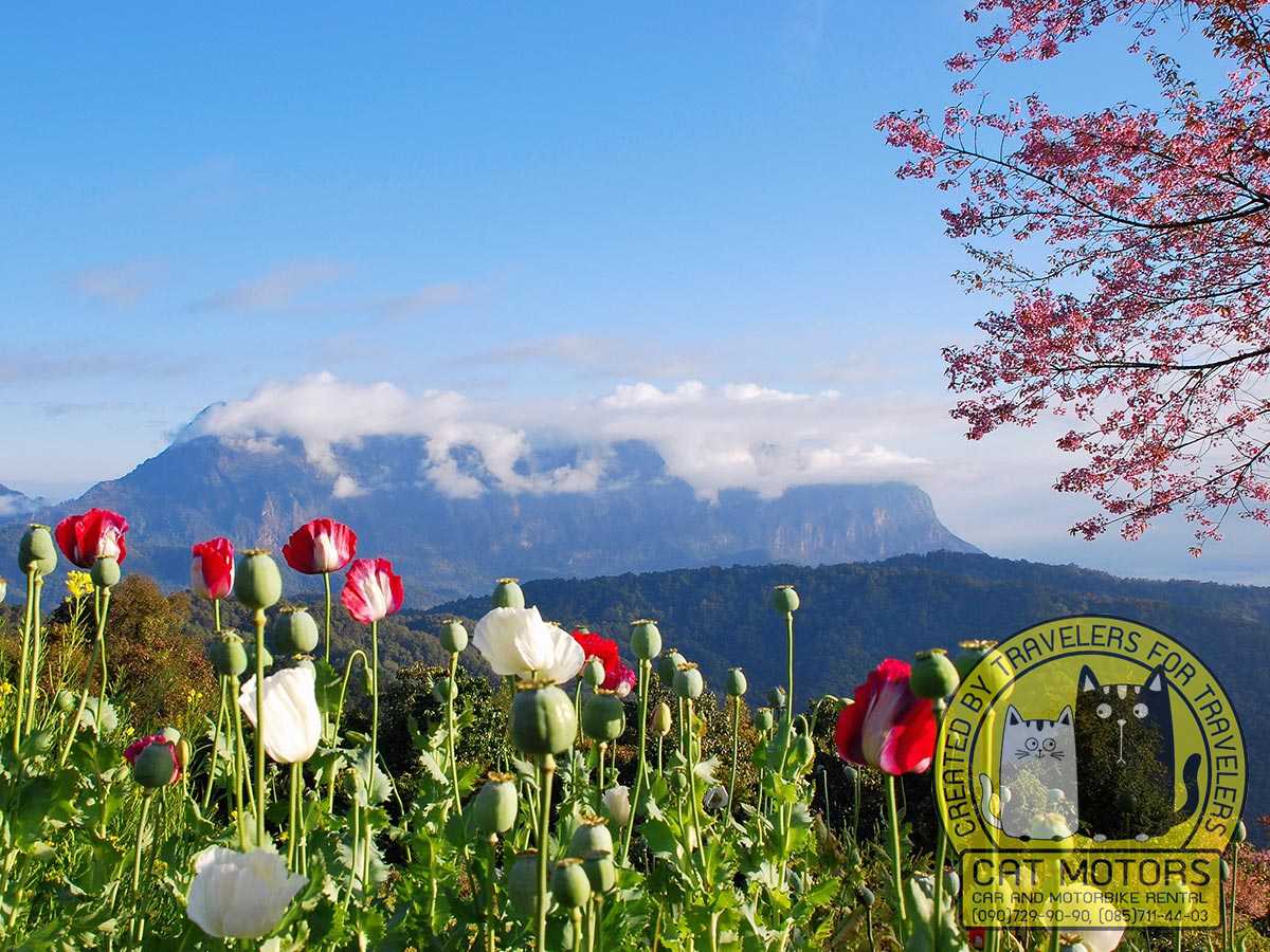
Two days and one night suits most first visits. One day covers Ban Tham. A second day buys you one northern direction, Pha Daeng, Arunothai, or Mueang Khong. A third makes room for a highland village, San Pa Kia, or a push further north. Plan by zone, and let the number of days decide how many zones you reach.
One day
Keep a one-day trip inside Ban Tham: Chiang Dao Cave in the morning, lunch nearby, Wat Tham Pha Plong afterwards, and any spare time on the valley roads, a cafe, or the local hot spring. Bua Tong Sticky Waterfall can be added only by cutting the Chiang Dao side down to the cave and temple; the separate Bua Tong Sticky Waterfall guide covers that detour.
Two days and one night
Give the first day to the cave district and the second to one northern route. Sleep in Ban Tham for the mountain and the early cave, or in town for transport and services. On day two, pair Pong Arng and Sri Sangwan in the park, or make Arunothai the day for Yunnanese food and community history, or choose Mueang Khong for a rural valley and a dawn viewpoint. The overnight also absorbs the delays that a day trip cannot: a longer cave route, a slow lunch, rain, a temple climb.
Three days or more
Give the third day one clear purpose: San Pa Kia and Doi Mae Taman, the Lisu homestays at Ban Na Lao Mai, an overnight in Mueang Khong, or a continuation toward Fang and Doi Ang Khang. A longer stay also supports birdwatching, photography, meditation, or simply a slower valley pace. The Doi Luang trek stays a separate trip, because its registration, orientation, trekking days, and recovery time follow the sanctuary’s own programme.
Things to Do Around Chiang Dao Town and Ban Tham
The cave and the forest temple anchor this zone. Hot springs, farms, theatre, and a small distillery fill it out for travellers with a specific interest.
Chiang Dao Cave
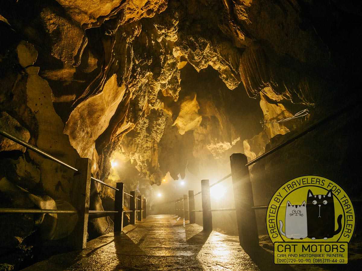
Chiang Dao Cave is a large limestone system beneath Doi Luang. A 2023 survey recorded more than five kilometres of interconnected passages, though ordinary visitors enter only the designated sections near the main entrance. The simplest route is Tham Phra Nawn, roughly 360 metres and fitted with electric light, holding Buddhist images, stalactites, stalagmites, and broad chambers. Two longer routes, commonly called Tham Kaew–Tham Nam and Tham Mued–Tham Ma, run around 730 metres and use local lamp guides through darker, narrower, more uneven ground.
Entry costs around 40 baht for foreign visitors. The unlit routes cannot be walked alone: a lamp guide is compulsory and costs about 200 baht for a small group rather than per head, with a tip on top, and the money goes to lamp fuel, cave upkeep, and the guides’ fund. The site runs from early morning to about five. These are local rates set at the gate, so read the board when you buy the ticket.
The entrance is also a religious site. Thai tradition connects the cave with Chao Luang Kham Daeng, a guardian figure of Chiang Dao; a distinctive 25-spired chedi is linked with the Shan hermit U Kanta and his followers in the early twentieth century, and a nearby hall with followers of the northern monk Kruba Srivichai. Wear footwear you can move in, dress for a temple, expect the visitor office to assign the route open that day, and know that water levels change which passages are accessible by season.
Wat Tham Pha Plong
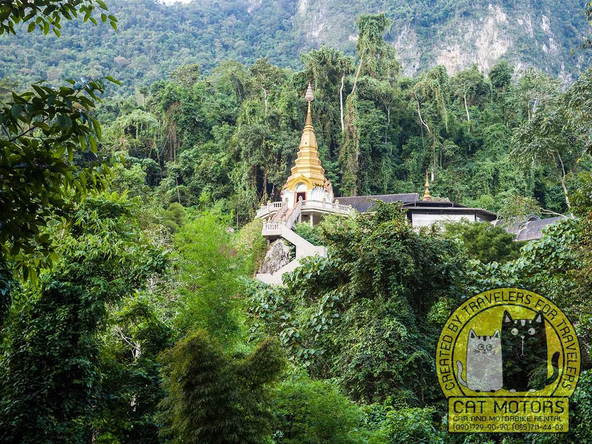
Wat Tham Pha Plong is a forest meditation temple above Ban Tham. Around 530 concrete steps climb through woodland, lined with Buddhist teachings that turn the ascent into a slow shift from the road to a quieter place. The temple is closely tied to Luang Pu Sim Phutthacaro, an important Thai forest meditation master who lived here, and the site reflects the forest tradition’s preference for caves and seclusion. The steps are wide and in good repair, but heat and humidity set the pace, so morning or later afternoon beats the middle of the day. Dress for a working temple, keep your voice down, and give space to people meditating. The climb and the quiet at the top are the point.
Chiang Dao Hot Spring
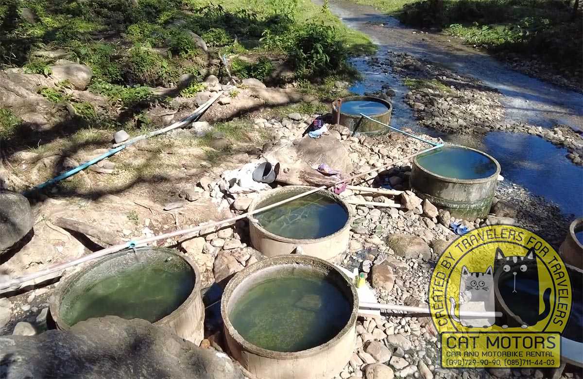
Chiang Dao has two separate hot springs, and articles constantly confuse them. The main-valley one, locally tied to Ban Yang Pu Toh and often signed as Chiang Dao Hot Spring, sits near Ban Tham; Pong Arng Hot Springs is a different place further north inside Pha Daeng National Park. This is a modest local bathing spot rather than a landscaped resort: warm water beside a stream, simple communal soaking, and a few private rooms. It fits naturally after the cave or the temple. Bring a small towel and respect local bathing practice.
Our advice: at the Chiang Dao hot spring the water is piped into soaking pools built from stacked concrete rings. It feeds in at the top and spills down from one pool to the next, so the upper rings run hotter and the lower ones cooler. If you are not sure how hot you like it, start low and work your way up. There is a cold stream right alongside, so you can cool off between soaks.
If you want something more private and more built up, the same site also has a paid onsen run by the village, with its own enclosed pools.
Pink Lotus Garden, Makhampom, and Choeng Doi
Three smaller stops in the valley, each worth a call ahead.
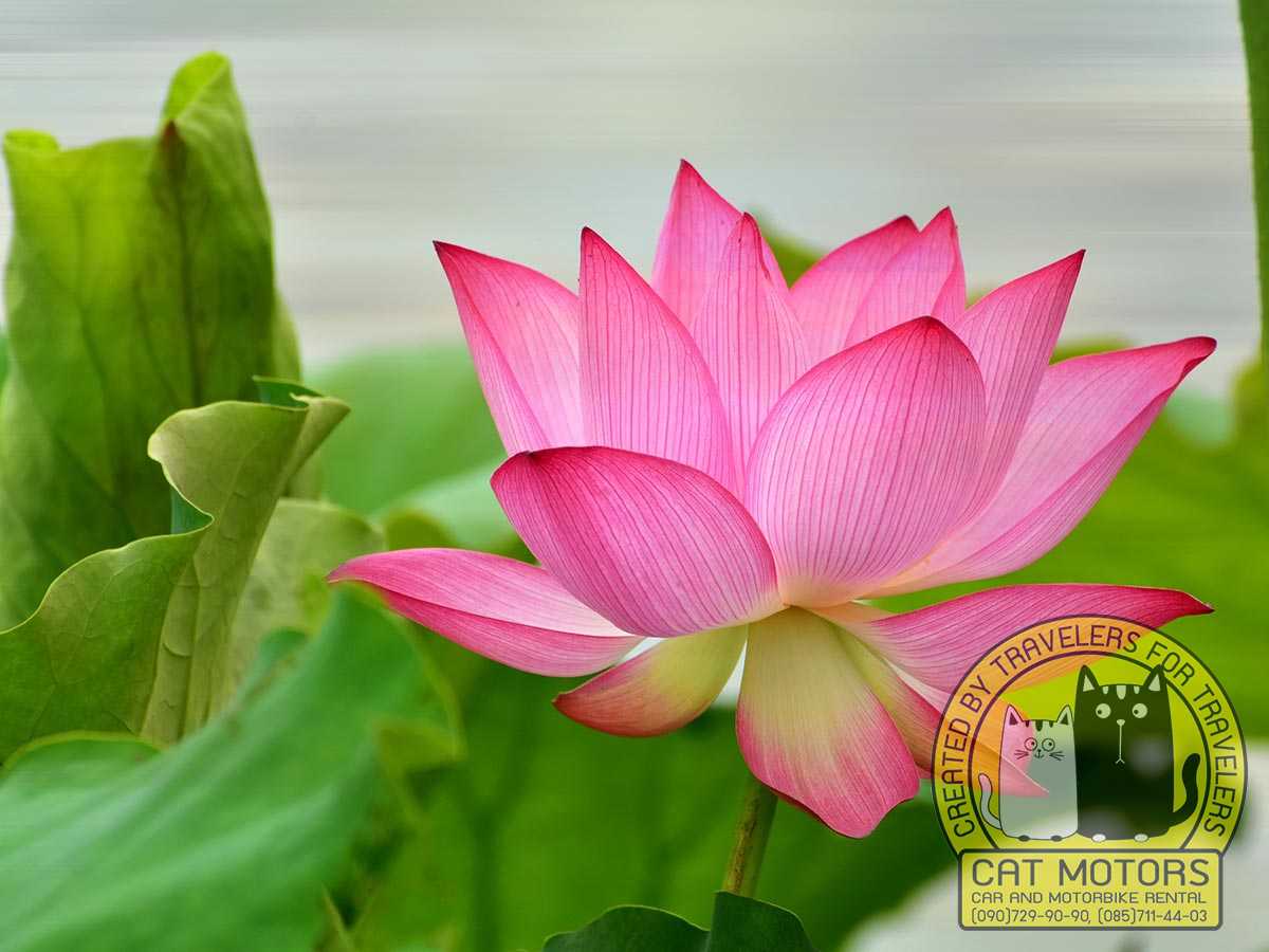
Suan Bua Chompoo Na Jomkiree, usually signed in English as Pink Lotus Garden, is an organic farm and the district’s agricultural learning centre, with Doi Luang standing behind the rice fields. Entry is free. What grows changes with the season: several rice varieties including hom nil and riceberry, roses and chrysanthemum raised for tea, organic salad and cold-climate vegetables, strawberries in the cool months, and a small planted woodland for mushrooms. There is a farm shop and a cafe working off the same produce, and you can pick vegetables yourself. One honest warning about the name: visitors have reported the lotus ponds standing empty, with staff saying the lotus growing had been dropped, so come for the farm, the roses, and the mountain view and treat lotus flowers as a bonus.
Makhampom Art Space sits about two kilometres east of town across the Ping bridge, among rice paddies, small lakes, and gardens. It belongs to the Makhampom Theatre Group, which has made socially engaged community theatre in Thailand since 1980. Entry is free, there is a cafe-gallery called Gooseberry, and rooms in the art house for anyone who wants to stay. How much there is to see depends on whether a performance, workshop, or residency is running, so message ahead.
Choeng Doi Distillery, at 99/9 Wang Jom, is the first licensed distillery in the district and opened to the public in November 2025. Visits are by booking only, at least 48 hours ahead, and start from around 420 baht: a signature cocktail, a walk through the distillery and the estate, then a guided tasting at the visitor centre, with longer full-day and multi-day programmes for anyone who wants to see production up close. The flagship is Sonklin, a rice spirit made from estate-grown Khao Niew Sanpatong sticky rice, double-distilled and filtered through coconut carbon, with the water coming off the Doi Luang Chiang Dao biosphere. The shop sells bottles you cannot buy elsewhere. If you are riding, keep the tasting away from the road: a non-drinking rider, a hired driver, or an overnight nearby.
Northern Chiang Dao and Pha Daeng National Park

The northern route begins around Mueang Ngai and runs through Pha Daeng National Park toward Arunothai, mixing Thai historical memory, Shan religious influence, mineral springs, waterfalls, and Yunnanese community history. Pong Arng and Sri Sangwan fit one park day; Arunothai needs more time and works better as the day’s main destination.
One naming point that trips people up: Pha Daeng National Park was originally declared as Chiang Dao National Park, and the old name still turns up on maps, signs, and booking sites. It is the same park. Entry for foreign visitors is 100 baht for an adult and 50 for a child, plus 20 baht for a motorbike or 30 for a car, and a single ticket covers both the hot springs and the waterfall on the same day, so keep it in your pocket.
Wat Phra That Doi Mon Ching
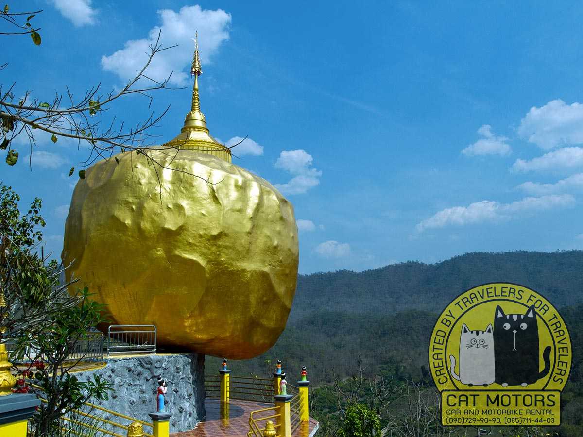
Wat Phra That Doi Mon Ching, in the Mueang Ngai area, reflects Shan (Tai Yai) religious influence, with a golden-rock form inspired by Kyaiktiyo in Myanmar that links it visually to a major regional pilgrimage tradition. Local accounts give the site a long history, while the visible structures reflect restoration and community patronage. Elevated above the road, it works well as the first cultural stop on a northern day; dress modestly and give time to the stupas, guardian figures, and the compound beyond the golden-rock replica.
King Naresuan Memorial
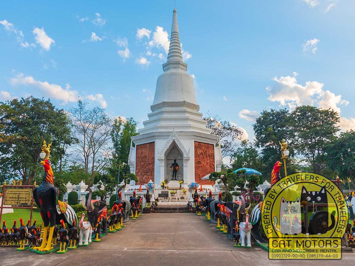
The King Naresuan Memorial in Mueang Ngai commemorates the Ayutthaya-era king whose northern campaigns hold an important place in Thai national memory, with local tradition tying the area to a camp or passage during operations toward the frontier. Statues and ceremonial space express the modern memory of Naresuan as a symbol of independence; treat it as a place of remembrance, since little survives as an archaeological site. A short, respectful visit fits before continuing toward Pha Daeng.
Pong Arng Hot Springs and Sri Sangwan Waterfall
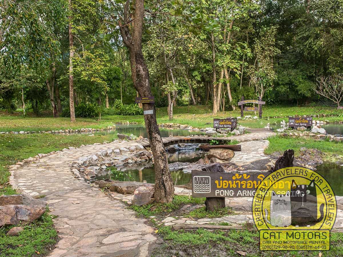
These two sit on the same park route and pair naturally. Pong Arng Hot Springs is a set of natural mineral pools in forest, with a camping ground and park accommodation beside them, and it suits a long soak and a break. Outlets differ in temperature, so test the water before you settle into a pool.
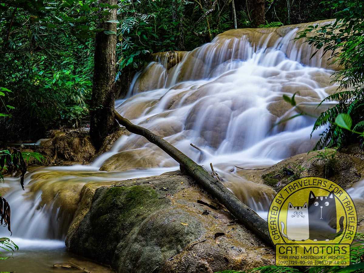
Sri Sangwan Waterfall drops about 20 metres over pale limestone in four tiers, each carrying its own Thai name, and it stands only 150 metres from the park office, so it costs almost no walking. The mineral crust gives it a cream-white colour unlike the darker forest falls common in the north, and because the limestone carries little moss the tiers are unusually easy to move between. Wet rock is still wet rock, so use the paths and wear footwear with grip. Bring bathing clothes, a towel, water, and cash for the park.
Arunothai Village
Arunothai is a Yunnanese Chinese community in northern Chiang Dao with historical links to soldiers and families of the former Chinese Nationalist, or Kuomintang, 93rd Division. Migration, border politics, and later settlement shaped a village whose food, language, religious practice, and architecture differ from the central Chiang Dao valley. This is the same displaced-army story that runs through the Yunnanese settlements along the northern border, and here it survives in ordinary streets, shops, and kitchens, with no museum needed to hold it.
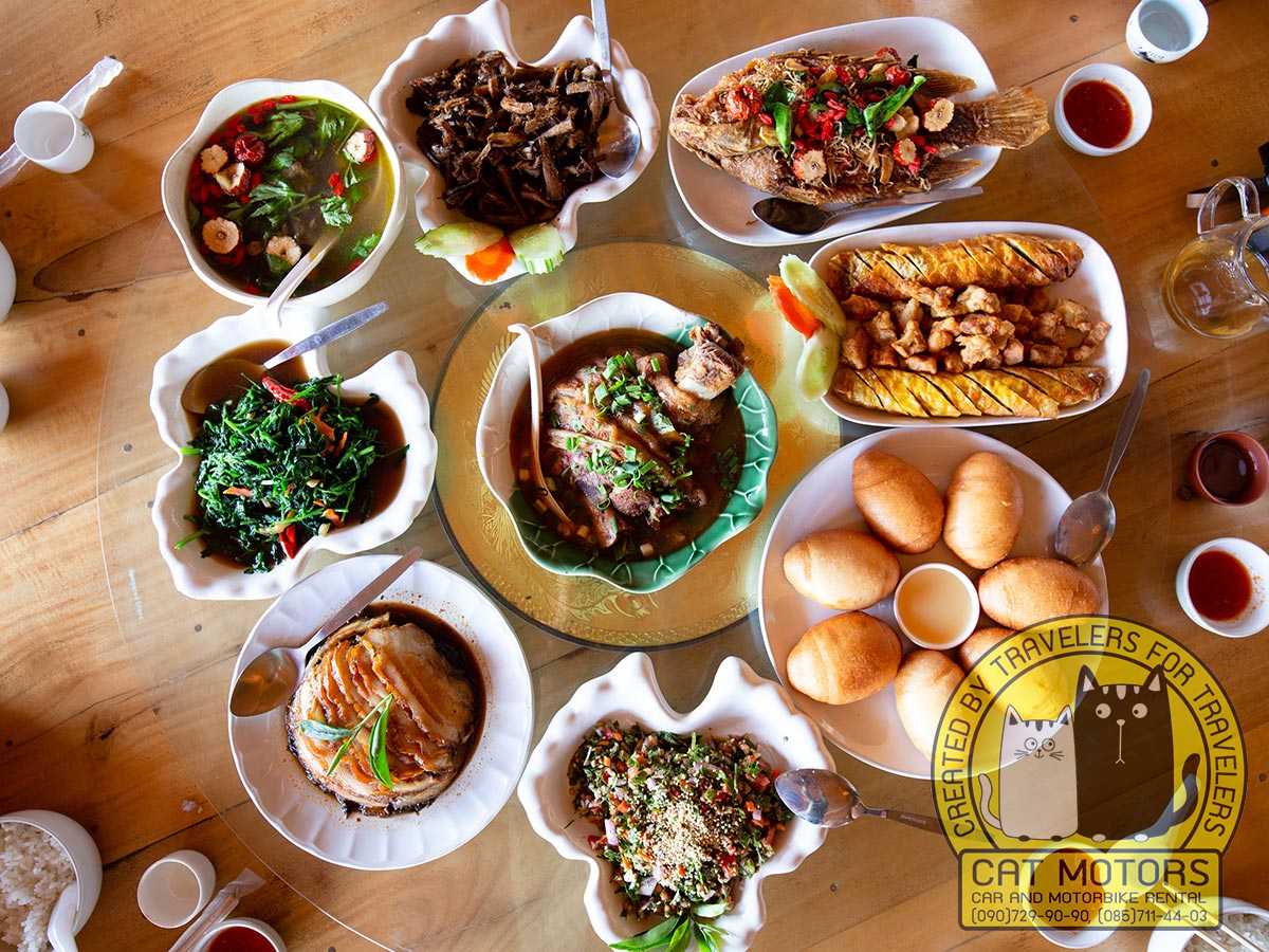
Yunnanese noodles, steamed buns, tea, pork dishes, and preserved vegetables are a large part of why Thai travellers make the drive. Make Arunothai the day’s main destination, eat locally, and give time to the farmland around it; one temple or memorial fits on the way, but a full Pha Daeng programme plus Arunothai is too much road for one day.
Our advice: the meal in Arunothai is the reason to come this far north, so build the day around it. The village’s best-known kitchen is Ta Yong, a family place near the 7-Eleven at the entrance, run on a Yunnanese recipe handed down through the family; go for the noodle soup with wontons and the crisp fried dumplings. It keeps long hours, roughly morning to evening, but this is a mountain village, so treat any posted time loosely. There is also an early Yunnanese morning market on Fridays, one of the biggest of its kind in the country; if that is your target, sleep nearby or leave Chiang Dao before dawn, because it is over by the time a late start arrives.
Doi Luang Chiang Dao Trek
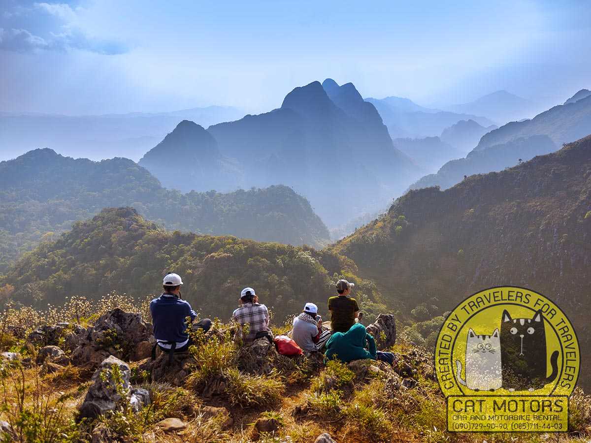
Trekking Doi Luang Chiang Dao is a protected seasonal activity run by Chiang Dao Wildlife Sanctuary, with registration, quotas, orientation, assigned routes, and environmental rules. It is a serious mountain trek and it cannot be improvised on the day.
Doi Luang Chiang Dao rises to about 2,225 metres, the third-highest mountain in Thailand after Doi Inthanon and Doi Pha Hom Pok, and the country’s highest limestone peak. A separate sharp spire nearby, Doi Pyramid, is often photographed from the summit and sometimes confused with the main peak. Its steep limestone profile, exposed ridges, sinkholes, and isolated high-elevation habitats set it apart from the forested granite peaks elsewhere in the north. The surrounding Doi Chiang Dao area joined UNESCO’s World Network of Biosphere Reserves in 2021, recognised for Thailand’s unique high-elevation subalpine vegetation and a concentration of endemic plants found nowhere else. That sensitivity is exactly why access is capped and managed.
The sanctuary opens the mountain under an announced seasonal programme, normally in the cooler, drier months, and independent entry is not part of the system: you register through the official process and follow the sanctuary’s schedule. Two main routes, Den Ya Khat and Pang Wua, run between roughly 6.5 and 8.5 kilometres from their trailheads and meet partway; from the Ang Salung camp the final push climbs about 225 metres up limestone, roughly 30 to 45 minutes, to the summit. Expect sustained climbing and descent, uneven rock, narrow sections, strong sun, cold wind, and fast-changing cloud. The difficulty is accumulated effort and terrain, and there is no technical climbing involved.
Prepare before booking opens: train with long uphill and downhill walks, use footwear already tested over distance, keep the pack light, and follow the equipment list issued for the active season. Choose a valley trip instead when fitness, injury, breathing, or recovery time make a long ascent unwise, or when haze is heavy. Doi Luang stays impressive from Ban Tham, Mueang Khong, Ban Na Lao Mai, and San Pa Kia even without a summit permit.
Our advice: the trek is booked out through the sanctuary well ahead, and the season and quota are announced separately each year, so do not ride up expecting to walk on. If the trek is your goal, sort the registration first and build the rest of the trip around the confirmed dates. If it is not, you still get the mountain: the valley views of Doi Luang are the reason many of our riders come back, permit or no permit.
Remote Mountain Trips Beyond the Main Valley
Each remote road leads somewhere different, and the drive, the village, and the overnight often matter as much as the named viewpoint. Plan modest distances, an early start, and usually an overnight, and settle food, fuel, accommodation, and the final road before you leave. Final approaches can mix asphalt, concrete, gravel, broken surface, and mud after rain, so straight-line distance tells you very little about travel time.
San Pa Kia and Doi Mae Taman
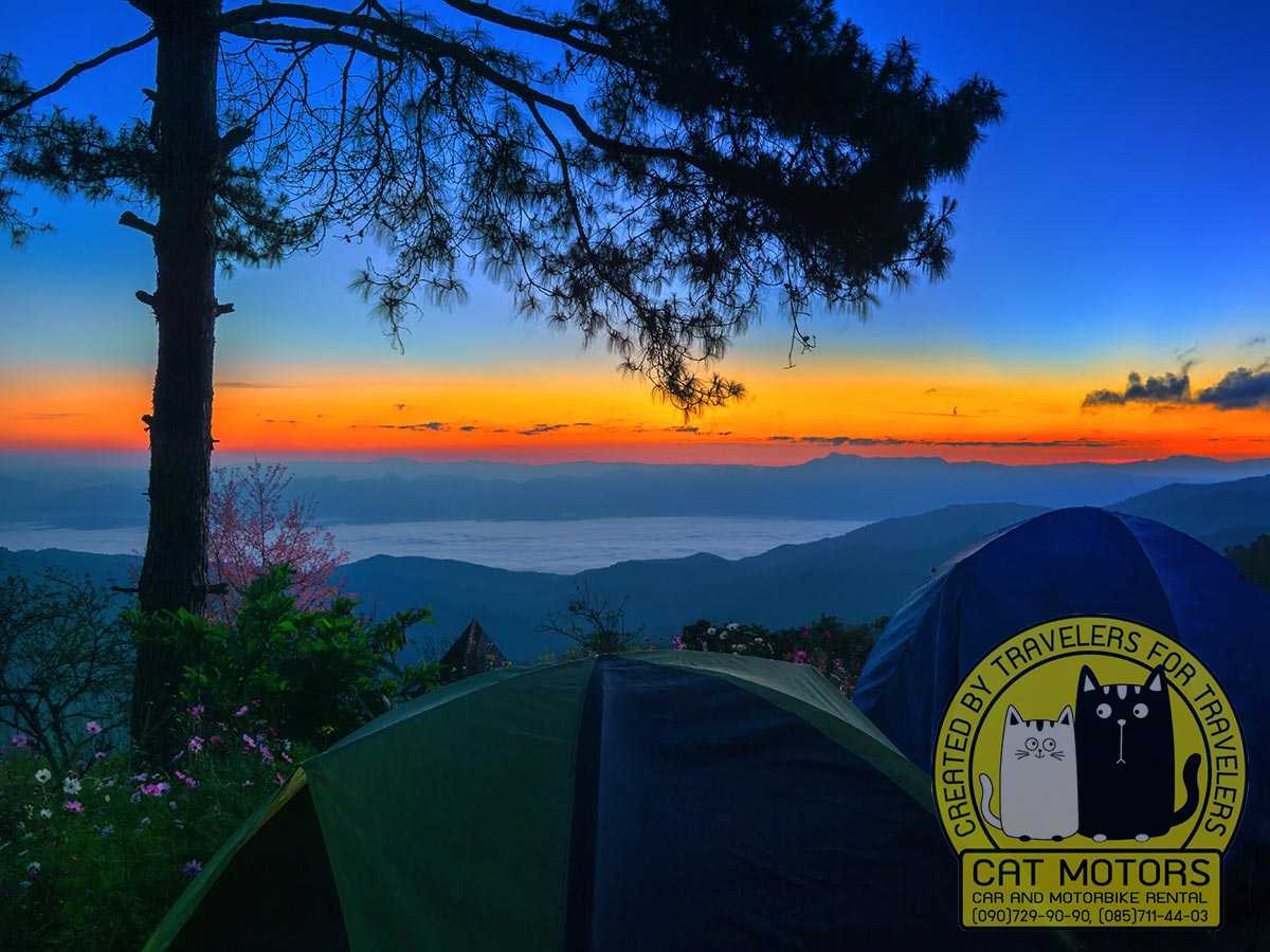
These are two neighbouring viewpoints on the same climb, often taken for one place because they sit only 200 to 300 metres apart. San Pa Kia is the Chiang Mai University highland research station, which grew out of a Thai-Australian highland development project and later passed to the university; Doi Mae Taman is the watershed unit beside it. Both look across the valley to Doi Luang through stands of pine, and both are known for sunrise over a sea of mist and for the wild Himalayan cherry that colours the slopes from late December to mid-January. The turn is off Highway 107 just before Ban Mae Na, then about 21 to 23 kilometres of climbing dirt and broken tarmac that wants a pickup or 4WD, especially in the wet. Tourism Authority of Thailand material puts the whole run around 90 kilometres and 2.5 to 3 hours from Chiang Mai, so it fills a day. There are cabins and a camping area at the top; bring your own tent and warm layers, because the nights stay cold through the year.
Ban Na Lao Mai
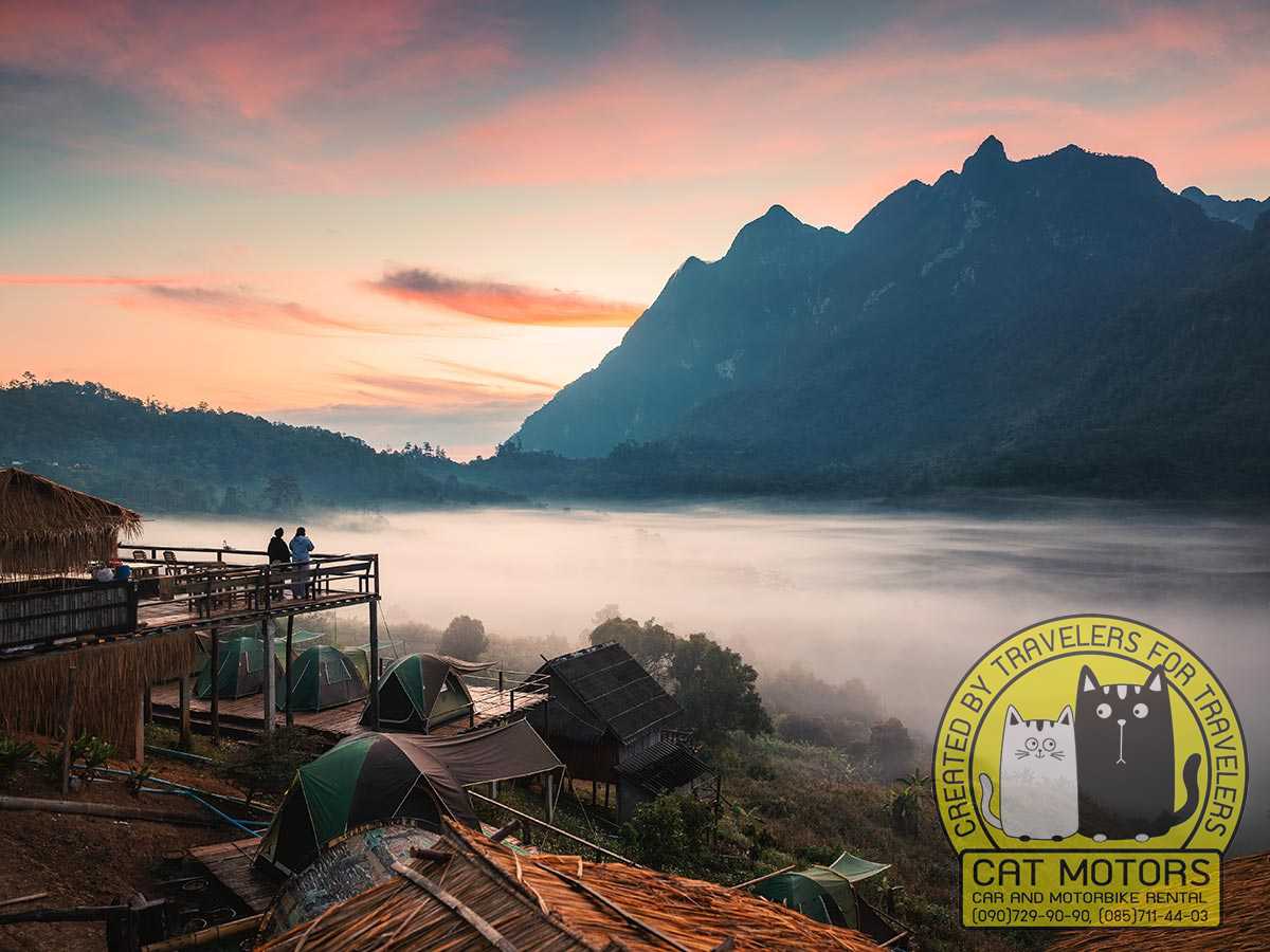
Of all the viewpoints you can reach by road, this small Lisu village gives you the closest frontal view of Doi Luang Chiang Dao. It sits around 1,150 metres up and roughly 19 kilometres from Chiang Dao Town, and the peak fills the view from almost every homestay porch, at dawn, at sunset, and above the morning mist. The road climbs and twists but the surface is decent, so a careful driver in an ordinary car can make it, though a stronger bike or a pickup is more comfortable. Two windows stand out: late rains into early cold (September and October) for thick mist wrapped around the ridge, and the cool clear months (November to February) for crisp long views. The stay is genuine hospitality in a working village, so ask before photographing residents, book the homestay direct, and arrange meals with the host, because services are limited compared with town. Walkers also use it as a staging point before the Doi Luang nature trail.
Mueang Khong and the Den TV Viewpoint
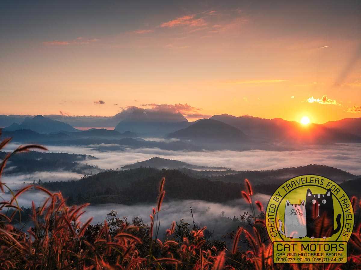
Mueang Khong is a quiet farming town on a small valley floor ringed by mountains, with the Khong and Mae Taeng rivers running through it, the kind of slow, green place people compare to old Pai. It sits about 43 kilometres from Chiang Dao Town over the ridge road, home to Northern Thai, Shan, Lisu, Lahu, and Karen communities, and it shows its best in the rainy season, when the paddies turn vivid green and morning mist settles over the whole basin. There are a handful of simple wooden homestays, plus bamboo rafting and tubing on the river. Above the town is Den TV, a ridge viewpoint whose odd name comes from the days when villagers carried the settlement’s only television up here to catch a signal for the boxing. Reaching it means about 10 kilometres of rough dirt in a villager’s truck, leaving around half past five in the morning, and the reward is a dawn sea of mist with Doi Luang clear on the horizon. Off the same track, about 800 metres past the viewpoint, a steep dirt spur drops away to Tham Oah, a hidden waterfall that runs all year in a quiet fold of the valley; the descent wants a 4×4, or you leave the vehicle at the top and walk down about a kilometre to the falls, and a road scooter or a low car will not get you there. Sleep in Mueang Khong, take Den TV at sunrise, then give the rest of the morning to the rice fields, a village meal, and the surrounding roads.
Doi Kham Fah
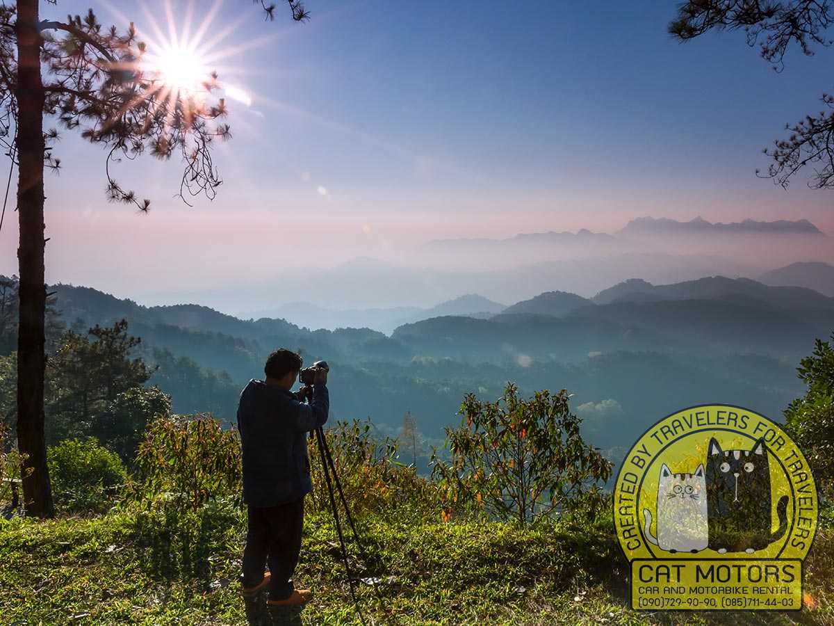
Doi Kham Fa, also called Kiu Jai Hai, is the remote option, a highland viewpoint and campsite at the Mae Ngai watershed unit in Thung Khao Phuang, roughly 1,834 metres up and inside the wider Pha Daeng area. It faces Doi Luang across a sea of mist, with wild Himalayan cherry around mid-January, and a second lookout on a white-rock terrace opens the view toward the Wiang Haeng side. Come prepared for basic conditions: a single cabin, limited water, electricity only from six in the morning to nine at night, patchy phone signal, and shared toilets. The access road is narrow, steep in places, and awkward for passing oncoming vehicles, and it takes around an hour and a half, so arrive in the late afternoon and stay the night. The early light is what you came for. Check the current park arrangement for access, camping, and fees before departure, because those details change.
Our advice: these are the routes where the wrong bike ruins the day. The final approaches can turn to gravel, broken concrete, steep hairpins, and mud after rain, and a city scooter may have the power but not the clearance or the tyres. Tell us the exact highland destination before you pick a machine, and get a recent description of the last few kilometres, because those change with the weather. In the wet, hire a local pickup and leave the bike in town.
Getting from Chiang Mai to Chiang Dao
Highway 107 connects Chiang Mai with Chiang Dao and continues north toward Fang and Tha Ton. Getting to the main valley is easy; the choice that matters is how you move once you arrive, because the district’s attractions sit on separate branches.
By motorbike, the ride from central Chiang Mai takes about two hours before longer stops, and leaving early spares you the worst of the urban traffic and keeps daylight for the return. Highway 107 carries buses, trucks, and fast traffic, so you want to be comfortable with Thai road behaviour, overtaking, and mountain curves before you take it on. The Ban Tham road is quieter and paved; the northern route stays paved through the main settlements and park sites, though distance and elevation climb; the highland side roads are a separate decision covered below.
By car, you get weather protection and space for luggage, and a normal passenger car handles Highway 107, the town, Ban Tham, Mueang Ngai, and the main paved northern sites. Air-conditioning earns its keep in March and April, and an enclosed vehicle makes the rainy season far less disruptive. The remote roads are the exception: San Pa Kia and some highland stays can involve gravel, broken concrete, and steep sections better suited to a higher-clearance vehicle, so get final-road instructions before you commit a low car.
By public transport, buses and vans heading north toward Fang or Tha Ton use Highway 107 and stop in Chiang Dao Town, leaving from Chiang Mai’s northern bus system, with departure points and vehicle types varying by operator. Public transport gets you to the town and no further into the zones: Ban Tham, Pha Daeng, Arunothai, Mueang Khong, and the mountain villages all sit on different roads, so you will still need a local songthaew, a private transfer, an accommodation pickup, or a rental to move around. Choose a place to stay that can explain transfers in advance, and confirm the last practical service before you set off sightseeing.
Chiang Dao also sits naturally on a longer northern loop: Highway 107 carries on to Fang and Tha Ton, and side roads reach Arunothai and the country around Doi Ang Khang, so an overnight here breaks a bigger trip into comfortable stages. Riders continuing that way can use the separate Doi Ang Khang route guide, and anyone folding Chiang Dao into a wider northern circuit will find it on our Chiang Rai loop itinerary.
Choosing the Right Motorbike for Chiang Dao
Match the bike to the road. The main valley needs a reliable road bike; the northern paved routes add distance and reward passenger comfort; the highland tracks add surface, clearance, suspension, and low-speed control to the list.
For an experienced rider travelling light, a well-maintained 125 to 160cc scooter is generally enough for Highway 107, the town, Ban Tham, and the main paved valley roads. Condition beats a small difference in engine size: good tyres, predictable brakes, working lights, and stable handling matter more than extra power on a tired machine. Add a passenger and luggage and you may want a larger scooter or motorbike for suspension, braking, and a little overtaking reserve, though you still have to control the weight at low speed and on slopes. The northern route to Pha Daeng and Arunothai adds bends, elevation, and long gaps between services, so refuel before the distant stretches and start early. The remote approaches can combine gravel, mud, broken concrete, steep hairpins, and drainage channels, where a city scooter often has the power but not the clearance, tyres, or controllability, and a heavier motorbike can be harder to manage in mud. The right choice comes down to the exact road and the rider.
Our advice: we match the bike to your route once you have chosen it, because “the biggest bike” is the wrong answer as often as the right one. Tell us honestly how confident you are on mountain curves and whether you are two-up, and be straight about the highland roads you actually intend to ride. The commonest mistake we see is a rider taking a small automatic scooter onto a long mountain descent and cooking the brakes; if that is your plan, talk to us first.
Review our motorbike and scooter rental in Chiang Mai and the riding safety advice for Thailand before you go. Do not ride at all when you lack the documents, the highway experience, or the low-speed control the route needs; a bigger rental cannot replace those. Heavy rain, dense fog, severe haze, fatigue, or a late start are all good reasons to switch to a car, a driver, or public transport and keep the destination without forcing the plan.
Best Time to Visit Chiang Dao
November to February is the easy window: cooler air, less rain, and comfortable paved-road travel, with cool Ban Tham mornings and colder nights at highland accommodation. Wild Himalayan cherry around San Pa Kia may colour the slopes for a short spell, but the timing shifts every year, and demand rises around weekends, New Year, and cold snaps, so mountain-facing rooms and small homestays book up earlier. Carry a warm layer, and remember that winter cloud or morning mist can hide Doi Luang for a while.
March and April are hotter and can bring severe regional haze from accumulated pollution and seasonal burning, dropping visibility enough to erase the mountain layers and making hard exertion a poor idea on bad-air days. Conditions swing by the day, so check official air-quality readings, visit the cave and temple earlier, and rest through the worst heat. Songkran in April adds holiday traffic and celebration, so leave more slack in travel and accommodation.
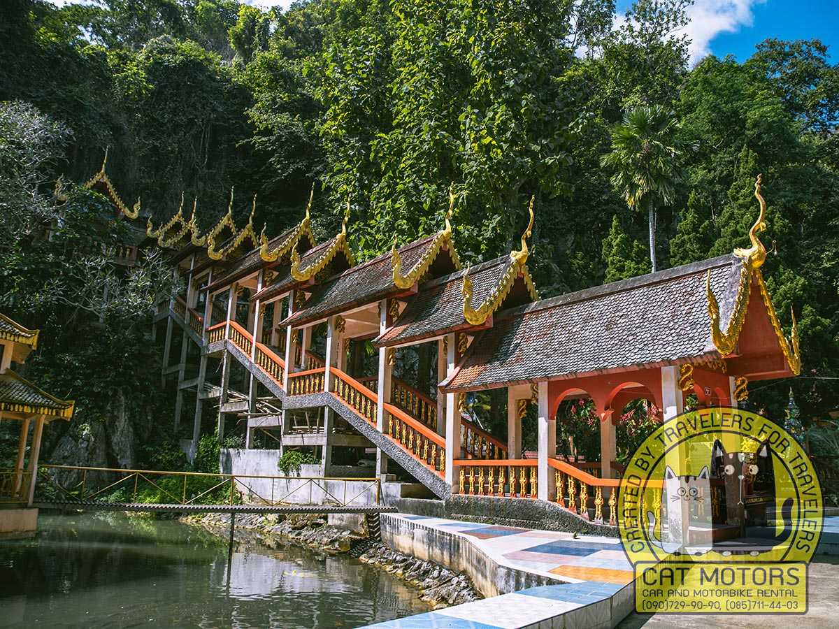
The rainy season turns the valley deep green: cloud wraps the cliffs, rice fields brighten, and the waterfalls fill. Rain usually arrives in bursts, an hour or two at a time, so the paved highway and the Ban Tham valley stay practical with flexible timing, but wet rock and soil affect caves, waterfalls, temple steps, and above all the remote roads, and lamp-guided cave sections can change with water levels. A paved two-day plan is the dependable base for the season.
One separate note on Doi Luang: its trekking season is announced on its own schedule by the sanctuary, and a general “visit November to February” is not a booking calendar. The official announcement sets the opening dates, quota, orientation, route, and equipment. Outside that season the summit is closed, but Ban Tham, Ban Na Lao Mai, San Pa Kia, and Mueang Khong still give you the mountain from below.
Where to Stay in Chiang Dao
Choose your bed by the next morning’s route. Ban Tham keeps the cave and the temple close and Doi Luang in view, with resorts, guesthouses, and homestays spread thinly along rural roads and no single centre, so check the exact pin: a mountain-facing place can sit several kilometres from food or the cave, which matters if you have no vehicle. Chiang Dao Town trades the mountain setting for easy buses, markets, food, fuel, and an early northbound start. Mountain homestays and campsites, the Lisu stays around Ban Na Lao Mai, rural rooms in Mueang Khong, or camping at Doi Kham Fa when the park allows, mean simple rooms, local meals, early nights, and cold air, and they are worth arranging in full ahead: get the map pin, the road instructions, the meal plan, and the vehicle recommendation from the host before you set out.
What Things Cost in Chiang Dao
Chiang Dao is cheap to visit and awkward to pay for, because most of it runs on cash. These are the fixed costs you can plan around. Local rates change without notice, so treat them as a working budget rather than a price list.
What | Cost | Notes |
Chiang Dao Cave entry | about 40 baht | Foreign visitors; Thai nationals pay less |
Cave lamp guide | about 200 baht | Per group for the unlit routes, tip on top |
Pha Daeng National Park | 100 baht adult, 50 child | Foreign rate; one ticket covers Pong Arng and Sri Sangwan the same day |
Park vehicle fee | 20 baht motorbike, 30 car | Paid at the same gate |
Chiang Dao Hot Spring | small local fee | The village onsen next door charges separately |
Pink Lotus Garden | free | Organic farm and learning centre, cafe pays its own way |
Makhampom Art Space | free | Events and performances may be ticketed |
Choeng Doi Distillery | from about 420 baht | Booking only, at least 48 hours ahead |
Homestay, remote village | simple rooms, meals arranged | Book direct, agree meals with the host |
Practical Information
Chiang Dao Town sits about 72 kilometres from Chiang Mai, roughly two hours before you start stopping. Inside the district, time depends on the branch: Ban Tham is a short hop from town, Pha Daeng and Arunothai stretch north, and Mueang Khong, San Pa Kia, and the highlands sit on slower roads. Build each day around one branch.
On fuel and coverage: fuel is easy along Highway 107 and around town, so fill up in town before any long northern or highland branch. Small community fuel points exist, and a tourist is unlikely to find them, because they often sit off the road inside a village and are known to locals. Mobile coverage is fine in town and the populated valleys and thins out behind ridges and on remote approaches, so download the map, save your accommodation pin, and screenshot Thai-language directions while you still have signal. Navigation apps will happily route you onto a private, seasonal, or damaged track, so follow the host’s directions when they differ.
Our advice: carry cash, more than you think, before you leave the main valley. Cave guides, park entry, the local baths, small kitchens, homestays, and village markets run on cash, and while QR payment is everywhere in Thailand, it needs a signal you may not have up a mountain, and foreign cards do not plug into every Thai method. Draw what you need in Chiang Mai or in Chiang Dao Town, keep small notes for local payments, and hold a separate reserve for fuel and the ride home.
For clothing and kit: water, sun protection, a light rain layer, and shoes with grip cover the valley, since cave floors, waterfall rock, and temple steps stay damp even when the road is dry. Temple visits need shoulders and knees covered, and a warm layer earns its place on cool-season mornings and at any highland stay. For Doi Luang and Doi Kham Fa, use the equipment list the protected area issues; a general day-trip list does not replace it.
Chiang Dao mixes protected ecosystems, working temples, farmland, and communities that live differently from the valley, so treat each as a living place: stay on authorised roads and trails, keep noise down near temples and homes, ask before photographing people or ceremonies, buy locally without haggling hard over small sums, and carry your rubbish out of the remote areas.


