Nestled at Thailand’s northernmost tip on the Mekong’s western bank, Mae Sai (แม่สาย) is a bustling border town where Thai, Burmese and hilltribe cultures merge. For centuries Mae Sai has been a key trade and transit point into Myanmar (Tachileik across the bridge), a legacy seen in its markets, languages (Thai, Shan, Burmese and Lanna dialects) and cuisine. Today Mae Sai’s covered market (along Phahonyothin Road) is famed for Burmese goods, fabrics and gemstones. A golden‐yellow arch proclaims “Thailand’s northernmost point” at the old customs house, flanked by monuments (including a shrine to King Naresuan with a giant scorpion statue aimed at Tachileik).
Contents
show
Mae Sai’s story is one of frontier exchange: as Wikipedia notes, the main AH2 highway (Phahonyothin Rd) simply continues into Myanmar, reflecting a once–regular flow of traders. (One-day visa runs now require advance clearance, and since 2016 even the simple permit to pop into Tachileik is at immigration’s discretion.)

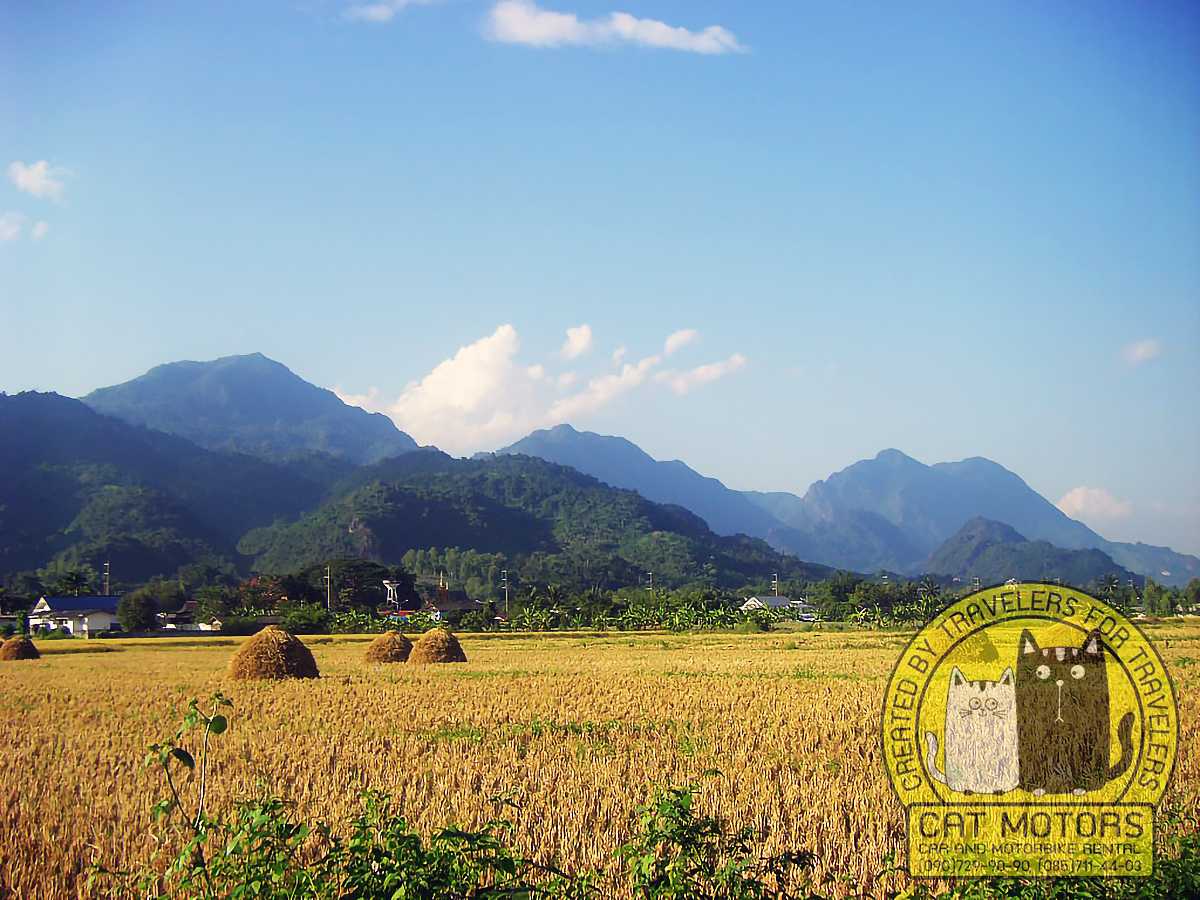
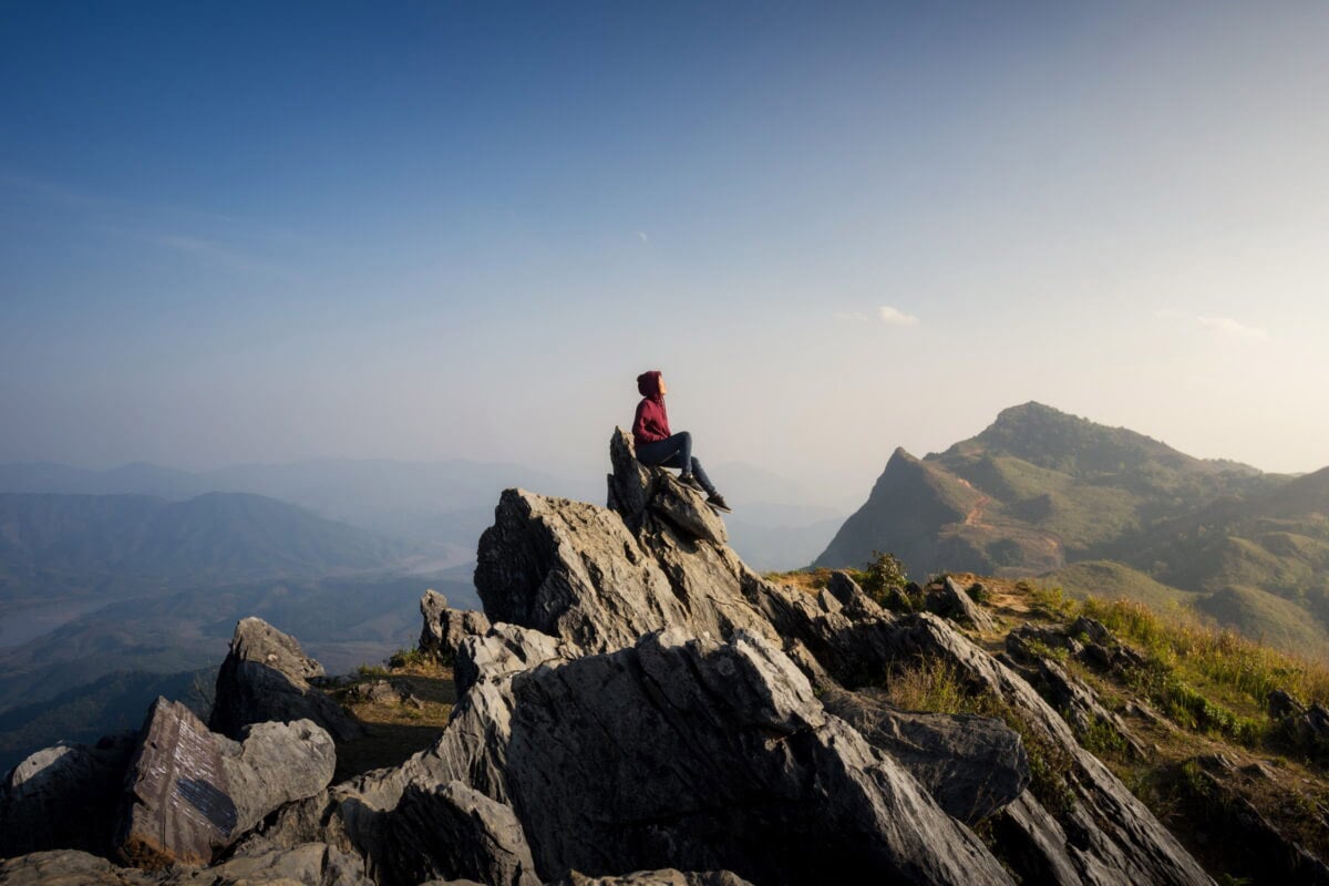
Mae Sai district’s western hills rise into the Daen Lao Range. The most prominent peaks are Doi Tung (the district’s tallest, crowned by the hilltop Wat Phra That Doi Tung) and the curious Doi Nang Non (“Sleeping Lady”), whose silhouette of a reclining woman is visible from the road into town. This mountainous terrain contains tropical forests, tea and coffee plantations, and numerous caves and temples – many now open to visitors. Mae Sai’s border location also made it strategic in modern history; during the 20th century it was an entry point for refugees and (notably after the 1962 Burmese coup) for the cross-border jade and gemstone trade. Today it’s a mix of small factories, transit trade and tourism, with longtail boats cruising the Ruak and Mekong rivers.
Travel Planning

Mae Sai lies 61 km north of Chiang Rai city and about 259 km north of Chiang Mai. Buses from Chiang Mai’s Arcade Station (5–6 hr) arrive frequently (≈180 ฿ reg, 350 ฿ VIP). Chiang Rai buses (≈1.5 hr, 40฿) and vans also serve Mae Sai.
Thailand ends at Mae Sai. Markets overflow with goods from Myanmar: gems, lacquerware, textiles, and foods unavailable elsewhere in the kingdom. The border crossing sees constant foot traffic, with day-trippers walking into Tachileik for quick shopping and stamped passports. Temples crown hills above town, offering views across both countries. Caves dot the surrounding countryside, including Tham Luang where the world watched rescue efforts for trapped youth footballers. The atmosphere mixes commerce, religion, and border-town energy.
Our motorbike rental in Chiang Mai equips you for the scenic ride to Mae Sai via Doi Tung and the Golden Triangle. Cat Motors equips bikes for multi-day Chiang Rai province travel, with luggage capacity for overnight gear. We recommend Mae Sai as a turnaround point for the northern loop, returning through Mae Chan and Chiang Rai city for variety. The ride north rewards those who resist highway speed and take mountain detours instead.
Car or motorcycle routes diverge: the direct way is via highway 118 (Chiang Mai–Lampang–Phayao–Chiang Rai) then Route 1 into Mae Sai; this is fast but can be busy. Adventurers often detour through the hills. For example, many riders recommend continuing north to Mae Chan then turning onto scenic Route 1149 along the Thai–Myanmar border (passport/ID check needed at certain passes). This quiet road eventually meets Route 1138, which winds up to the hill town of Doi Mae Salong (formerly a KMT refuge, now a Yunnanese-Shan community).
Mae Salong’s tea plantations, views and Chinese markets are a popular stop on the way to Mae Sai. Seasonal flooding (June–Oct) can affect rural roads, so always check local conditions in the monsoon.

Seasonal Guide & Festivals
- Cool Season (Nov–Feb): Dry days and chilly mountain nights (sometimes <10 °C). This is peak travel season. The mountains bloom with winter flowers (e.g. at Mae Fah Luang Garden, Doi Tung). Major festivals include New Year’s Eve (Dec 31–Jan 1) and Thai New Year Songkran (April 13–15) in mid-April, both celebrated nationwide. In Mae Sai especially, Songkran sees playful water fights in the streets. Loy Krathong (Nov) and Yi Peng lantern festivals (often mid-Nov) in Chiang Rai province fill the nights with candles and paper lanterns. If visiting Doi Mae Salong, note that its annual Tea & Cherry Blossom Festival runs Dec–Jan (blending Chinese New Year celebrations with local tea-tasting).
- Hot Season (Mar–May): Rising daytime temps (peaking ~35–38 °C) and clearer skies. This is the best time for long motorcycle rides and open vistas, but afternoons can be harsh. Cooler altitudes like Phu Chi Fa (border with Laos, accessed via Chiang Rai) or Doi Pha Tang (see sunrise over the Mekong) offer relief. Beware of dehydration and sunburn on long rides. Local hilltribe villages may hold small Bun Pha Wet (Stinging Nettle Festival) or other traditional ceremonies to mark the Thai New Year’s Buddhist Lent.
- Wet Season (Jun–Oct): Afternoon thunderstorms and heavy rains, especially July–Sept. Waterfalls and forests turn lush, but landslides and flooded stretches are possible on backroads. The famous Tham Luang–Khun Nam Nang Non cave is closed during monsoon for safety. On the positive side, this is low season, so crowds thin and accommodation rates drop. Local Lanna ceremonies like Asalha Bucha and Buddhist Lent (July/Aug) occur with candlelight processions at hilltop temples.
Cultural & Historical Context
Mae Sai’s identity is deeply tied to the Thai–Myanmar border. The Mae Sai and Ruak Rivers mark the modern frontier, but the area historically lay at the edge of the Lanna kingdom and various Shan principalities. A monument to King Naresuan in Mae Sai honors a 16th-century Lanna king famed for repelling Burmese invasions. (The temple above Mae Sai on Doi Wao – known locally as the Scorpion Temple – is dedicated to Naresuan; its enormous golden scorpion statue is a warning to old foes.) In the 19th–20th centuries, Mae Sai’s fertile hills were sometimes raided by opium warlords and sawcross-border guerrilla activity; since the 1960s the Thai government developed the highlands and promoted ethnic development.
Today Mae Sai’s streets bustle in Thai and Burmese, and the district is home to many Shan, Akha, Lisu, Lahu and Yunnanese (Chinese) hilltribes. Neighbouring villages may include Ban Sop Ruak (Golden Triangle area), Ban Tham (near Tham Luang), and Ban Pong Ngam (near the Fish Cave temple). Many elders speak Shan or Lanna, and you’ll still hear traditional Lanna and Shan music at festivals. The Thai government refers to Mae Sai Market at the border as “Tha Khi Lek Market,” reflecting local dialect. This melding of cultures makes Mae Sai region unique: you can sip a Burmese-style milk tea in the morning and enjoy northern Thai khao soi by lunch.
Highlights: Temples & Monuments
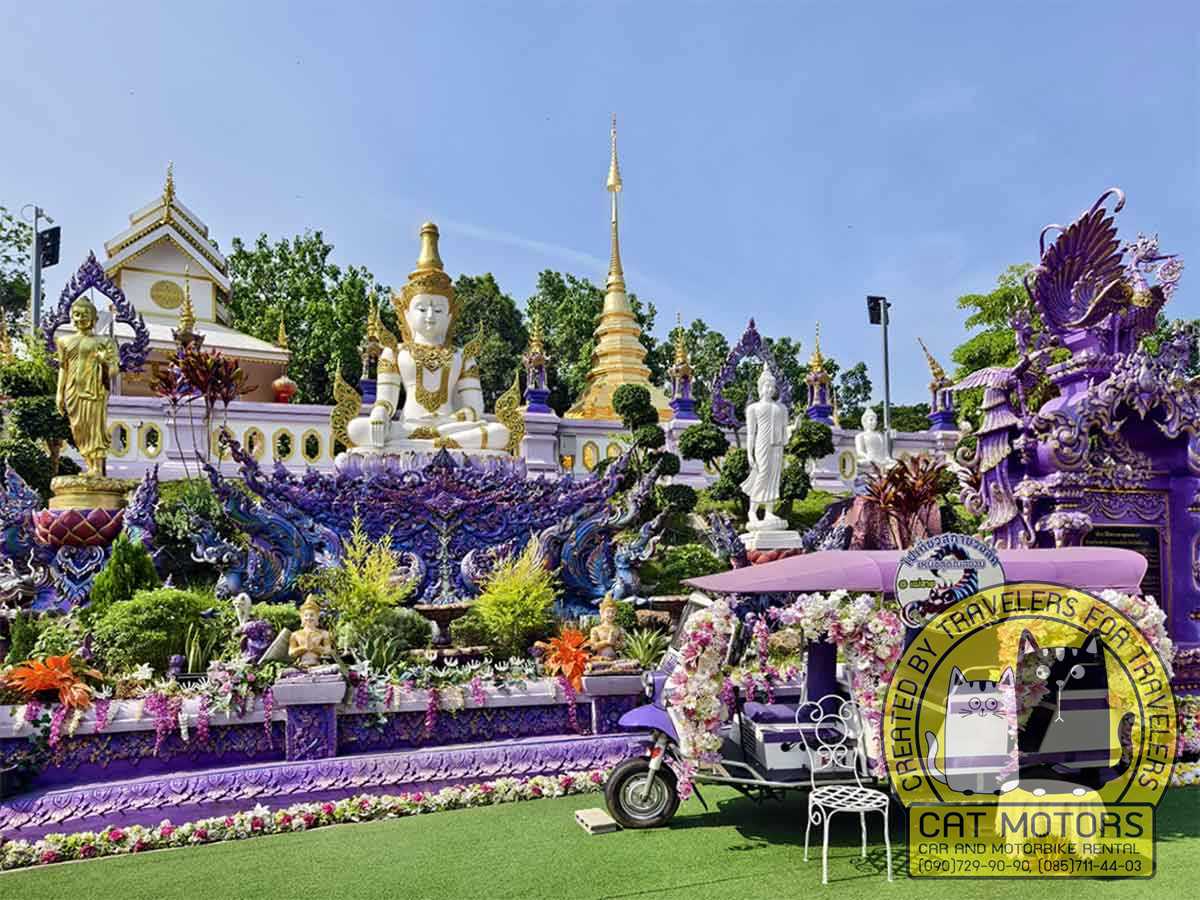
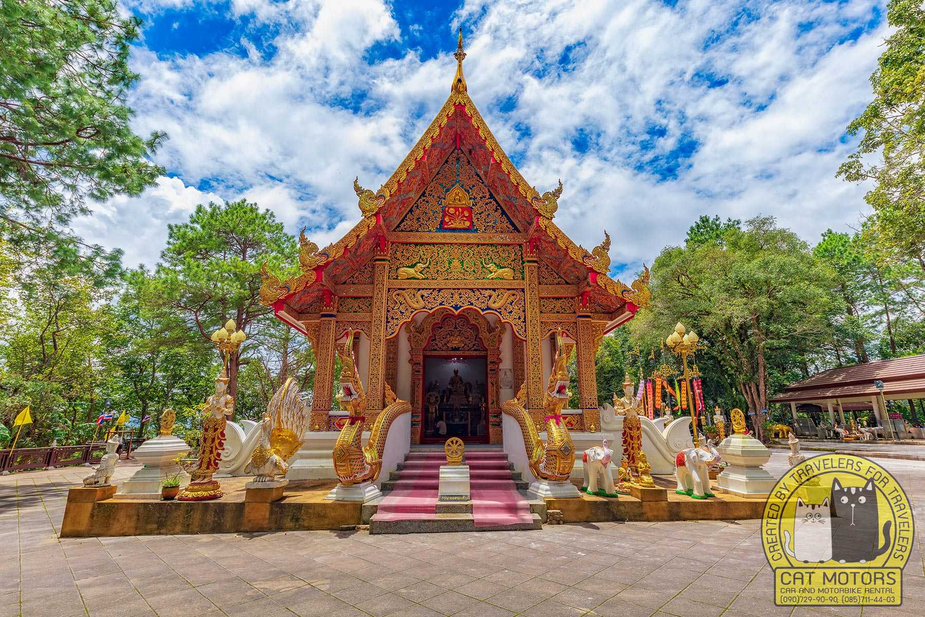
Wat Phra That Doi Wao (Scorpion Temple)
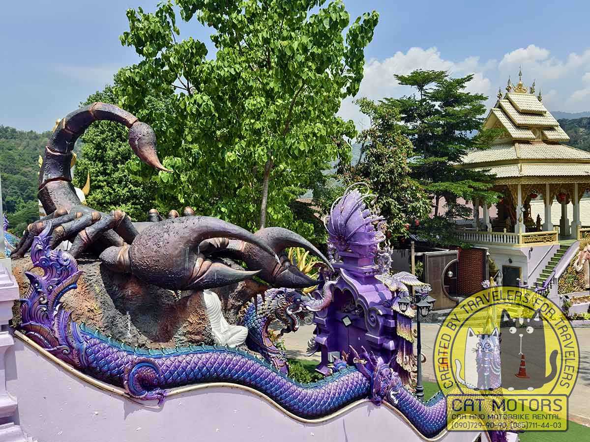
Just a short climb above Mae Sai town, this hillside temple complex is Mae Sai’s iconic spot. It features glistening white and gold stupas and several shrines; behind the main chedi is a gigantic golden scorpion fixed with pincers aimed at Tachileik. (As one guide explains, it symbolizes a warning to Burmese invaders, commemorating King Naresuan’s victories.) The compound houses many ornate pagodas and elephant statues. Hike up the stone stairway or winding road to the summit for panoramic views over Mae Sai, the Ruak River and Myanmar’s Tachileik. The temple’s origins date back to the Lanna era; local legend even ties it to the bygone King Wao of Yonok. Allow 30–45 min to explore, and note that a small Burmese monastery nearby shares the hilltop.
Practical: modest dress, remove shoes in ordination hall, cameras OK.
Skywalk at Wat Doi Wao
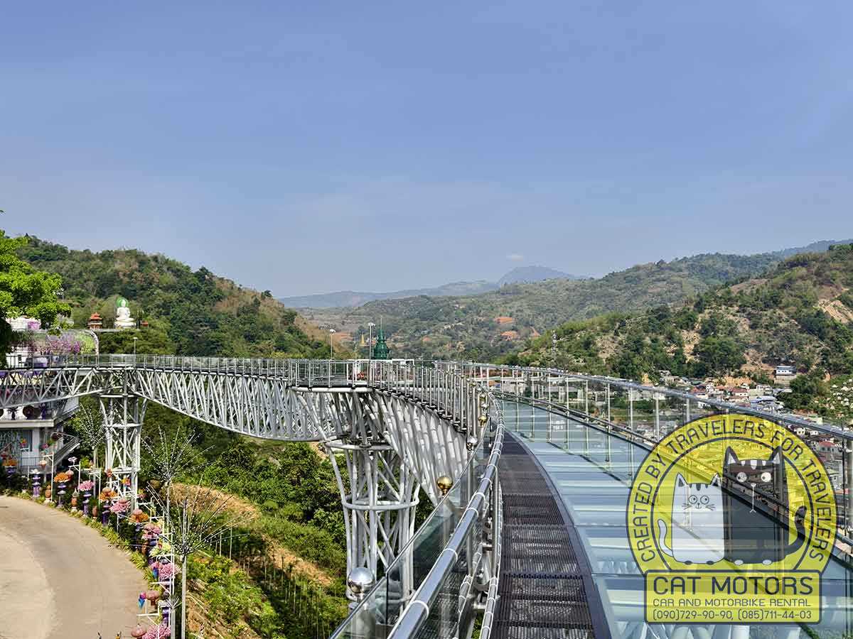
A 150-meter glass Skywalk extends from Wat Doi Wao’s hilltop platform, about 480 m above the Mae Sai valley. Walking out over the clear deck is thrilling: you’ll literally see the winding border rivers below, and on a clear day the Golden Triangle bend of the Mekong with Vietnam in the distance. (The view of Tachileik’s roofs and pagodas through your feet is unforgettable.) To avoid glare and crowds, visit the Skywalk right after opening (around 8:30–9:00 AM). Admission is a modest fee (~50 THB). Note that temple staff will lend shoe covers and helmets for the glass platform. Strappy sandals or heavy boots are not allowed on the Skywalk.
Insider Tip: Aim to hit Wat Doi Wao early. Morning light gives the clearest views – afternoons can be hazy – and the hillside is much cooler before midday.
The temple also features numerous spots designed specifically for selfies. Many of them are clearly set up with photo angles and props in mind, making it easy to capture memorable shots.
Wat Mae Sai (Chantharam Pagoda)
In town, this riverside temple has an elaborate Lanna-style viharn (prayer hall) with a beautiful teak-carved façade. It’s a peaceful place to observe local devotional life, and its small cemetary shrine is evocatively adorned with spirit houses. Not far away is the Mae Sai Customs House (now an immigration office) which still displays relics of the old Thai‐Burma frontier.
Wat Phra That Doi Tung (Mae Sai District)
About 30 km west of Mae Sai, up on Doi Tung (1,389 m), sits this temple and Royal Villa of Doi Tung. Two golden pagodas (chedis) glide over the misty Mekong valley. A 730-step staircase leads to a thousand-handed Kuan Yin statue and multiple gold Buddhas. The adjacent Mae Fah Luang Garden is a renowned botanical park of seasonal blooms and cultural displays (designed in the 1980s by the Princess Mother). Together they form the Doi Tung Development Project, a royal initiative that transformed the hill from opium fields into model tea and coffee farms. Plan 2–3 hr here.
Wat Pong Namtok (Fish Temple / Wat Tham Pla)
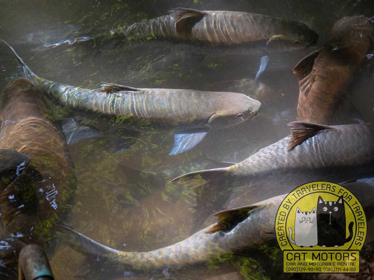
Also called the Fish Cave Temple or Monkey Temple, this hidden gem sits at the foot of limestone cliffs (Tambon Pong Ngam, ~16 km south of Mae Sai on the highway to Chiang Rai). Legend gives it this name because a shrine and fishpond lie at the cave’s mouth. The hillside above is home to wild macaques, which often wander the temple grounds. Behind the ornate ordination hall is a steep staircase lined with nagas (serpents) leading through a narrow canyon to the cave entrance. Inside the cave (flashlights can be rented) stands a reclining Buddha amidst stalactites. Nearby on the temple grounds are a large crocodile pool and a “hell garden” of painted statues. Few foreign tourists visit this site, so it feels tranquil and overgrown – mossy stone Buddhas and golden murals draped in ferns. Visitors report seeing monkeys on the hall’s roof and bathing in the fish pond. [Practical: free entry; bring good shoes for the climb; small fee for lamp].
Tham Luang–Khun Nam Nang Non Forest Park
A network of caves under Doi Nang Non (“Sleeping Lady Mountain”), located ~8 km south of Mae Sai town. Its most famous attraction is Tham Luang Cave – the sprawling karst cave system where 12 footballers were trapped in 2018. Today a memorial and visitor center mark the site. The first cavern (about 0.6 mi long) is open for guided tours in the dry season (roughly Nov–April). Inside one sees stalactite chambers and the pools where the boys were rescued. (A Thai museum outside shows exhibits on the rescue.) Even from the road you can glimpse Doi Nang Non’s silhouette – the “sleeping lady” shape that gave the area its name. Local guides tell how this mountain was once said to be a princess who died of heartbreak; her “tears” formed the cave’s waters while her body formed the ridges. Hikers can also trek upstream to waterfall trails and smaller caves (permits required). Winter mornings often feature mist between the peaks. [Practical: Cave tours Nov–Apr only; bring a jacket for the cave, watch wet floors].
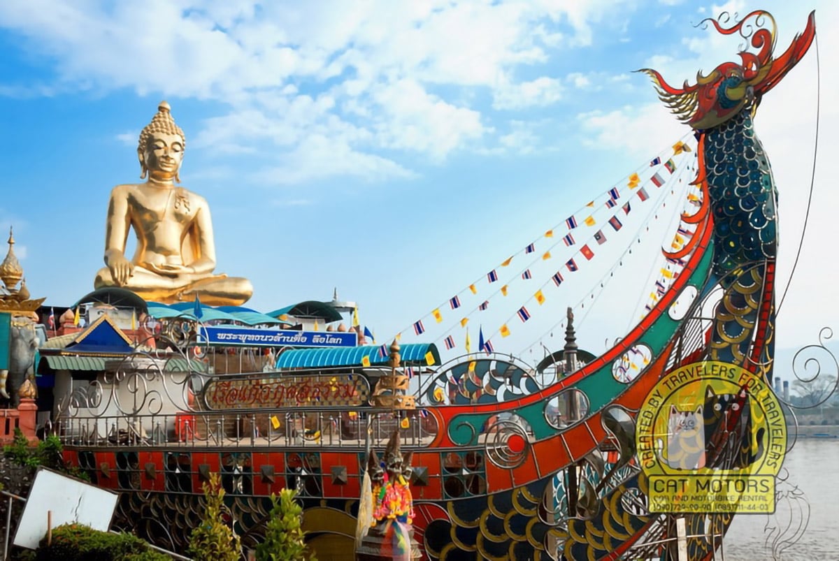
Golden Triangle & Sop Ruak
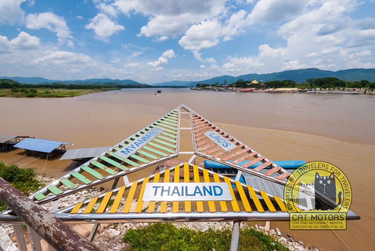
Although technically in Chiang Saen District, the Golden Triangle area (Mae Sai’s eastern neighbour) is a must-see when in northern Chiang Rai. Here the Ruak and Mekong rivers meet Myanmar and Laos. Atop the Thai side hill is the Golden Triangle viewpoint park, with a gilded Buddha and views into all three countries. Nearby is the Hall of Opium museum (an excellent interactive museum on the history of opium cultivation in the region). Boat tours can take you across the Mekong to Laos’s Golden Triangle Monument. The 1940s-era Sop Ruak village itself has riverside restaurants and a Chinese temple. This scenic loop is about 45 km south of Mae Sai and is often combined into half-day itineraries with Chiang Saen’s old city ruins (Wat Phra That Chedi Luang) nearby.
Mae Sai Market (border bazaars)
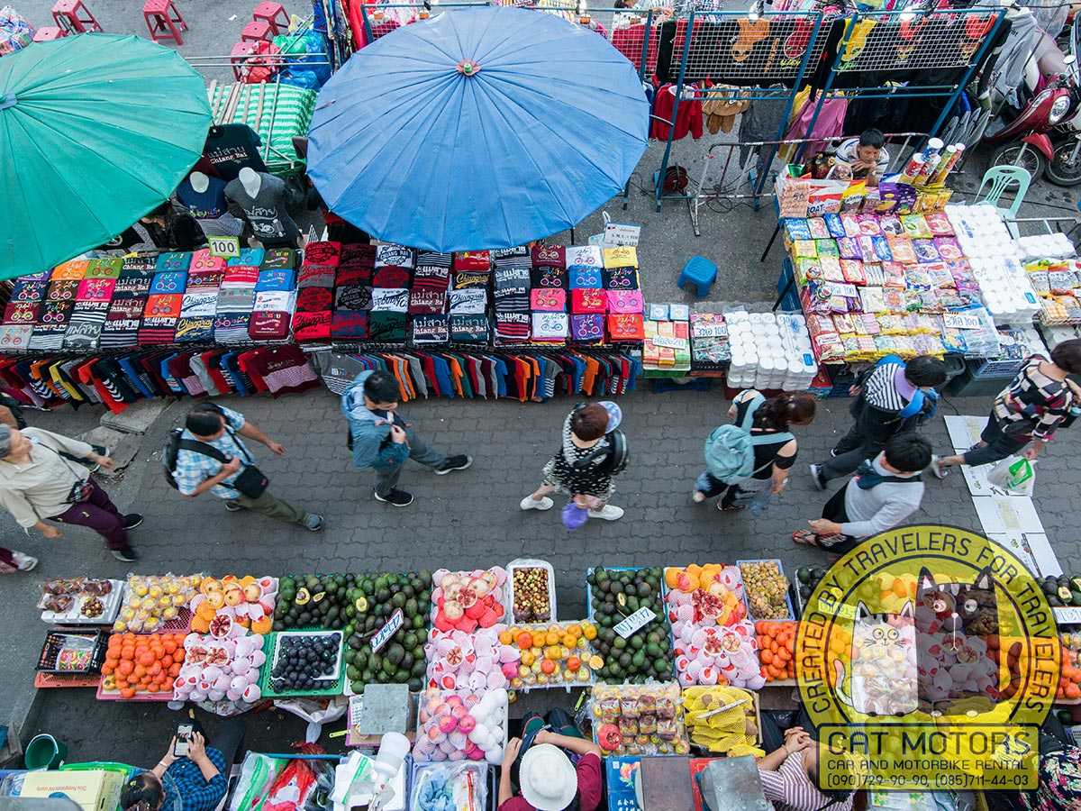
No trip is complete without visiting the Mae Sai border market. On the Thai side, rows of stalls offer cheap clothes, toys, electronics and Burmese products. Bargains on textiles and imitation gemstones (jade, rubies) are common. A riverfront Thai market nearby sells Lanna snacks (grilled river fish, sai oua sausage, sticky rice). Burmese vendors line Tachileik’s lane (if you cross the bridge by foot, carry passport), but even just eyeing the bustling Burmese street market is an experience. Note that visa rules often require an escorted tour or overnight stay if entering Myanmar.
Mountains & Caves (Nature Attractions)
Doi Nang Non (“Sleeping Lady”)
The karstic mountain ridge just south of Mae Sai (in fact partly within Mae Sai District) is known locally as the Sleeping Lady. From certain angles along Route 1 between Chiang Rai and Mae Sai you can make out the outline of a reclining woman. Above the busily visited Tham Luang Cave are dozens of smaller caves, some containing Buddha shrines (e.g. near Ban Tham village). Outdoors enthusiasts can hike sections of this range (while respecting park trails). The “Sleeping Lady” is entwined with a tragic folk tale: legend says a princess who loved a stable-boy hid in these caves; when he was captured and killed, the princess also died, and her blood became the cave’s waters while her body formed the mountain.
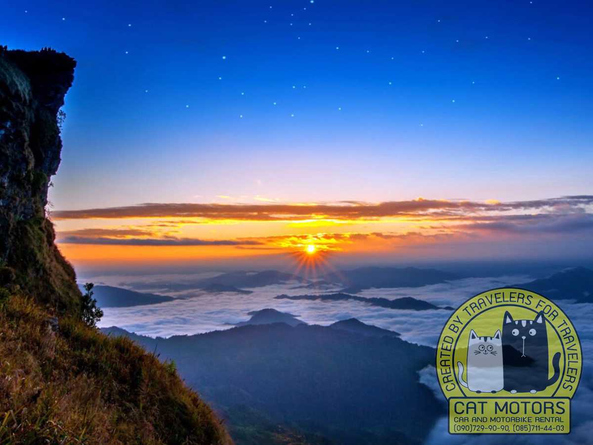
Phu Chi Fa (Chiang Rai border)
About 100 km south-east of Mae Sai, on the Laos border, Phu Chi Fa is famous for dawn sea-of-mist views. Hike up its 1,628 m peak at sunrise to see the Mekong valley blanketed in fog. Nearby hilltribe villages (Hmong and Thai Lue) sell local coffee and wild mushrooms. [Note: Off-grid park; cooler temperature; stay overnight in Chiang Khong or with a guide].
Doi Pha Tang
A scenic cliff near Huay Xai (Laos side), accessible by road from Chiang Rai. It offers panoramic views of the Mekong sunrise. On the Thailand side, a viewpoint and park welcome early visitors. Often combined with Phu Chi Fa or the Golden Triangle.
Khun Nam Nang Non Forest Park
Beyond Tham Luang, this national park contains jungle streams, waterfalls (e.g. Huai Mae Sai, Huai Mae Sai Sri), and trailhead hikes into the hills. During dry season longtail boats can bring visitors upriver to forested campsites along the Ruak River. (The park protects headwaters flowing down from Doi Nang Non.) [Permits and guides required for deep treks].
Villages & Cultural Stops
Doi Mae Salong
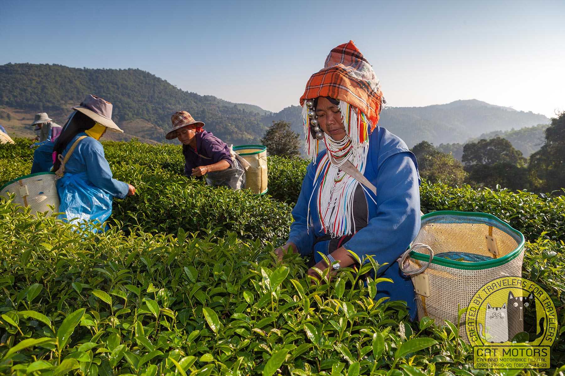
A highland town settled by ethnic Chinese (ex-KMT soldiers) after 1949 (Mae Fa Luang District, 60 km west of Mae Sai). It’s now famous for tea plantations, Yunnan-style restaurants and its colorful Wat Santikhiri (built by hilltribe communities). The nearby Tea 101 and Sweet Mae Salong cafes offer mountain-view lattes. Mae Salong’s hilltop promenade gives views into Myanmar; a small Sun Yat-sen museum recalls its history. The annual winter Tea Festival (Dec–Jan) features orchid exhibits and parades.
Akha and Lahu Villages (Fang District)
North-west of Mae Sai, the mountains host many hilltribe villages. From Chiang Rai or Fang one can take guided tours (or stay homestays) in Akha or Lahu villages, learning about their traditions (intricate hilltribe textiles, headdresses) and trying tribal dishes. Hilltribe-run coffee farms along these roads are worth a stop.
Ban Sop Ruak (Golden Triangle Village)
At the confluence of the Ruak and Mekong, this scenic riverside village is touristy but lively. Besides the Golden Triangle viewpoint, visitors can boat to a Lao border island (Pier next to beautiful Wat Sop Ruak) or visit the Hall of Opium museum to understand the region’s past. The village also has a folklore park dedicated to Thai heroines and local spirits.
Food and Drink Guide
The Mae Sai area combines Northern Thai and Burmese/Shan cuisines. Must-try northern Thai dishes are plentiful (often eaten with sticky rice). Popular items include Khao Soi (coconut curry noodle soup), Sai Oua (spicy herbal sausage), Nam Ngeow (fermented pork and tomato noodle soup), and Kaeng Hang Lay (northern pork curry). Local northern Thai style sticky rice grilled fish and minced pork salads are common street foods.
From Myanmar/Shan traditions: look for Shan noodles (kuaytiow kha kha), Mohinga (Burmese fish chowder), and Laphet Thoke (Burmese tea-leaf salad). Burmese-style milk tea and coffee stands are common; they brew strong coffee with sweet condensed milk. Vendors also sell tikkausang (sticky rice with spicy sausage) and lap chee sauce (famous Sri Lanna chili-dip).
Cafés and tea stops: In Mae Salong and nearby, “Sweet Mae Salong” and “Pha Yang Coffee” offer fresh coffee, cakes and views. The Tea 101 plantation (Mae Salong) and Choui Fong Tea Plantation (further east in Mae Chan) have tea gardens with tasting rooms. In Mae Sai town, small roadside kiosks sell oliang (iced Thai coffee) and fruit shakes. For a sit-down meal, local Lahu-run restaurants serve kao kan chin (pork and herb rice) and BBQ meats, while larger eateries may serve Isaan and Thai curries.
Don’t miss dessert: Kanom Krok (coconut-rice hotcakes) at market stalls, sai mai mamuang (Northern Thai silk floss candy), and seasonal wild bananas or Burmese smoothies (with roasted peanuts and jaggery).
Itinerary Suggestions & Routes

Scenic Motorcycle Route (2–3 days)
A popular loop starts in Chiang Mai, heads north through Fang to Mae Salong and Mae Sai, then returns via Mae Chan and Chiang Rai. For example:
- Day 1: Chiang Mai – Fang (via Hwy 107) – Doi Mae Salong – Mae Sai (≈300 km). Start pre-dawn to pass Fang (visit Wat Chaloem Wanaram) and drop down to Doi Mae Salong; stop at Tea 101 and Wat Santikhiri in late morning. In the afternoon ride along the restricted Border Road 1149 toward Mae Sai (passport/ID needed), which a seasoned rider calls “stunning, pretty much no one on this road”. Arrive Mae Sai by evening, visit Wat Phra That Doi Wao at sunset for views.
- Day 2: Mae Sai – Golden Triangle – Chiang Saen – Chiang Rai (≈200 km). Cross the Friendship Bridge into Tachileik (unless you don’t have a visa) and return to Mae Sai Market for lunch. Head south to the Golden Triangle viewpoint, then stop in Chiang Saen’s old city (Wat Phrathat Chedi Luang and Lao Chai market). Continue via Singha Park or Choui Fong Tea Plantation (north of Chiang Rai) back to Chiang Mai (use Route 118 or 118+1).
One-Day Mae Sai Excursion from Chiang Mai
Start early (5am) and take the direct highway (118→1). Optional stops: Doi Saket orchid farms, Ban Den Golden Pagoda (near Mae Malai), and Wat Rong Khun (“White Temple”) near Chiang Rai. By noon, continue to Chiang Saen or Doi Pha Tang for riverside lunch. Afternoon: Golden Triangle, then Mae Sai border. Return via highway or make a loop via Phayao. Expect ~12–14 hr total ride; pack snacks and fuel well.
Chiang Rai Day Trip (versatile)

From Chiang Rai city, you can ride north to Mae Sai directly (Route 1, ≈1.5 hr), or east across the mountains to Phu Chi Fa for sunrise (requires overnight). Alternatively, Chiang Rai→Doi Pha Tang→Mae Sai covers many highlights in ~8 hr (8:00 depart Chiang Rai, Mekong sunrise at Doi Pha Tang, lunch at Chiang Saen, border afternoon).
Note: All itineraries above assume good weather. Adjust start times for daylight and fitness for climbs (some trails are steep). Fuel up often – gas stations can be sparse in the hills after dark. Always carry identification (especially passport) when riding near the border (the restricted border road has occasional checkpoints).
Practical Travel Tips
- Border Crossing: Thai and Myanmar immigration offices lie on the Friendship Bridge. Tourists cannot casually enter Tachileik without proper visa. A few tour companies offer one-day visa-run services; otherwise, plan an overnight stay in Myanmar. Thai immigration no longer permits rapid “border run” entries: expect a 15-day stamp at best if you try. Always show your passport/ID when requested in this militarized zone. Smokers: note that both countries enforce strict littering and smoking laws at customs.
- Transport: Buses and vans run frequently between Chiang Rai city and Mae Sai, and from Chiang Mai. In Mae Sai, tuk-tuks and red trucks (songthaews) ply short routes (e.g. to bus station or temple). Renting a motorbike from our fleet (by the day or longer) is a popular way to explore – rates ~250–350 ฿/day. If riding, insist on a good helmet (Thailand requires one) and check brake/tire condition before long hill rides.
- Local Customs: Dress modestly at temples (cover shoulders/knees, remove shoes indoors). It’s polite to wai (put palms together in greeting) when interacting with elders or monks. Feet should not point at Buddha images or people. Many locals (especially in villages) appreciate if you remove shoes when entering homes. Tipping is not expected but small payments at local coffee stalls or tour guides are appreciated. Bargaining is common in markets – start around half the asking price on souvenirs.
- Safety: Mae Sai’s main town is safe, but petty theft can occur in crowded markets (watch your belongings). In very remote areas, bear in mind that medical help is distant; carry a first-aid kit and sufficient drinking water on long hikes. Beware of weather-related issues: during the rainy season roads (especially dirt trails) may wash out. Flash flooding can make some border river crossings dangerous on foot. Listen to local radio or ask hotel staff about road closures after storms.
- Gear: For hill treks and caves bring sturdy shoes, a hat, and raincoat. A headlamp or flashlight is useful for Wat Tham Pla or cave tours. Sunscreen and mosquito repellent are essential year-round. In winter (Nov–Feb) pack a light jacket and layers for nighttime, as temperatures can drop below 10 °C in the mountains.
- Connectivity: Smartphone data generally works in town and along main roads, but can be spotty in high elevations (e.g. Doi Mae Salong peak). SIM cards with data are available in Chiang Rai (TrueMove, AIS), which can be used for navigation.
- Money: Thai baht is used on the Thai side; Myanmar kyat on the Tachileik side. ATMs in Mae Sai town dispense baht. Credit cards are accepted at larger hotels and resorts, but smaller shops and villages may be cash-only. The border market vendors may quote prices in dollars or baht – clarify currency up front.
Local Legends & Folklore
Northern Thailand is rich in legends, and Mae Sai’s landscape has a few stories to tell. The best-known is the Sleeping Lady legend of Doi Nang Non. Local lore goes that a Shan princess and her lover hid in the mountains (now Doi Nang Non) to escape her father’s wrath. The stable-boy was captured and killed, and grief-stricken, the princess stabbed herself. Her blood is said to have formed the waters of Tham Luang cave, and her body became the mountain range itself – forever sleeping atop the hills. Villagers still whisper that at night one can hear her cries in the wind, and that the cave’s waters are infused with her tears. This legend became internationally famous in 2018 when the real-life Wild Boars soccer team got trapped in that very cave. The dramatic rescue of those 12 boys (now dubbed the “Tham Luang Miracle”) has entered local folklore too: tours of the cave site recount the tale of compassion, sacrifice and global teamwork that unfolded under the Sleeping Lady.
At Wat Tham Pla, there is a lighter folk story: visitors joke that the resident monkeys obey no one but the temple’s abbot, and that the fish in the pond are the reincarnated souls of old fishermen. Enshrined in the “hell garden” are dioramas of Buddhist karma – eerie images meant to remind onlookers of a life beyond sorrow. The moss-covered reliefs and Buddha statues around the cave temple seem to emerge from a fairy tale, where nature and the divine co-exist. The longtime stupa at Doi Wao is associated with King Wao of Yonok (an ancient Lanna ruler), and some legends say a relic (a golden Buddha hair) is interred there, giving the mountain its sanctity.
Finally, even Mae Sai’s modern border market has its myths: one story says that if you stand at sunset on the Thai–Myanmar Friendship Bridge and watch the sun sink over Tachileik, you’ll see a vision of two kingdoms once joined. Whether myth or not, Mae Sai’s fusion of cultures and history feels almost magical. Travelers leave not just with souvenirs, but with a sense of having stepped into a land of ancient tales – and lived experiences – at Thailand’s very edge.
Mae Sai is a beautiful destination with many natural attractions and historical landmarks. When planning your trip, make sure you include a visit to the white temple and caves and arrange a day of hiking and exploring the mountainous region of Mae Sai and its remote villages. Stop by the market and purchase Thai and Burmese trinkets and souvenirs. Lastly, find an authentic Thai restaurant and enjoy a laid-back lunch with a view of the town.


