Nan Loop Ride Guide: 820 km of Empty Roads in 5 Days
The Nan Loop is a 5-day motorcycle route through the mountains and valleys of Northern Thailand, starting and ending in Chiang Mai. At roughly 820 kilometers, it winds through Phrae, Nan, and Phayao provinces on roads that range from smooth four-lane highways to mountain passes where the nearest fuel station is an hour behind and another hour ahead.

Most riders who come to Northern Thailand do the Mae Hong Son Loop first. It is the famous one, the one with 1,864 curves and a certificate at the end. The Nan Loop is what those riders do next, when they want the same quality of mountain riding without the tour buses, the banana pancake hostels, and the Instagram crowds that have settled in Pai. The provinces east of Chiang Mai are emptier, less marketed, and in most ways more rewarding. Phrae has teak mansions that wealthy logging families built a century ago, still standing on streets where dogs sleep in the road with the calm of creatures that know traffic will wait. Nan was an independent kingdom until the late 19th century, and its temples contain murals that art historians rank among the finest narrative paintings in Southeast Asia. Bo Klua, a village enclosed by mountains on all sides, has been producing salt from underground wells for 800 years using a process that has not changed since the 13th century.
And then there are the roads. Route 1081, the “Road Above the Clouds,” runs along ridgelines for 80 kilometers of continuous curves with valleys dropping away on both sides. Route 1148, on the western leg, is consistently ranked among the top 10 motorcycle roads in the world: 91 kilometers of smooth asphalt, perfectly cambered bends, and virtually zero traffic. Riders who have done both the Mae Hong Son Loop and the Nan Loop tend to say the same thing: Mae Hong Son has more famous stops, but Nan has better roads.
The 5-day route described below covers the full loop at a comfortable pace, with one night in Nan city, an overnight in Pua after the Doi Phukha loop, and an evening by the lake in Phayao. The route is entirely paved and can be ridden on any motorcycle of 150cc or above, though the sustained mountain climbs through Doi Phukha National Park will punish anything smaller.

The Nan Loop rewards planning. Fuel stops are limited on mountain stretches, particularly between Pua and Bo Klua and along Route 1148, so riders must top up at every opportunity. The mountain sections include sustained climbs through Doi Phukha with gradients of 15-20%, where 150cc is the minimum and 250cc or above is comfortable.
Day 1: Chiang Mai to Phrae (The Teak Towns That Time Left Behind)
Distance: approximately 200 km. Riding time: 4-5 hours with stops. Route: Highway 11 south to Lampang area, Route 1023 east to Phrae. Highlights: Wat Doi Ti glass skywalk, Ban Pin Railway Station, Phrae old town teak mansions.
The first day eases into the journey. Highway 11 south from Chiang Mai is wide, flat, and largely unremarkable, the kind of road that exists to deliver riders somewhere else. But that somewhere else, Phrae, is worth the transit. One of Thailand’s least-visited provincial capitals, Phrae still has teak mansions from the logging era standing on quiet streets where the loudest sound at midday is a temple bell. The riding is a warm-up: no mountain curves, no altitude, no white-knuckle sections. Those come on Day 3.
Depart Chiang Mai before 9:00am. The ride to Phrae takes 4-5 hours with stops, and an early start leaves time to explore the old town in afternoon light. Fill up in Chiang Mai. Fuel stations are frequent along the entire Day 1 route.
Wat Doi Ti Skywalk
Leaving Chiang Mai, head east on Kaew Nawarat Road and join Highway 11 south toward Lampang. About 20 minutes out, entering Lamphun province, a large golden statue on a hilltop appears to the left. This is Wat Doi Ti, home to the largest monument of Kruba Srivichai in Thailand and a glass skywalk that opened in August 2024.
Kruba Srivichai is the most revered monk in Northern Thai history. In the 1930s, he organized the construction of the road up Doi Suthep mountain, mobilizing thousands of volunteers who built it by hand without government money. Every Northern Thai knows his story. His statue at Wat Doi Ti sits on the hilltop like a guardian at the gateway to Lamphun, and the reverence of visiting Thai families is evident even on a Tuesday morning.
The glass-bottomed skywalk wraps around the hilltop with 360-degree views: Doi Suthep and Doi Inthanon to the west, the Si Kru Ba pagoda below, the green valleys of Lamphun in every direction. On clear mornings, Thailand’s highest peak is visible from here. The skywalk is modest by international standards, but the temple complex is genuine and the views are good.
Skywalk entrance: 50 baht. Socks required for the glass floor (bring your own or buy for 20 baht at the entrance). Open daily 08:00-17:00. Shuttle up the hill for 20 baht. Budget 30-45 minutes. Visible from Highway 11 on the left.
Lampang detour: Two extra hours and 40 extra kilometers open up the finest Lanna temple in Northern Thailand. Wat Phra That Lampang Luang in Ko Kha district, 18 km south of Lampang city, is a 15th-century fortified temple complex containing the oldest surviving wooden building in the country (Wihan Luang, built 1476) and a camera obscura that projects an inverted image of the golden chedi onto a white cloth inside a tiny chapel. A detailed Lampang guide covers this and 19 other attractions in the province.
Ban Pin Railway Station
After Wat Doi Ti, continue south on Highway 11. The road climbs a forested mountain range marking the border between Lampang and Phrae provinces. On the descent into Phrae’s side, watch for the left turn onto Route 1023, a two-lane country road with gentle curves and almost no traffic. This is the standard motorcycle route into Phrae, avoiding the busier Highway 101 through Den Chai. Rice paddies, forested hills, small villages, and the kind of emptiness that makes riding feel like exploration rather than commuting.
About 19 km along Route 1023, the road passes through Ban Pin village, home to a railway station preserved from another era. Ban Pin Station is built in a European-style timber frame, painted in pastel colors, and looks like it was transported from a Bavarian village. A few trains per day stop here, and the station is often deserted except for a couple of waiting monks or a woman selling fruit from a basket. The single platform, the wooden ticket window, the hand-painted signs, all original.
There is something about a nearly empty railway station that invites lingering. The tracks curve away in both directions toward places that cannot be seen, and the only sound is the creak of the wooden building settling in the heat. Thailand’s railway history feels tangible here, personal rather than displayed under glass.
In Ban Pin village, signed from Route 1023. Budget 15-20 minutes. The slow local trains between Chiang Mai and Bangkok sometimes stop here. Timing a visit with a train arrival is luck, but it makes for a good scene.
Detour: Wat Phra That Suthon Mongkhon Khiri (approximately 50 km round trip). Riders who stay on Highway 101 through Den Chai instead of turning onto Route 1023 will pass an 85-meter reclining Buddha in Burmese style along a hillside, 5 km south of Den Chai town. Behind the reclining Buddha, a naga staircase leads up the hill to an ordination hall where a gold-coated Buddha sits surrounded by more than 30 golden pagodas. The temple rarely appears in English-language guidebooks. Free entry, open daily 8:00-17:00, budget 30-45 minutes. This route bypasses Ban Pin and Route 1023 entirely.
Phrae
From Ban Pin, continue east on Route 1023 for about 20 km to Phrae. The city has roughly 15,000 people, a moated old town, and the quiet confidence of a place that was once very wealthy and has not yet decided whether that era is over.
Phrae was a center of the teak trade in the 19th and early 20th centuries. The Borneo Company and other European logging firms operated here, and the Thai-Chinese merchant families who supplied them built mansions to announce their success. Several survive. The old town retains a quietness that busier tourist centers like Pai and Chiang Rai lost years ago. Foreign visitors are rare. The night market vendors may look up with mild surprise when a farang walks past.
Phrae’s old town is compact: all attractions within a 1-2 km radius, easily covered on foot or motorcycle in an afternoon. Arrive before 4:00pm for enough daylight.
Vongburi House
The most famous building in Phrae is Vongburi House (also spelled Wongburi), a pink-and-white teak mansion built between 1897 and 1907 by Chinese craftsmen for a noble family connected to Phrae’s last ruling dynasty. The exterior features elaborate fretwork carvings typical of the Thai-European fusion style that teak money produced: tropical materials arranged in Victorian patterns, a hybrid architecture that existed only in this part of Southeast Asia for about forty years.
Inside, period furniture fills the rooms. Imported European pieces sit alongside Thai decorative arts, formal dining rooms have teak floors polished to a mirror finish, and bedrooms contain antique four-poster beds with mosquito net frames. The family photographs on the walls add a dimension that museum exhibits often lack: actual faces of the people who walked these rooms, posed stiffly in Edwardian collars and Lanna silk.
Entry 30 baht. Open daily. Photography allowed. Budget 20-30 minutes.
Wat Luang
Founded in the 9th century, Wat Luang is the oldest temple in Phrae and still an active religious site. The compound includes a Lanna-style stupa, a wooden viharn with carved details showing Burmese and Lanna artistic influences, and a small museum of Buddha images collected from across the province.
Wat Luang feels less polished than the famous temples of Chiang Mai, which is part of its value. The buildings show their age honestly: weathered wood, faded gilding, a sense of genuine history rather than tourist restoration. Monks sweep the grounds in the early morning. Cats sleep in the shade of the ordination hall.
Free entry. Open daily. Inside the old city walls. Budget 15-20 minutes. The small museum is worth a look if the door is open.
Wat Phra Non
Wat Phra Non houses a 300-year-old reclining Buddha, one of the oldest in the province. The temple compound also features a scripture library built on stilts in the middle of a small pond, a Lanna architectural solution to protect palm-leaf manuscripts from termites and flooding.
The reclining Buddha stretches across most of a dimly lit viharn. The quiet of the room and the age of the statue make it easy to sit for a few minutes and simply look.
Free entry. Open daily. The scripture library on stilts is the most photogenic element, particularly with reflections in the pond water. Budget 15 minutes.
Detour: Phae Muang Phi (approximately 36 km round trip). About 12 km northeast of Phrae, a 6 km access road leads to eroded sandstone pillars and mushroom-shaped rock columns in a pine forest clearing. Some pillars stand up to 15 meters tall, shaped by millions of years of wind and water erosion. The pine forest setting is unusual for Thailand. On weekdays, the place is almost empty. Entry 100 baht for foreigners, 20 for Thais. Open daily 8:00-16:30. Budget 45-60 minutes. Best in late afternoon light. Better suited for travelers arriving in Phrae early or staying an extra night.
Phrae Night Market and Dinner
In the evening, the small night market sets up in the old town area. This is not Chiang Mai’s Sunday Walking Street. Phrae’s market is a dozen vendors, maybe twenty on a busy weekend, selling grilled meats, som tam, sticky rice, and curry dishes. The food is cooked for locals, and the pricing reflects that. A full dinner runs 60-80 baht.
Phrae is also known for “moh hom” indigo-dyed cotton products. Workshops and small shops in the old town sell traditional shirts, trousers, and bags dyed using genuine techniques, not factory reproduction. A hand-dyed moh hom shirt runs 200-400 baht.
For a sit-down meal, look for Khao Soi Mae Jang near the old town, or any restaurant displaying sai ua (Northern Thai sausage) on the counter. Phrae’s sai ua is distinctly different from Chiang Mai’s version: coarser grind, more lemongrass.
The night market is daily but busiest on weekends. Location can shift seasonally; ask at the guesthouse. If arriving on a quiet weeknight and the market is sparse, food stalls along the main road near Pratu Chai gate serve the same dishes every evening.
Overnight in Phrae
Phrae’s accommodation is modest. Baan Pratap Chai is a converted teak house within the old city walls, basic but with character, rooms around 600-900 baht. Phrae Nakara Hotel is the most comfortable option in town: mid-range with a pool, clean rooms, reliable air-conditioning, 900-1,500 baht. A handful of homestays offer rooms in traditional wooden houses for 300-500 baht with thin mattresses and shared bathrooms.
Most places have secure motorcycle parking. Book ahead during peak season (December-January). If everything in the old town is full, the highway hotels on the outskirts are modern, anonymous, and always have availability.
Day 2: Phrae to Nan (Where Siam Kept Its Secrets)
Distance: approximately 120 km. Riding time: 2-3 hours. Route: Highway 101 north. Highlights: Tham Pha Nang Khoi cave, Nan valley countryside, Wat Phumin murals, Nan National Museum, teak noble house, Khao Noi sunset viewpoint, walking street.
Day 2 is short by design. The 120 km from Phrae to Nan takes 2-3 hours on the bike, leaving the entire afternoon and evening for Nan city on foot. This is the cultural day, the day where the motorcycle gets parked and the walking begins. Nan was an independent kingdom for centuries before absorption into Siam, and that autonomy left its mark: the temples here do not look like Chiang Mai’s, the murals tell different stories, and the museum displays artifacts from a culture that developed its own artistic traditions in relative isolation.
Sleep in a little and still arrive in Nan by lunchtime. Highway 101 from Phrae is well-paved and quiet: gentle hills, farmland on both sides, occasional views of the Nan River valley opening up ahead. No challenging riding. Save energy for the Doi Phukha mountains on Day 3.
Tham Pha Nang Khoi
About 40 km from Phrae on Highway 101, a striking limestone cliff appears ahead, a vertical wall of gray rock rising abruptly from flat farmland. Watch for the sign to Tham Pha Nang Khoi at the foot of the cliff.
A natural stone archway marks the entrance to the temple grounds. Unlike the typical bright, multicolored Thai temple, the small chapel here is plain white, set under large shade trees with only birdsong for a soundtrack. Behind the temple, a rocky stairway of about 100 steps leads up into the limestone cave.
Inside, the temperature drops immediately. Stalactites hang from the ceiling, stalagmites rise from the floor, some illuminated by colored lights that shift the mood from geological to theatrical. Deeper in, the cave’s famous formation appears: a stalagmite said to resemble a woman holding a child, the “Nang Khoi” or “Waiting Lady.” Local legend says she waited here for her lover to return from war until she turned to stone. Near the figure is a heart-shaped stalactite, an accident of geology that the legend has claimed as proof.
The cave is small enough to explore in 20 minutes, large enough to feel like a genuine cave rather than a tourist attraction with a cave theme.
Highway 101, 40 km north of Phrae. Budget 30 minutes. Bring a phone light for the dim sections. Watch footing on damp floors. Free entry to the temple grounds; a small fee (20-40 baht) sometimes collected at the cave entrance.
Arrival in Nan
Back on Highway 101, continue north. The road crosses into Nan province. The landscape changes subtly: gently rolling hills covered in cornfields, and after harvest season the dry stalks give the land a golden-brown color dotted with surviving green. About 50 km past the cave, Nan city appears in its valley.
Nan (population roughly 25,000) sits along the Nan River with the unhurried confidence of a place that has never needed to compete for attention. The handful of foreign travelers here at any given time are mostly riders doing this loop or people specifically seeking places where tourism has not yet rewritten the character of a town. Check into accommodation and head out on foot.
Most of Nan’s sights are within walking distance in the compact old town. The circuit below follows a logical order and takes 3-4 hours at a relaxed pace. Start with Wat Phumin, then the museum, then walk the connecting streets to the remaining temples and the noble house, finishing at Khao Noi hill for sunset.
Wat Phumin
Start at Wat Phumin, Nan’s most famous temple and the reason art historians make the trip here. Built in the 16th century in a cruciform plan with four entrances, each guarded by elaborate naga serpent stairway railings, it is architecturally unique in Thailand.
The real treasure is inside. The interior walls are covered with murals depicting scenes of local life, Buddhist legends, and the daily activities of Nan’s people in centuries past. The most iconic painting shows a man whispering into a woman’s ear, often called “the Whisper of Love” or “Pu Man Ya Man.” Art historians believe it portrays one of the mural painters flirting with a local woman, a moment of human intimacy preserved in paint for over a century. The image has become Nan’s unofficial symbol, reproduced on everything from coffee mugs to city signage.
The murals reward slow looking. They are filled with details: market traders arguing, fishermen pulling in nets, dogs underfoot, and depictions of foreigners that Nan’s people encountered through trade, their clothes and features rendered with the curious precision of someone drawing the unfamiliar. These murals are considered among the finest examples of Thai narrative art in the country.
Free entry. Open daily. Photography allowed, no flash. Most peaceful early morning or late afternoon; midday sometimes brings small tour groups. Budget 30-45 minutes.
Nan National Museum
Directly across the street from Wat Phumin, the Nan National Museum occupies a former palace of the ruling family. The building alone is worth the entry fee: a classic Lanna-colonial structure with high ceilings and wide verandas.
Inside, displays cover Nan’s history as an independent kingdom and the Tai Lue culture of the region. The textile collection is particularly strong. Nan’s weaving traditions are among the most sophisticated in Thailand, with patterns that differ from village to village, each encoding information about the weaver’s community and status. Weapons, ceramic artifacts, and Buddha images spanning several centuries fill the remaining rooms. One room focuses on the ethnic communities of Nan province: Tai Lue, Hmong, Mien, and Khmu peoples.
English-language descriptions are provided for most exhibits, which is not always the case in Thai provincial museums. The air-conditioning is also welcome after walking in the heat.
Entry 150 baht for foreigners. Open Wednesday to Sunday, 9:00am-4:00pm. Closed Monday and Tuesday. Plan Nan days accordingly. Budget 45-60 minutes.
Wat Phra That Chang Kham
A 5-minute walk from Wat Phumin, Wat Phra That Chang Kham is the “Elephant Temple.” The central golden pagoda rises from a base decorated with 24 carved elephant statues, their trunks raised, supporting the stupa above them. This design exists nowhere else in Thailand.
The compound is quiet and well-maintained, with several old viharns containing Lanna-period Buddha statues. One houses a golden walking Buddha considered among the finest examples of Sukhothai-era sculpture in the north.
Free entry. Open daily. The golden elephants catch the low afternoon sun well. Unlike Wat Phumin, Chang Kham is often nearly empty. Budget 15-20 minutes.
Wat Ming Muang
Wat Ming Muang is hard to miss: entirely white and gleaming against the older buildings of the old town. Its significance is the city pillar (lak muang), the spiritual center of Nan. Every Thai city has a lak muang, and this is where Nan’s has stood for centuries. The interior murals are recent and detailed. For foreign visitors, this is a quick stop: interesting for the city pillar context, photogenic for the exterior, not in the same league as Wat Phumin or Chang Kham.
Free entry. Open daily. Budget 10 minutes. On the walking route between Wat Phumin and the museum, no detour required.
Nan Noble House
Hong Chao Fong Kham is a 200-year-old teakwood mansion built entirely without nails or screws, using traditional mortise-and-tenon joinery throughout. The same construction technique used in Lanna temple architecture, applied here to a domestic building.
The house operates as a small museum: antique furniture, old photographs, silverware, artifacts from Nan’s royal past. The teak has aged to a deep, almost black color, and the rooms still feel like someone’s home rather than an exhibition. Floorboards creak underfoot. Light enters through shuttered windows in patterns that shift through the afternoon. A caretaker is usually on site, happy to explain the history in Thai with occasional English, or simply to wave visitors through.
The craftsmanship rewards close examination: every joint fitted without metal fasteners in a building that has stood for two centuries in a climate that destroys wood.
Entry 20 baht. Open Wednesday to Sunday, 9:00am-5:00pm. Closed Monday and Tuesday. Short walk from the National Museum. Budget 20-30 minutes.
Khao Noi Sunset
Time this for the end of the afternoon. Wat Phra That Khao Noi sits on a hill west of Nan town, the access road climbing steeply for about 2 km from the main road.
At the summit, a golden Buddha faces east over the city. Behind the Buddha, the sun sets over the mountains. The view takes in Nan town, the Nan River winding through it, rice fields in golden light, and mountain ranges fading to blue in the distance. On clear evenings during cool season, the colors deepen to oranges and purples that look staged but are not.
Free entry. Arrive 30 minutes before sunset for the best light. Cool season sunset is roughly 5:45-6:00pm. Bring a jacket: the hilltop catches wind. Ride back down carefully after dark, no lighting and a few sharp bends. Budget 30-45 minutes.
Walking Street and Dinner
If the visit falls on a Friday, Saturday, or Sunday evening, the area in front of Wat Phumin becomes a walking street market. Grilled meats, sai ua, papaya salad, Nan’s local desserts. Handicraft stalls with Tai Lue textiles, hand-woven scarves, silverwork, and indigo-dyed moh hom cotton. The market is smaller and calmer than Chiang Mai’s night bazaars. Prices are local. The Tai Lue textiles are genuinely handmade, and a hand-woven scarf (300-800 baht) is a meaningful purchase.
Walking Street: Friday, Saturday, Sunday, approximately 5:00pm to 10:00pm, in front of Wat Phumin.
For dinner any night of the week, the food market opposite Dhevaraj Hotel (the “State Property market”) has stalls open late. Grilled meats, khao soi, papaya salad, at prices that make Chiang Mai’s food scene look inflated. For a sit-down meal, Krua Huen Hom is a family-run restaurant known for gaeng om (herbal curry with pork ribs), sai ua, and laab moo. Portions are generous, 50-120 baht per dish.
Nan also has a surprisingly good cafe scene. Several coffee shops in the old town serve locally grown arabica from the mountain villages, grown at elevations comparable to Chiang Rai’s. Ask at the guesthouse for the current favorite; the cafe scene turns over.
If khao soi is the priority, it should be. Nan’s version uses a slightly different curry base than Chiang Mai’s, and the egg noodles are often fresh-made.
Overnight in Nan
Nan has more accommodation options than Phrae but remains modest. Pukha Nanfa Hotel is a well-run mid-range option with pool, clean rooms, 800-1,500 baht. Dhevaraj Hotel near the night market is older and more basic, but step outside and food is everywhere, 500-800 baht. Several boutique guesthouses in converted wooden houses along the river offer character and quiet for 600-1,200 baht. A few hostels near the old town have dorm beds from 200 baht.
Rest well. Tomorrow is Day 3: the Doi Phukha loop, 200 km of mountain roads, the day that makes the entire Nan Loop worth the trip.
Day 3: Salt, Stone, and the Road Above the Clouds
Distance: approximately 150 km. Riding time: 3-4 hours without stops, half day with stops. Route: R1169 south to Santisuk, R1081 north along the ridgeline to Bo Klua, R1256 west over Doi Phukha to Pua. Overnight in Pua.
Everything up to this point has been prologue. The temples in Nan, the teak mansions, the pleasant valley riding through rice fields, all of it exists in orbit around this single circuit. The Doi Phukha loop is what riders come to Nan province for, the reason GT-Rider’s forums carry a dedicated thread that runs to 47 pages, the reason the few motorcycle tour companies operating in this province charge a premium for the Bo Klua day. Two hundred kilometers on a map. On these roads, with these gradients and this density of curves, it fills an entire day and leaves riders in Pua by evening with forearms that ache from gripping the bars and the kind of tired that sleeps well.
The direction matters. Some riders do this loop from Pua first, climbing Doi Phukha on R1256 and descending to Bo Klua before taking R1081 south. Our route runs the opposite way: south from Nan on R1169 to pick up R1081, then north along the ridgeline to Bo Klua, then west over Doi Phukha on R1256 and down into Pua for the night. The logic is simple. Tomorrow’s Route 1148, the best motorcycle road in Northern Thailand, begins at Tha Wang Pha, 25 km south of Pua. Ending the day in Pua means waking up 25 minutes from the start of that road, instead of backtracking 60 km from Nan to reach the same point. The views on R1081 heading north are better too, facing east toward the Lao border and away from the afternoon sun. David Unkovich, who has ridden these roads more times than anyone cares to count, makes the same observation.
Depart Nan early, before 8:00am. The day is long and the mountain roads demand concentration that fades with heat and fatigue. Fill up in Nan. There is fuel again in Bo Klua, roughly 85 km into the ride, but nothing between.
Nan to Route 1081
Route 1169 leaves Nan heading south toward Santisuk. The first few kilometers pass through villages and light traffic, the kind of suburban outskirts that every Thai provincial town wears like an untucked shirt. After that, the road finds its character: smooth asphalt, winding hills, steep undulations, and the traffic thins to almost nothing. The landscape rolls and dips through dry forest and cornfields. This is not the warm-up that Highway 101 to Pua would have been. R1169 has real curves and real gradient, enough to wake up the arms and settle the rider into the bike before the main event.
About 25 km from Nan, R1169 meets R1081 at a junction near Nam Yao. Turn left, heading north. This is where the day begins in earnest.
Route 1081: The Road Above the Clouds
The road runs along high ridgelines for 80 km between the R1169 junction and Bo Klua. On clear mornings between November and February, it sits above a solid layer of white cloud that fills the valleys while the ridgetop stays in sunshine. The Thai name translates as “Road Above the Clouds,” which is descriptive rather than poetic. On afternoons when the valleys are clear, the views are no less striking: mountain ranges receding in layers of blue and green to every horizon, the scale of it making the valley roads below look like model railway layouts.
This is the section that appears in every motorcycle article about Northern Thailand, the reason riders add Nan to their itinerary in the first place. The Nation newspaper crowned it the most beautiful road in the country. Motorcycle tour operators who have ridden across five continents put it in their personal top lists. The claims sound inflated until the first ridgeline view, after which they sound understated.
The pavement is excellent. The curves are continuous, with no straight sections longer than a few hundred meters for the entire 80 km. Sweeping bends alternate with tighter switchbacks. Traffic amounts to a pickup truck every ten minutes and the occasional tour bus grinding uphill in first gear. The road surface is well maintained, the lane markings are fresh, and guardrails appear where the drop warrants them.
No fuel, no food vendors, and intermittent phone signal between the R1169 junction and Bo Klua. Carry water. If riding a smaller bike (125-250cc), the sustained climbs will work the engine hard but should cause no problems on a well-maintained machine. Watch for fog before 8:00am and the occasional farm truck.
The Viewpoints
The Department of Highways has marked four viewpoints along the ridgeline between kilometer markers 32 and 64. These are pull-offs where the road’s geometry creates shapes photogenic enough to have acquired names. Riding north from the R1169 junction, they appear in ascending order.
The first, near km 32, is a U-shaped bend that curls back on itself tight enough to see the opposite side of the curve from the apex, a disorienting piece of road geometry that the brain takes a moment to parse.
Road Number 3 arrives at km 38: three curves stacking vertically down the hillside, dark asphalt vivid against the green slope, the shape unmistakably a numeral three seen from above. This is the postcard, the image that makes people book flights to Nan. Tour buses stop here. A drinks vendor parks a cart nearby.
“I Love Nan” appears at km 46, a curve that has acquired a heart-shaped sign. The sign is absurd. The fifty motorcycles routinely parked beside it for photographs suggest that absurdity is not a deterrent. The curve itself offers views south toward the Santisuk valley, the road visible below as a grey line descending from the ridge.
The last viewpoint coming from the south arrives near km 64: Cloth-Fold Bend, a series of tight switchbacks folding down the mountainside in pleated layers, each curve visible from the viewing area above.
Tour buses stop at the viewpoints and passengers walk into the road for photographs, which creates a hazard around blind mountain corners. Ride accordingly. The light is best in late afternoon when long shadows emphasize the road’s curves against the slope, but riders coming from Nan in the morning will catch the eastern light on the east-facing slopes, which has its own quality.
Bo Klua Salt Wells
Past Cloth-Fold Bend, R1081 descends from the ridgeline and drops into the Bo Klua valley, a settlement enclosed by mountains on all sides. Bo Klua means “salt pond,” and the village has been producing rock salt from mountain wells for over 800 years, one of the oldest continuously operating salt production sites in the world.
This is not a museum reconstruction. The salt wells are a working operation that has continued without interruption since at least the 13th century. The village sits roughly 500 kilometers from the nearest coastline, deep in continental Southeast Asia, yet concentrated saltwater rises from underground through geological formations left by sea beds that retreated hundreds of millions of years ago. Two wells remain active.
The process is old and simple: saltwater drawn from wells with buckets, poured into flat pans, heated over wood fires in open-air huts. As the water evaporates, white crystals form on the surface and are scraped off. The entire cycle, from well to packaged salt, happens in front of visitors, unenclosed by ropes or glass. Workers tend fires, stir pans, scrape salt into bags. With even basic Thai, they will explain the process. Without it, the operation is visual enough that language is unnecessary.
This salt was so valuable that Nan’s kings used it as currency and tribute. It traded along mountain routes to Chiang Mai, Chiang Rai, and as far as Yunnan. Wars were fought over these wells. The village’s strategic importance lasted centuries, long enough that it shaped the politics of an independent kingdom, and it gives a different weight to what is now a quiet settlement with chickens in the road and a coffee shop on the corner.
The village itself is small enough to walk in twenty minutes. A handful of wooden houses line a single road. The local restaurants use Bo Klua salt generously, and the food tastes different for it, the same dishes found in any Northern Thai town but with a mineral edge that commercial table salt cannot replicate. The salt scrubs sold in small bags near the wells make practical souvenirs, the kind of thing that costs 50 baht here and would cost twelve times that in a Bangkok spa shop with a logo on the packaging. Watching salt being made the way it was made seven centuries ago, fire under the pans and the crust thickening in real time, belongs to a category of travel experience that resists description and persists in memory.
The wells are open 8:00 to 17:00 daily. Free admission. Salt production halts during Buddhist Lent (approximately July through September) and around Songkran in mid-April. During those periods the wells and infrastructure are visible, but the fires are out and the pans are dry. For the full experience, visit November through March. Budget 45-60 minutes for the wells and a walk around the village.
Doi Phukha National Park
From Bo Klua, Route 1256 heads west and begins climbing immediately. The change is abrupt. Tight switchbacks, sustained gradients, elevation gain from the valley floor to over 1,700 meters at the road’s highest point. Tropical lowland forest gives way to mixed deciduous and pine, a combination unusual for Thailand, making the upper slopes of Doi Phukha feel closer to northern Laos or Yunnan than to anything in the lowlands below. The air temperature drops eight to ten degrees from the valley. On cold-season afternoons the upper slopes are genuinely cold.
The road is fully paved and in good condition, but the curves are relentless. Sections of R1256 reach 15 to 20 percent gradient, with blind hairpin turns at intervals that keep the concentration locked in. A 125cc scooter will overheat on sustained climbs. 150cc is the practical minimum; 250cc and above is comfortable. The eastern side of R1256, climbing from Bo Klua, is rougher than the western descent toward Pua. The surface improves as you gain altitude.
About 24 km before Pua (or 23 km from Bo Klua), a signed entrance on the left marks the park headquarters and checkpoint. Entry: 200 baht for foreigners, 20 for Thais, 20 for the motorcycle. Basic facilities: toilets, a small shop, and a camping area with tent rentals.
Doi Phukha National Park is home to the Chomphu Phukha tree (Bretschneidera sinensis), a species so rare it exists only here and in a few patches of southern China. In February and March these trees bloom with pink flowers that cover entire hillsides, drawing photographers from across Thailand. For the rest of the year the park offers mountain forest, cool air, and the kind of solitude that comes from being in a place most of the country has not heard of.
At 1,715 meters, the road reaches its summit at a viewpoint marked simply “1715.” A ranger station, toilets, and a camping area occupy the site. The view extends across ridges and valleys in all directions, clouds drifting below the road as though the mountain has risen through the weather rather than the other way around. The air is thin enough to notice and cold enough to regret not packing a jacket.
West of the summit, the road begins its long descent toward Pua. The surface here is better, the asphalt smoother, and once past the ridgeline the road opens into faster, more flowing curves. After the tight technical climbing from Bo Klua, the descent feels like a reward. Downshift and use engine braking rather than riding the brakes continuously. Overheated disc brakes on a mountain descent do not fade gradually. They stop working.
Ban Tai Lue Cafe
Route 1256 delivers you into the Pua valley and joins R1081 heading south toward the town. About 7 km south of Pua, on the left side of R1081 in Sila Laeng subdistrict, a collection of thatched-roof wooden structures stands in the middle of rice paddies. This is Ban Tai Lue Cafe, and after five or six hours of mountain concentration it is exactly the kind of place where the body and the brain agree to stop arguing about whether to keep riding.
The cafe is built on stilts above the paddy fields, connected by a network of bamboo and wooden bridges that extend out over the rice in several directions. The seating is scattered across raised salas, each one offering a slightly different angle on the same view: green rice in season, harvested gold later in the year, and the mountains of Doi Phukha rising behind it all. Water buffalo stand at the edge of the paddies with the patience of animals that have never been anywhere in a hurry. A wooden waterwheel turns slowly at the field’s edge.
The coffee is locally grown arabica, better than it needs to be. The cafe also serves as a textile shop for Tai Lue woven fabrics, the traditional cloth of the ethnic Tai Lue communities in Pua district. Bolts of handwoven cotton and silk line the corridor leading to the seating area, and a shop at the front sells scarves, shirts, and bags at prices well below what the same pieces would fetch in Chiang Mai. The weaving is genuine, done by villagers in the surrounding community, and the patterns differ from anything in the Lanna tradition further west.
Open 8:00am to 5:00pm daily. Coffee 40-80 baht. Food available at a noodle shop next door, 60-80 baht. GPS: 19.145823, 100.940665. Busier on weekends with Thai tourists; weekday visits are quieter. A homestay on the property offers rooms at 1,500 baht including dinner and breakfast for two. Budget 20-30 minutes for coffee, longer if the textiles catch your eye.
Wang Sila Laeng
Half a kilometer south of Ban Tai Lue, a sign points to Ban Hua Nam village. The turnoff leads through rice paddies to a parking area next to Ban Hua Nam Mushroom Farm, which is both a farm and a small restaurant. This is Wang Sila Laeng, and after a full day in the saddle it serves as a final stop where the body remembers how legs work.
A forest trail descends fifteen minutes from the parking area to the gorge. The Koon River has spent thousands of years carving through rock along the Pua Fault Line, creating a 400-meter corridor of smooth cylindrical formations, deep pools, and narrow passages. The rock has been shaped into curves and hollows so precise they look designed. Seven distinct pools line the stretch. Locals call them “wang.”
In dry season, December through April, the water drops and the pools turn clear turquoise. Visitors climb into the gorge, wade ankle-deep between smooth rock walls, and swim in the deeper sections. The rock surfaces are warm from the sun and polished to a finish that feels deliberate. Cool water after a day of mountain curves is restorative beyond the geological interest.
In rainy season, July through September, the river floods and the gorge becomes inaccessible. Only the view from above remains, which is not worth the detour.
Free entry. The mushroom farm restaurant serves dishes from its own crop, 50-100 baht, better than they need to be. Water shoes or sandals with grip are useful for wading. Budget 45-60 minutes in dry season, 15-20 in wet when access is limited. Wang Sila Laeng is absent from most English-language guides to Nan, which the place seems to benefit from.
Overnight in Pua
From Wang Sila Laeng, Pua is seven kilometers north on R1081. The town exists because three highways meet here, and has the character of a place shaped by logistics rather than ambition: a morning market, a few restaurants, a main street where evening activity consists of people eating grilled pork on plastic chairs. The local riders’ community has used Pua as a Doi Phukha base for two decades, and the town has acquired a handful of adequate hotels as a result.
The reason to sleep here rather than backtracking 60 km to Nan is practical. Tomorrow’s Route 1148 begins at Tha Wang Pha, 25 km south of Pua. Overnight in Pua converts the morning ride to the start of the best motorcycle road in Northern Thailand into a short valley warm-up, instead of retracing the same 60 km that was already ridden this morning.
Sangaroon Hotel in the town center: clean rooms, air conditioning, hot water, secure covered motorcycle parking, 400 baht. Local legend David Unkovich, who has ridden these roads since before most current visitors even knew Thailand existed, calls it his preferred budget option in Pua as of early 2025. Chomphu Phukha Resort near the R1080 junction, the longtime rider favorite, has raised prices without improving its rooms. Pua De View Boutique Resort offers mountain views and a pool for those spending more. During Chomphu Phukha blooming season in February-March, book ahead. Pua fills with Thai photographers and the hotel supply was not designed for it.
Day 4: Pua to Phayao via Route 1148
Distance: approximately 200 km. Riding time: 4-5 hours without stops, 6-7 hours with stops. Route: 1080 south to Tha Wang Pha, 1148 west, 1021 south to Phayao.
The number does not look intimidating. Two hundred and twenty kilometers on a map is a half-day affair on any decent highway. But Route 1148 is not a highway, and the distance is misleading. The road crosses a succession of forested mountain ridges between Nan and Phayao provinces, climbing and dropping repeatedly through elevation changes that turn a straight-line distance into something considerably longer in practice. The curves are constant, the gradient shifts every few minutes, and the concentration required to ride well through 91 kilometers of unbroken mountain switchbacks means that covering the R1148 section alone takes two to three hours at a pace that is both safe and enjoyable. Add the short valley ride from Pua to Tha Wang Pha, 80 km of lowland from Chiang Kham to Phayao, a coffee stop at Phu Langka, a temple in Chiang Kham, and an evening by the lake, and the day fills itself without hurrying.
Pua to Tha Wang Pha
Route 1080 heads south from Pua through the Nan River valley. After yesterday’s mountain marathon, the 25 km of flat road to Tha Wang Pha feels like a decompression chamber. Tha Wang Pha is a market town at the junction where Route 1148 branches west into the mountains.
Fill the tank here. There is no fuel between Tha Wang Pha and Chiang Kham, a stretch of roughly 91 km through uninhabited mountain forest. A small-tanked 125cc scooter on a steep road burns fuel faster than the gauge suggests. Top up, buy water, and check the time. If leaving Pua after 10:00am, the day will feel rushed by Phayao.
Route 1148
Experienced riders who’ve lived in Northern Thailand for years rank Route 1148 as the number one motorcycle road in the region, year after year. International touring publications rank it among the top 10 motorcycle roads in the world. These claims sound like the kind of inflation that motorcycle media traffics in, but R1148 is one of those rare cases where the reputation undersells the experience.
The road connects Tha Wang Pha in Nan province to Chiang Kham in Phayao province. It covers 91 km of mountain terrain with no villages, no intersections, no traffic lights, and on most days, no traffic at all. The asphalt was resurfaced in recent years and sits in immaculate condition: dark, smooth, with camber through the curves that feels engineered by someone who rides motorcycles rather than drives a desk. The bends flow from one to the next in a rhythm that experienced riders describe in terms that verge on the meditative. Climb a ridge, sweep through a set of curves along the crest, drop into a valley, and repeat. The forest on both sides is dense and unbroken, part of it within Tham Sakoen National Park, and the sound is engine note and wind.
Riders coming from the Mae Hong Son Loop will notice the difference immediately. Mae Hong Son’s famous 1,864 curves are tight, technical, and interrupted every few kilometers by villages, dogs, and the occasional water buffalo standing in the road with the calm of a creature that has never heard of right-of-way. Route 1148 is a different philosophy entirely: open sightlines, generous radius turns, and the kind of surface quality that allows carrying speed through curves without the anxiety that usually accompanies fast riding on Thai mountain roads.
The concentration required is the reason the 91 km section takes longer than the distance suggests. Riding 1148 at a pace that does the road justice means sustained focus through constant direction changes and gradient shifts. Most riders stop at least once to let their forearms recover and their brains catch up. Nobody races through here and wishes they had gone faster. Everybody stops, looks at the view, and wishes they had started earlier.
No fuel, no food vendors, and intermittent phone signal for the entire 91 km stretch. Carry water. If riding a smaller bike (125-250cc), the sustained climbs will work the engine hard but should cause no problems on a well-maintained machine. Watch for fog before 8:00am and the occasional farm truck. The road is fully paved and in better condition than most national highways.
Phu Langka
About 70 km from the Tha Wang Pha end, Route 1148 reaches its highest point at the Phu Langka ridge in Pha Chang Noi subdistrict. The road crests a saddle between two valleys, and on both sides the land drops away into a panorama of forested hills receding to the horizon in layers of green and blue.
Two cafes have colonized this spot with the instinct of entrepreneurs who recognize a million-baht view when they see one. Magic Mountain Cafe sits on rustic wooden decking cantilevered over the cliff edge, part treehouse, part hippie retreat, with mismatched furniture and flower pots along the railing. The coffee is locally grown arabica from Nan’s mountain villages, better than it has any right to be at this altitude and this distance from anywhere. Route 1148 Cafe, a few doors further along, sits slightly higher and has a broader food menu: pad thai, fried rice, omelettes at local prices. Its walls are covered in stickers left by passing riders, a tradition that has become its own form of decoration.
Thai tourists come here for the sunrise “sea of mist” from November through February, when clouds fill the valley below and the ridge floats above them. That requires an overnight stay in one of the village homestays or tent camps. For riders passing through on a day trip, the late-morning view trades mist for clarity: on a good day, the ridgelines are visible for what feels like a hundred kilometers in every direction.
Magic Mountain Cafe opens at 6:30am, closes at 4:00pm. Route 1148 Cafe stays open until 6:00pm and serves more substantial food. Budget 30-45 minutes for the stop. Camping is available on the ridge below Route 1148 Cafe: 100 baht with own tent, 800 baht for a provided tent for two.
Chiang Kham
West of Phu Langka, Route 1148 descends through the remaining ridges and the landscape flattens into the Chiang Kham basin. The transition is abrupt: empty mountain forest gives way to rice paddies, power lines, and a small market town that has more cultural weight than its size suggests. There is a PTT fuel station at the R1148/R1080 junction south of town.
Chiang Kham is a Shan trading town near the Laos border that preserves teak temples which elsewhere in Northern Thailand have rotted away or been replaced with concrete. The one that justifies pulling off the helmet and walking around is Wat Nantaram, near the central market. It was built entirely of teakwood in 1925 by Tai Yai craftsmen, and its multi-tiered roof, carved gables, and dark interior look transplanted from Mandalay rather than from anything in the Lanna tradition. Two mythical lions flank the entrance. Inside, the ceiling is elaborately carved, and the principal Buddha image was cut from a single teak log, lacquered black and gold in Mandalay style. A small museum in the back displays old banknotes, Shan manuscripts, a movie projector, and a collection of objects that someone clearly felt deserved preservation even if no one can entirely explain why. The temple is free, open during daylight hours, and rarely visited by anyone who is not local.
Four kilometers outside town, Wat Phrachao Nang Din houses a Buddha statue said to be over 2,000 years old. The name translates to “the Buddha sitting on the ground” because the image rests directly on the floor rather than on a raised pedestal, a rarity in Thai temple architecture. It is worth the short ride if the schedule allows.
Wat Nantaram: free entry, open daily. Budget 20-30 minutes. The morning market next door sells local snacks and is worth a walk-through. Chiang Kham also has a few simple restaurants in the town center for lunch.
Chiang Kham to Phayao
Route 1021 runs south and west from Chiang Kham to Phayao, roughly 80 km through lowland farmland. After the mountain riding of R1148, this stretch feels like the cool-down lap after a race. The road is straight, the traffic increases, and the flat rice paddies are pleasant in a way that does not demand any particular attention. Cover it in about an hour and arrive at Kwan Phayao with enough daylight left for the lake.
Phayao Evening
Both the riding day and the Nan Loop’s mountain phase end at Phayao, a lakeside town that operates at a tempo no one on a motorcycle has experienced for four days. After ridge after ridge of concentrated curves, Phayao’s contribution to the trip is stillness: flat water, soft light, grilled fish, and the complete absence of any reason to hurry.
Kwan Phayao
Kwan Phayao is the largest freshwater lake in Northern Thailand, covering nearly 2,000 hectares along a shallow basin backed by mountains. The word “kwan” is Lanna dialect used only here, meaning a large swamp or lake. The town lines the western shore, with a promenade running along the waterfront past restaurants, food stalls, and benches where families gather in the evening. In late afternoon, the surface turns glassy and reflects the eastern mountains, and the light between 5:00 and 6:00pm during cool season is the kind that makes amateur photographers behave like professionals.
A short boat ride from the lakeside pier (30 baht per person, boats run from 8:30am to around 5:00pm) reaches Wat Tilok Aram, a temple that has been underwater for most of the last century. The original structure, built between 1476 and 1488 under King Tilokarat of the Lanna Kingdom, was submerged when the Department of Fisheries dammed the Ing River in 1939 to create the lake. Only the top of its brick chedi broke the surface, and locals called it “San Tat Klang Nam,” the relic in the middle of the water. A Buddha image recovered from the ruins, Luang Pho Sila, now sits on a platform above the submerged temple. On Buddhist holy days, candlelit processions circle the island by boat, a ceremony that exists nowhere else in Thailand.
Wat Si Khom Kham
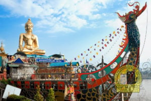
Phayao’s principal temple sits on the southwest shore of the lake. Locals call it Wat Phrachao Ton Luang, after the enormous Buddha image inside. Phra Chao Ton Luang is the largest Chiang Saen-era seated Buddha in the country: 16 meters high, 14 meters across the lap, cast over a 33-year period from 1491 to 1524. The statue occupies the main viharn with the quiet authority of something that has been sitting in the same spot for five centuries and does not intend to move. The ordination hall, built on stilts over the lake, contains murals by Angkarn Kalayanapong, a National Artist, painted in Lanna style with contemporary touches. Outside, a sculpture garden depicts Buddhist hell in graphic detail. Sinners are sawed in half, boiled, and impaled in scenes that manage to be simultaneously horrifying and oddly cheerful, the kind of moral instruction that has not troubled itself with subtlety.
Free entry. Open daily. Budget 15-20 minutes. Best in late afternoon light. A short walk south along the lake from the main promenade.
Detour: Wat Analayo Thipphayaram sits on the hillside of Doi Butsarakham, about 16 km west of the promenade. A sprawling forest temple with Sukhothai-style Buddha images, a Bodh Gaya-inspired chedi, and views over Kwan Phayao from the ridge. Worth the ride if arriving with daylight to spare. Free entry. Open daily.
Dinner
The lakeside restaurants serve what Phayao does best: freshwater fish pulled from the lake that morning. Grilled tilapia, deep-fried whole fish with herbs, pla som, som tam, sticky rice, and whatever the kitchen is pushing. Prices are local: a full meal for two with drinks runs 200-400 baht at restaurants where the tables face the water and the mountains darken into silhouettes across the lake. The Phayao night market operates evenings along Rop Wiang Road near the bus station for those who want street food instead.
Overnight in Phayao
Phayao’s accommodation is modest and does not pretend otherwise. A handful of hotels and guesthouses cluster near the lake, clean and functional without aspiring to anything grander.
Phuglong Hotel sits directly on the lake with views over Kwan Phayao from the lobby onward. Rooms run 1,150-1,500 baht with breakfast included, and the location is the best in town for the waterfront evening. For a budget option, Phu Thong Place in the city center has clean rooms at 400-500 baht, though it is a short ride from the water. Secure motorcycle parking is available at both. Book ahead during Thai holidays, especially Loy Krathong in November, when Phayao’s lake draws crowds from across the region.
Alternative route: Riders who prefer nature stops to pure road quality can take Route 1091 from Nan instead, crossing three mountain ranges through hill villages and farmland to reach Phayao via Chiang Muan. A detour to Doi Phu Nang National Park adds Than Sawan Waterfall, a four-tiered limestone cascade with swimmable pools. The distance is similar, the riding is more technical with tighter curves, and the scenery leans pastoral rather than dramatic. It is an excellent road. But it is not in anyone’s top 10 list for the world, and R1148 is. Take 1091 if waterfalls and village life matter more than the best asphalt in Southeast Asia. Take 1148 if the riding itself is the reason for the trip.
“R1091 from Pong – Chiang Muan – Nan is my favorite road in the North. A much better ride than 1148, which I believe is overrated. R1120 / R1179 / R1092 are also fantastic deserted unknown biking roads.” – David Unkovich, founder of GT-Rider
Day 5: Phayao to Chiang Mai (The Long Road Home)
Distance: approximately 150 km. Riding time: 2-3 hours with stops. Route: Highway 1 south, Route 120 west over the mountains, Route 118 south to Chiang Mai.
The final day is a full riding day but a gentle one. The route crosses two mountain ranges, passes through forest dense enough to form a canopy over the road, and offers stops for a hot spring, locally roasted coffee, and forest canopy thick enough to turn the highway into a green tunnel. The mood is homeward-bound. After four days of concentrated mountain riding, the mind replays highlights from the loop while the road unrolls steadily toward Chiang Mai.
Depart Phayao in the morning. Leaving by 8:00-9:00am ensures arrival in Chiang Mai in the afternoon with daylight to spare. Fill up in Phayao before departing. Fuel is available along the route but less frequent than on the main highways.
Phayao to Route 120
From Phayao, head south on Highway 1 for about 9 km, then turn right onto Route 120 heading west. The junction is well-signed. This is where the day’s riding begins properly: a two-lane mountain road that climbs through forested ranges for roughly 65 km before meeting Highway 118 in the Wiang Pa Pao area.
Route 120 is one of Northern Thailand’s quieter mountain roads. It does not carry the reputation of R1148 or the legends of R1081, and that is part of its appeal. The pavement is smooth, the traffic minimal, and the road rises from lowland into genuine mountain terrain with dense forest on both sides and elevation changes that keep the engine working and the rider attentive. Local riders describes the section through Wang Nua as having “magnificent forest cover and beautiful panoramic views.” It is not dramatic. It is steady, pleasant, forested riding, the kind that allows the mind to wander while the hands do the work.
Dinosaur Statues
Near the highest point on Route 120, a pair of large dinosaur statues appear at the roadside. These mark the area where paleontological finds were made in the Phayao-Lampang border region. The statues are kitschy rather than educational, but they make a recognizable landmark on the mountain crest.
Route 118 to Chiang Mai
Route 120 ends at a junction with Route 118 in the Wiang Pa Pao area. Turn south toward Chiang Mai. This is the standard return route from the northeast, familiar to anyone who has ridden to Chiang Rai. A wide, well-maintained road with moderate traffic winding through forested mountains.
Mae Khachan Hot Springs
Shortly after joining Route 118, the Mae Khachan Hot Springs appear on the right near km markers 64–65. It’s a scruffy little geothermal roadside stop: a few pools at different temperatures, steam drifting through the trees, and a geyser that refuses to keep a schedule. Most of the time it just boils and spits, then now and then it throws up a higher burst for the crowd, as if to remind everyone it still has something to prove. People park, soak their feet, buy baskets of eggs to boil in the hot water, and move on.
Signed from Route 118. Open daily during daylight hours. Egg baskets sold at vendors near the pools. Budget 20-30 minutes.
Khun Chae National Park and Doi Saket
South of hot springs, Highway 118 passes through the edges of Khun Chae National Park. The forest thickens, the road gains a canopy of trees, and the riding takes on a green-tunnel quality that is pleasant without demanding any particular attention. The park is a sprawling protected area with waterfalls and trails, but for riders heading home it functions as scenic wallpaper.
The final 30 km descend from the mountains into the eastern suburbs of Chiang Mai through Doi Saket district. Farmland replaces forest, traffic increases, and the transition from empty mountain road to Chiang Mai’s ring road happens in about thirty minutes. Wat Doi Saket, a hillside temple on the left, offers one last panoramic view over the Chiang Mai valley for those with energy and daylight remaining.
Nine One Coffee
Five to ten minutes after you cross the provincial line into Chiang Mai, one of the Nine One Coffee locations sits directly on the highway and makes an easy stop. Nine One runs its own farms in the northern hills, processes and roasts in-house, and sells the result at a handful of roadside shops where the barista knows the elevation the beans grew at and will tell you about it whether you asked or not. The jungle canopy thins here, the road starts to feel like it is leaning back toward civilization, and this is a calm place to pause before Chiang Mai traffic takes over. The menu rotates single-origin lots alongside the usual espresso drinks, and they sometimes stock oddities like durian-processed beans, which taste better than they sound. A bag of whole beans costs less than a night market t-shirt and lasts longer in the memory.
Arrival in Chiang Mai
Highway 118 enters Chiang Mai from the northeast, joining the ring road system. The contrast is abrupt: from the quiet of Khun Chae’s forest canopy to ring road traffic, pickup trucks, red songthaews, and the permanent low hum of a city that runs on internal combustion. The loop is over.
Over five days and approximately 820 km, the route has passed through three provinces, crossed a dozen mountain ranges, and covered roads that rank among the best motorcycle riding in the world. The temples, markets, salt wells, and lake evenings were the connective tissue between the riding, but for most people who do this loop it is the roads themselves that remain: Route 1081 running above the clouds on ridgetops where the valley drops into white, Route 1148 sweeping through empty forest with curves so well-engineered they feel designed for motorcycles specifically, the small mountain roads through Doi Phukha where the air cools by ten degrees in five minutes of climbing.
The Nan Loop is the ride for those who have already done Mae Hong Son and want something deeper. Or for those who choose to do the better loop first.
Return the motorcycle with a full tank. Most rental agreements require this. If arriving after business hours, confirm the return procedure with the shop in advance. Photograph the bike at drop-off. The deposit is typically returned the next business day.
Quick Reference
Total distance: approximately 820 km (5 days, Chiang Mai to Chiang Mai)
Route: Chiang Mai, Lampang, Phrae, Nan, Pua, Phayao, Chiang Mai
Minimum bike: 150cc (sustained mountain climbs on Doi Phukha and Route 1081)
Recommended bike: 250-300cc or above for comfort on long days and Route 1148
Best season: November through February (cool, dry, Phu Langka mist, Chomphu Phukha bloom in Feb-Mar)
Worst season: April through June (smoke haze, extreme heat)
Fuel planning: fill up in Nan before heading to Bo Klua, before Route 1148 (no stations for approximately 91 km), and before Route 120 mountain crossing on Day 5
Daily distances: Day 1 approximately 200 km (easy valley riding), Day 2 approximately 120 km (short, cultural day in Nan), Day 3 approximately 150 km (Doi Phukha mountain loop, overnight Pua), Day 4 approximately 200 km (Route 1148, overnight Phayao), Day 5 approximately 150 km (Route 120, return to Chiang Mai)
Key stops: Phrae old town, Wat Phumin murals, Doi Phukha summit, Bo Klua salt wells, Route 1081 viewpoints, Wang Sila Laeng canyon, Route 1148, Phu Langka cafes, Kwan Phayao lake
Budget per day (solo rider): 800-1,500 baht accommodation, 300-500 baht food, 200-400 baht fuel
- Author: Konstantin Zh
- Updated: February 15, 2026
- No Comments

Konstantin Zh
I've been based in northern Thailand for nearly 20 years, riding the same routes through different seasons. Some stretches that look good in photos aren't worth the detour. Some that look unremarkable on a map are the best riding in the region. Most of what circulates online about riding up here comes from one trip, one season, one version of conditions. It gets repeated until it reads like settled fact. A lot of it is outdated, oversimplified, or wrong in ways that matter when you're actually out there. I write to give you information that holds up when you're riding, not just reading.