Doi Inthanon – 14 Treasures of Thailand’s Highest Mountain
Well, today we will tell you about Doi Intanon National Park located on the mountain of the same name in Northern Thailand. Besides the obvious things (how to get there, entrance fees, best time to visit) we will tell you about the local attractions to visit. We’ll also recommend a couple of places where you can buy tours to visit Doi Intanon, and explore it with an English-speaking guide if you don’t want to drive a car or motorcycle yourself. Read our article to the end, and if you have any questions, feel free to ask us in the comments. Let’s go!
Doi Inthanon (Thai: ดอยอินทนนท์), the highest peak in Thailand, towers at an impressive 2,565 meters above sea level and serves as the crowning jewel of the Doi Inthanon National Park in Chiang Mai province. This magnificent destination offers visitors an unparalleled opportunity to explore lush forests, cascading waterfalls, and vibrant hill tribe cultures in a cool, refreshing climate. The mountain’s summit is home to the awe-inspiring Naphamethinidon and Naphaphonphumisiri pagodas, honoring the late king and queen of Thailand, and offering breathtaking panoramic views of the surrounding landscape. As you trek through the enchanting Ang Ka Nature Trail or stand amidst the vibrant blooms of the Royal Project, Doi Inthanon promises an unforgettable experience that combines natural wonders, rich cultural heritage, and a refreshing escape from the tropical heat.
Doi Inthanon National Park
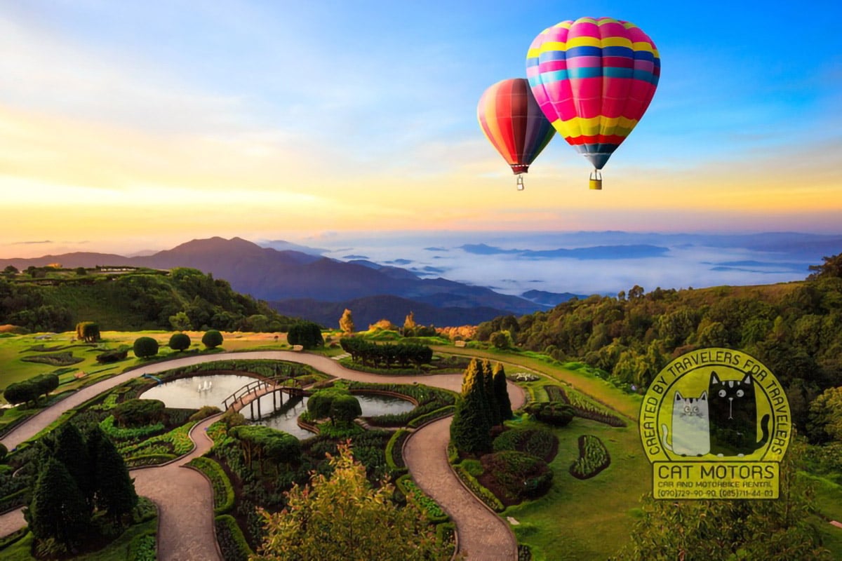
The Doi Inthanon National Park represents the beauty and ethos of the mountainous region of Thailand. It showcases its majestic rivers, waterfalls, tropical forests, and a habitat that is home to 362 species of birds and a wide variety of 466 animal species and 1274 plant species. The park is a dream bird sanctuary for bird watchers.
How to get to Doi Inthanon
Getting to Doi Inthanon from Chiang Mai for the day trip by bike or car is easy. First, you leave Chiang Mai towards the airport. Then, head towards Hang Dong on the #108 road, and then you must go straight without turning anywhere. After about 40 kilometers from Chiang Mai city, you will see a green road sign about a right turn to road #1009.

At this time, you must pay attention to the level of gasoline in your vehicle. If you are riding a scooter with an engine capacity of 110-150cc, and your gas tank is approximately half empty, then there is a gas station near this turn. Get to this gas station and fill up a full tank of gasoline. Otherwise, there is a chance that you will not have enough gas to get to the top. Because when climbing a mountain, gasoline at a motorcycle is consumed faster. After turning onto road #1009 in about 30-40 minutes you will be at the destination.
Map of Places to Visit
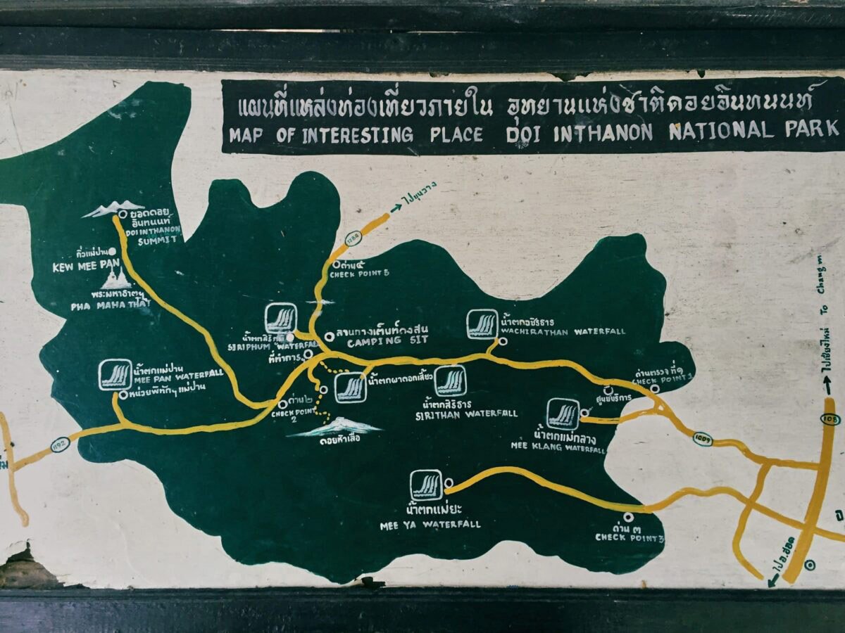
All the main attractions of the Doi Inthanon national park are located along the main road leading to the top of the mountain. Along the road, you will find many signs. Therefore, you will have no problems finding them.
Camping in Doi Inthanon National Park
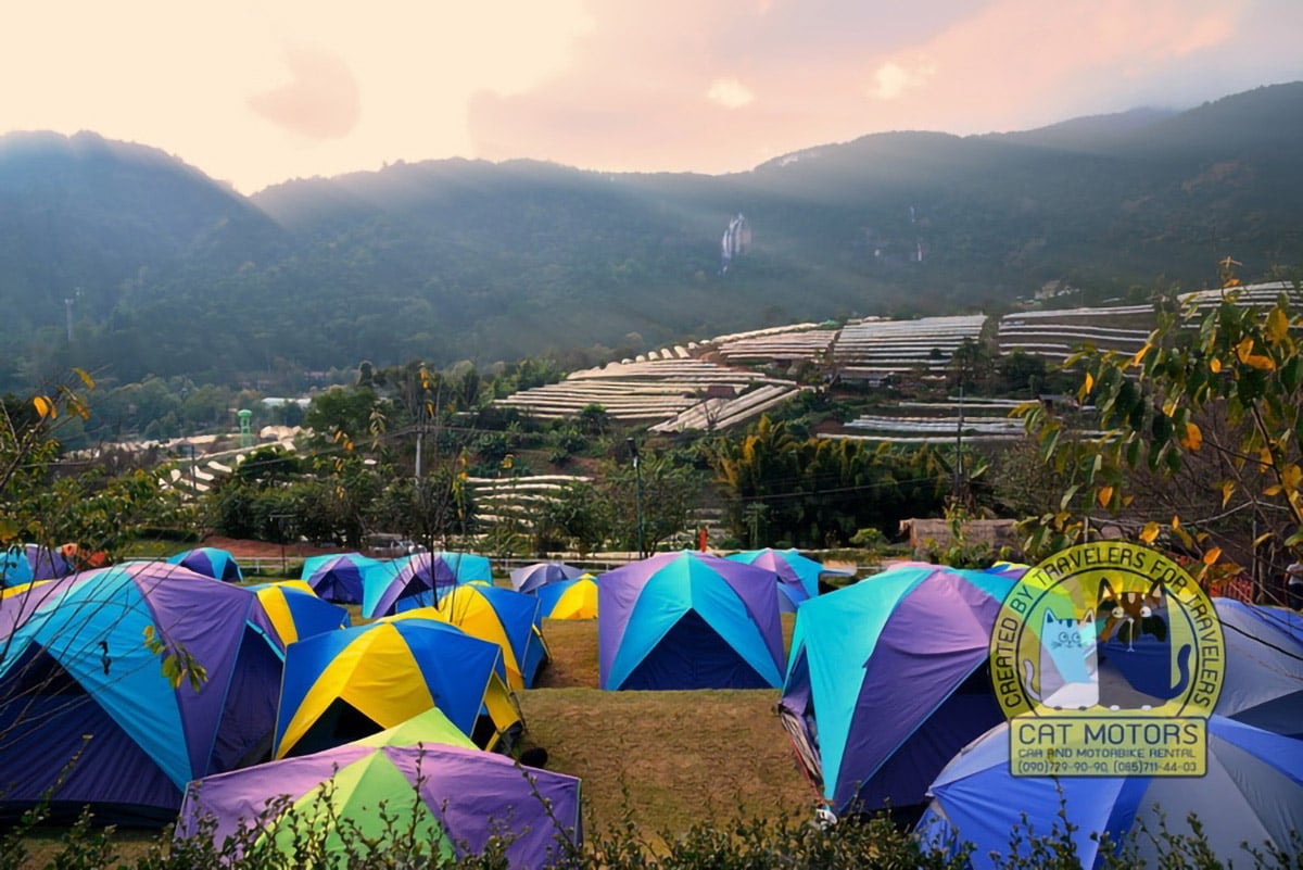
Camping is quite enjoyable because of the simple procedures to follow. All you need to do is to pay your entrance fees and contact the Main Camp Headquarters. You will find all the necessary details including a price list to help set up your camp. The camping costs are reasonable. For 400-600 baht, you can get a tent for 3 people, sleeping bags, pillows, and mats including the use of camping facilities. The facilities include a hot shower and bathroom beside hygienic toilets. Power is available for charging electronic items. If you are one of those into cooking, you can get your food at the nearby local cafe. You can also get wooden cabins for rent if you are not up for tent pitching.
Entrance fee
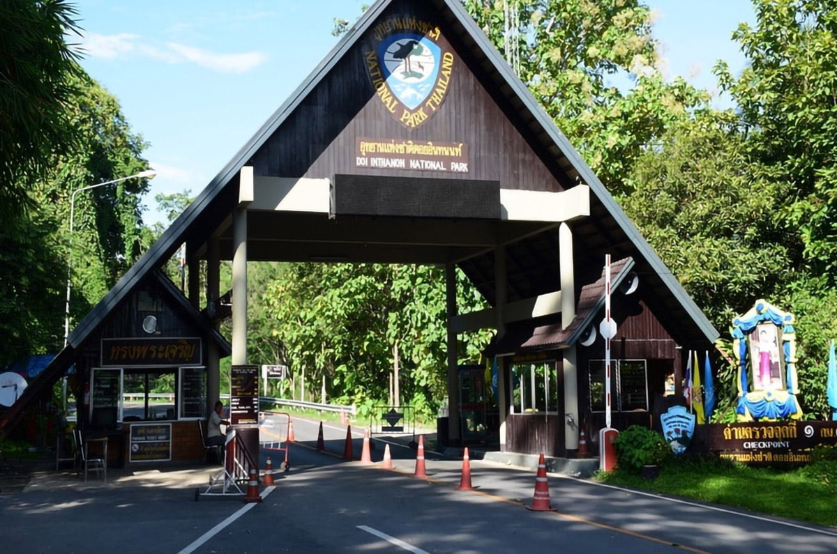
Adult: foreigners fee is 300 baht; locals – 50 baht
Children: foreigners – 150 baht; locals – 20 baht
Vehicles: car – 50 baht; motorcycle – 20 baht
Entrance to Royal Pagodas – 40 baht
The park is open from 7:00 to 20:00 every day of the week.
Closed for tourists from 1st May until 30th July every year.
Weather
The high altitude of the mountain determines the weather in the region. However, the weather in the area surrounding the mountain is pleasant throughout the year. The region receives almost no rainfall during the 4 months of January-April and 3 months of October-December. The 5 months of May-September receive between 180-350 mm of rainfall, peaking in August.
Climate and Temperature
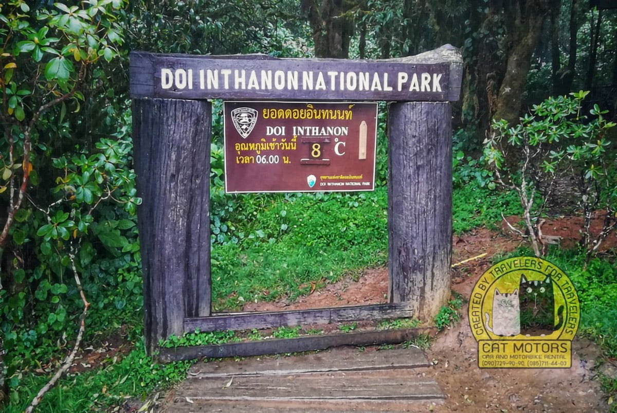
The average maximum temperature ranges between 25 and 33℃, while the average minimum temperature ranges between 15 and 22℃. The highest temperature occurs during April and the lowest during December and January.
Snow in Thailand? Sure!
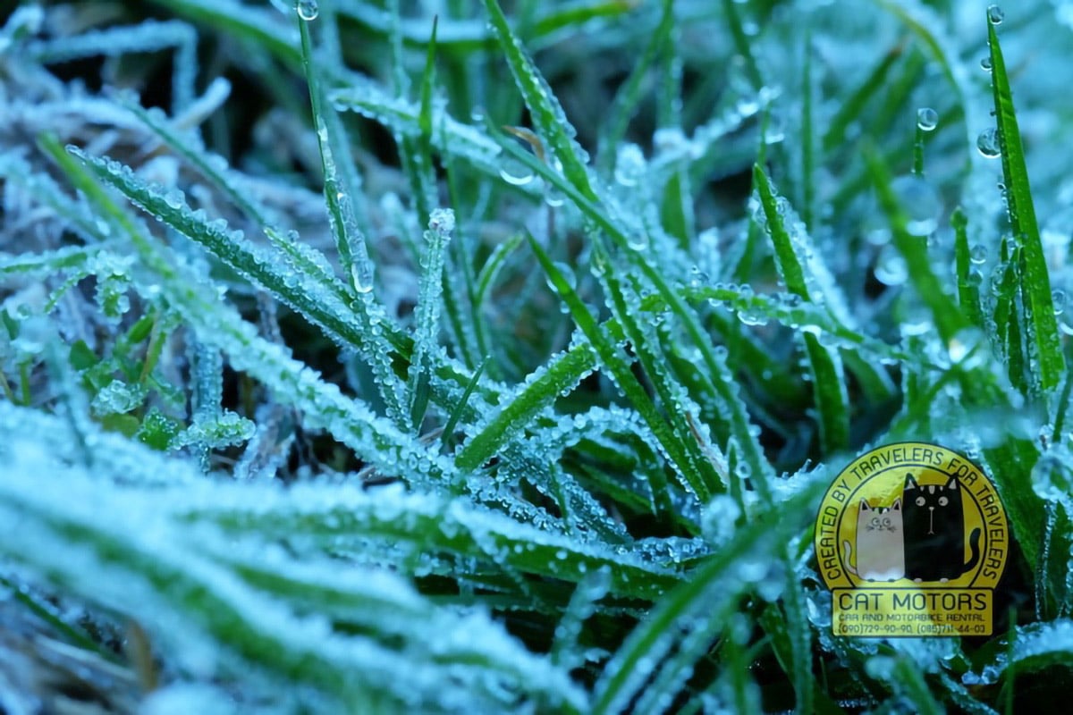
During the winter season between November and February, the weather goes below freezing point quite regularly with occasional sightings of snow, which in most cases has turned out to be frost.
If you plan your day trip from early morning until late at night, be sure to bring warm clothes with you.
Great Holy Relics Pagodas
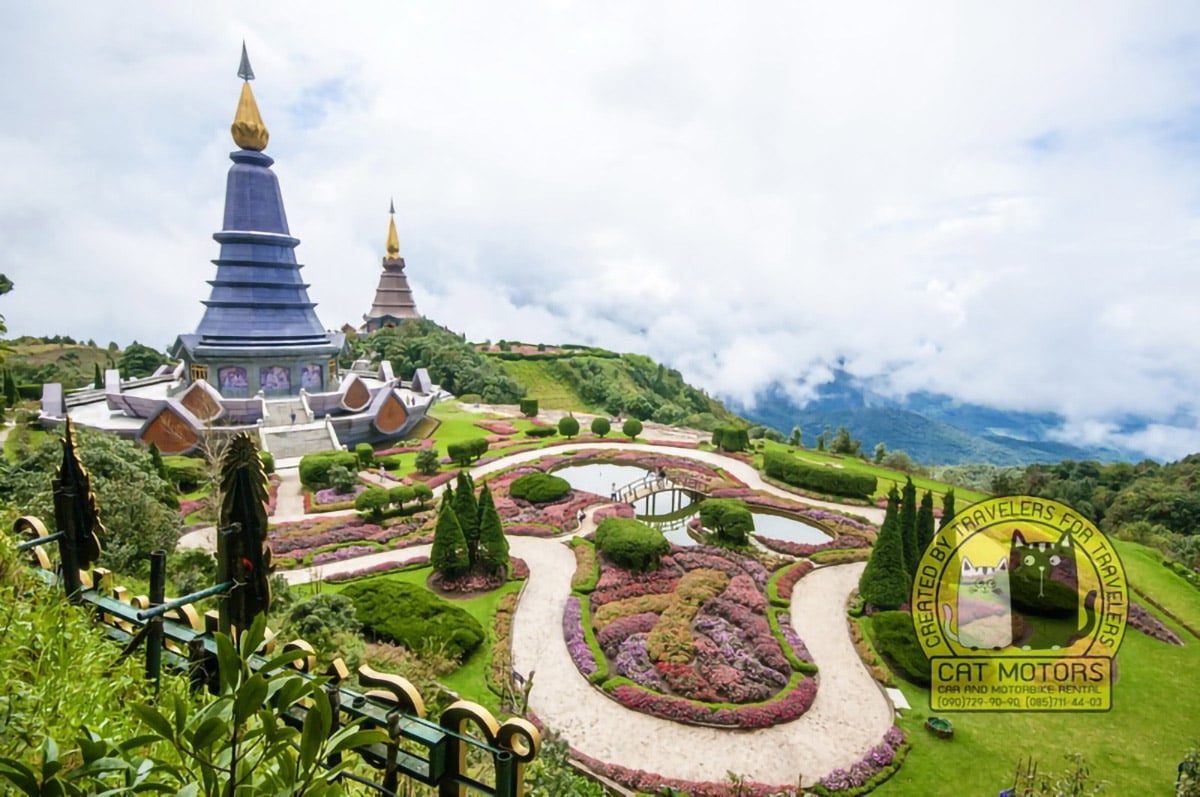
One of the major attractions in Doi Inthanon is the location of the Royal Twin Pagodas there. Thai Air Force built the pagodas to commemorate the 60th birthday anniversaries of the His Majesty Bhumibol Adulyadej and Her Majesty Queen Sirikit in 1987 and 1992 respectively. The whole area is a magnificent mixture of modernity laced with spirituality, natural surroundings, tradition, ancestry, and history. You can use the stair to reach the top of the pagodas or the modern escalator.
The Pra Mahathart Napamaythaneedol Chedi and the Pra Mahathart Napapoommisiri Chedi represent the His Majesty Bhumibol Adulyadej and Her Majesty Queen Sirikit respectively, and the height of the pagodas at 60 meters commemorates the 60th birth anniversaries of the royals. The pagodas, built with colorful marbles, contain sculptures recounting stories surrounding the Buddhists. The pagodas’ shape and design depict the enlightenment of Lord Buddha and his search for truth. The two pagodas also describe the virtues of the Thai warriors and the beauty of the Thai women through their beautiful patterns, colors, and choice of materials.
The defining attractions are the stupendous gardens and the magnificent view of the valley down below as the location of the pagodas is at the top of the hill. Birdwatchers especially will enjoy this location because of the immense variety of bird species they can spot, more so during the February-April period.
Waterfalls
Doi Inthanon, the tallest mountain of Thailand, coupled with multiple rivers flowing down the mountain gives rise to several waterfalls that will enthrall you. Among the several stunning ones, three of the waterfalls stand out- Mae Ya waterfall, Wachirathan Waterfall, and Sriphum waterfall. These waterfalls present an exciting facet as the base forms a thin mist providing an ethereal feeling as well as a thins water spray even if you stand a fair distance from them.
Mae Ya waterfall
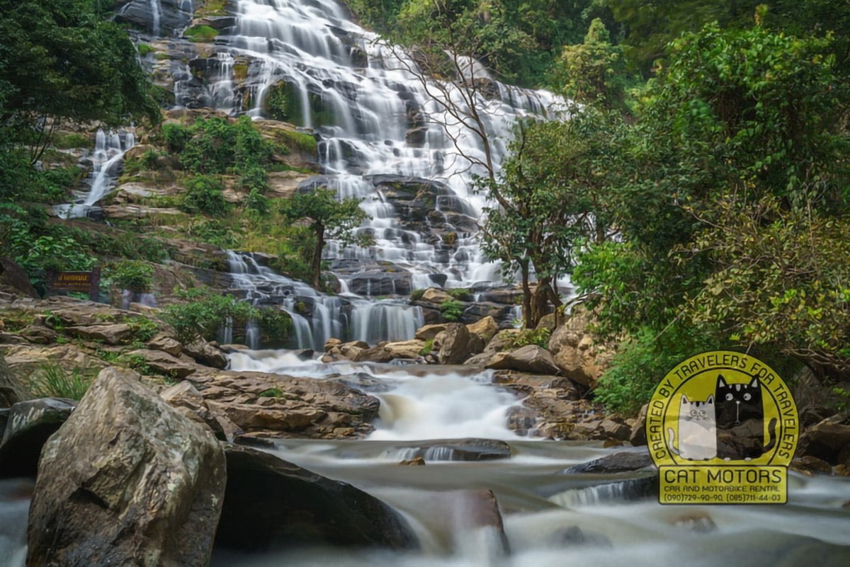
This waterfall is the most stunning simply because it is the highest here falling from a height of 100 meters in different tiers. Its location, just at the park entrance, gives visitors a foretaste of the wonder of waterfalls. Apart from the scenic beauty, the waterfall is an excellent place for picnics.
Mobile Network: AIS, TRUE
Wachirathan Waterfall
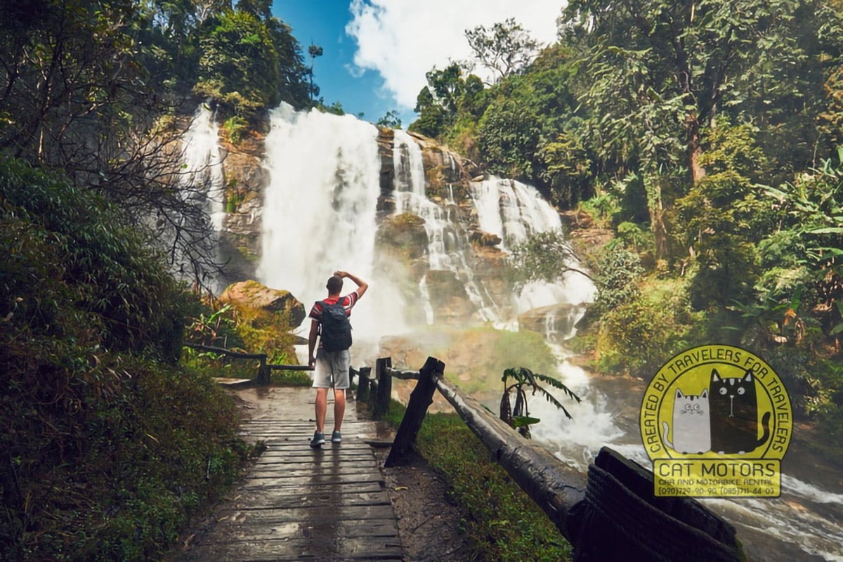
This is the most powerful waterfall of Doi Inthanon National Park. Small splashes and a water cloud overtake you a few tens of meters from the place where the waterfalls with an indescribable rumble.
Mobile Network: AIS, TRUE
Siriphum Waterfall
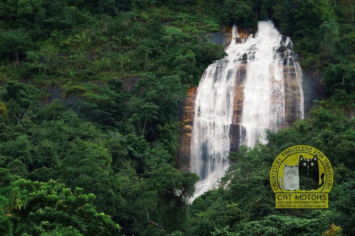
Siriphum Waterfall is the least crowded as its fall varies with the season. The base of the falls hosts wild gardens with an impressive array of plants and flowers.
Mae Klang Waterfall
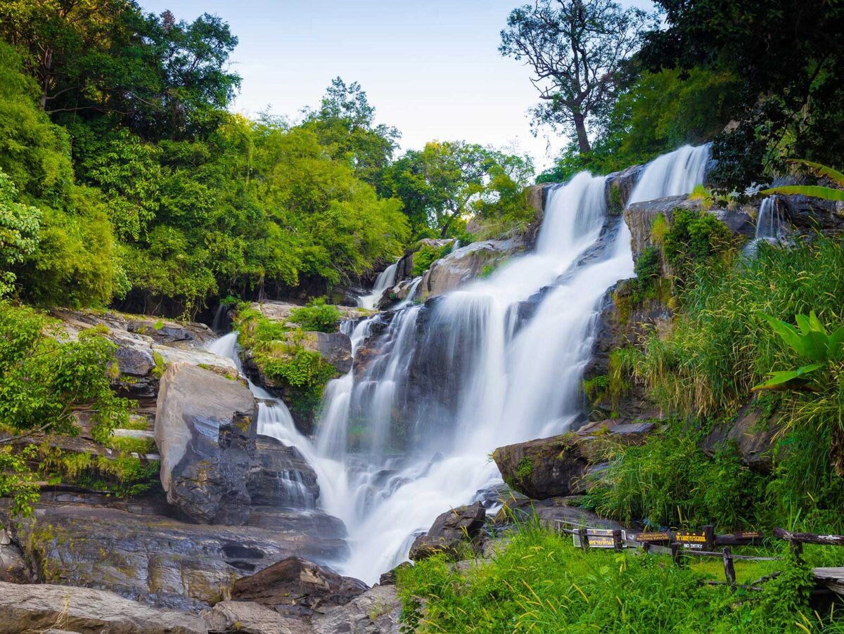
This is the first waterfall on the main road leading to the national park, it cascades over several tiers almost 100 meters high, the highest tier being about 25-30 meters high. It is located 600 meters south of the checkpoint in the southeastern part of the park.
Mobile Network: AIS, TRUE, DTAC
Doi Inthanon Peak
Climbing Facts
Peak: Doi Inthanon
Country: Thailand
Location: Northern Thailand
Nearest Town: Khuang Pao (Chom Thong, Chiang Mai)
Elevation: 2565 meters (8415 feet)
Vertical Elevation: <10 metres
Total Distance: ~100m one-way
Start/Finish: Summit parking lot
Climbing Time: 10 minutes return
Difficulty: Very easy
Mobile Network: AIS, TRUE
Summit
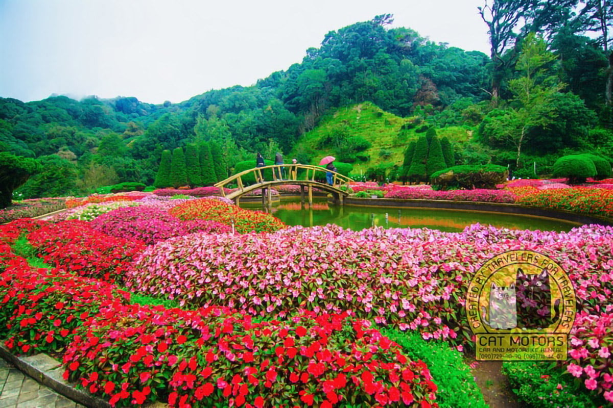
The highest peak at 2,565 meters, known as the roof of Thailand, is a remarkable scenic spot offering several grand attractions. The height provides a magnificent panoramic view of the sloping hills with its rugged terrain of Chiang Mai and lush green forests interspersed with rivers interrupted by at least eight beautiful waterfalls. To view the natural beauty of Thailand, you must visit the summit and enjoy its pristine natural beauty. The area is a protected one, thus enabling visitors a glimpse of the myriad flora and fauna in their natural habitat.
Very low temperatures in Thailand are almost non-existent but the peak allows Thais to experience temperatures below freezing point, as during the cool season temperatures can plummet.
Getting to the summit is all pretty well sign-posted. The roads are very good and with the number of Thai and foreign tourists visiting the summit, there are loads of amenities. On the way to the park entrance, most tour companies/guides will first stop at a Hmong roadside market. Here you can buy all sorts of dried fruits, nuts, and a few handy crafts. Soon after, you enter the actual park.
There is a 300 Baht entry fee per person (for foreigners only) and a 20 Baht motorbike entry fee. Once inside the national park there are several waterfalls, food stops, toilet stops, lookouts on the way to the summit. We ended up stopping at Sirithan Waterfall on the way up and Wachirathan Waterfall on the way down. Wachirathan is much more developed with a parking lot, toilet block, restaurants, whereas Sirithan is just the waterfall. Both are nice. We also stopped at the Royal Chedi on the way back from the summit.
This is a must. Despite the hordes of tourists and the why was this built here running through my mind, it’s still pretty cool. Built a couple of years ago in honor of the current King and Queen of Thailand, two massive Chedi (his and her I guess) have been constructed on apposing peaks. Each is essentially a temple, however, each has an internal temple with very nice stone relief and other wall paintings.
Don’t worry if the stair-case to the top of Chedi looks daunting. You can get an escalator up each flight of stairs. Yep, you can stand on the walkway to avoid walking for 2 minutes up the staircase (OK, we did it :).
As we were there in winter, we missed out on what is quite a spectacular flower festival on each of the two Chedi summits which are held during the warmer months.
But back to the summit. Getting to the actual summit is straight-forward. You can drive almost all the way. There is a big parking lot just below the summit. Here there is a Thai Air-force Base (which you can’t photograph) and there is then a pretty obvious sign and trail to the actual summit.
– Roland
Thai National Observatory
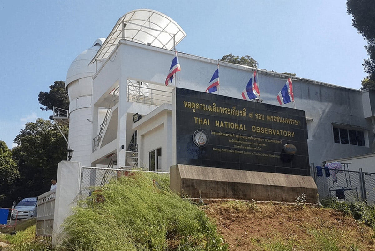
Amidst the natural beauty of the Doi Inthanon summit and its surroundings, there is a sense of contemporariness and modernity in locating two important scientific institutions taking advantage of the height of the mountainous area.
The Royal Thai Air Force weather radar station monitors the weather as the Doi Inthanon Control and Reporting Center with radar station for travel as well as military applications.
Thai National Observatory, under the National Astronomical Research Institute of Thailand, hosts the main observatory and an auxiliary station. The station is operational with all facilities and amenities for the employees to conduct their experiments. The station also permits the public to view the permanent exhibition set up there. It is a crucial outreach facility for students to learn about astronomy.
Trekking and hiking
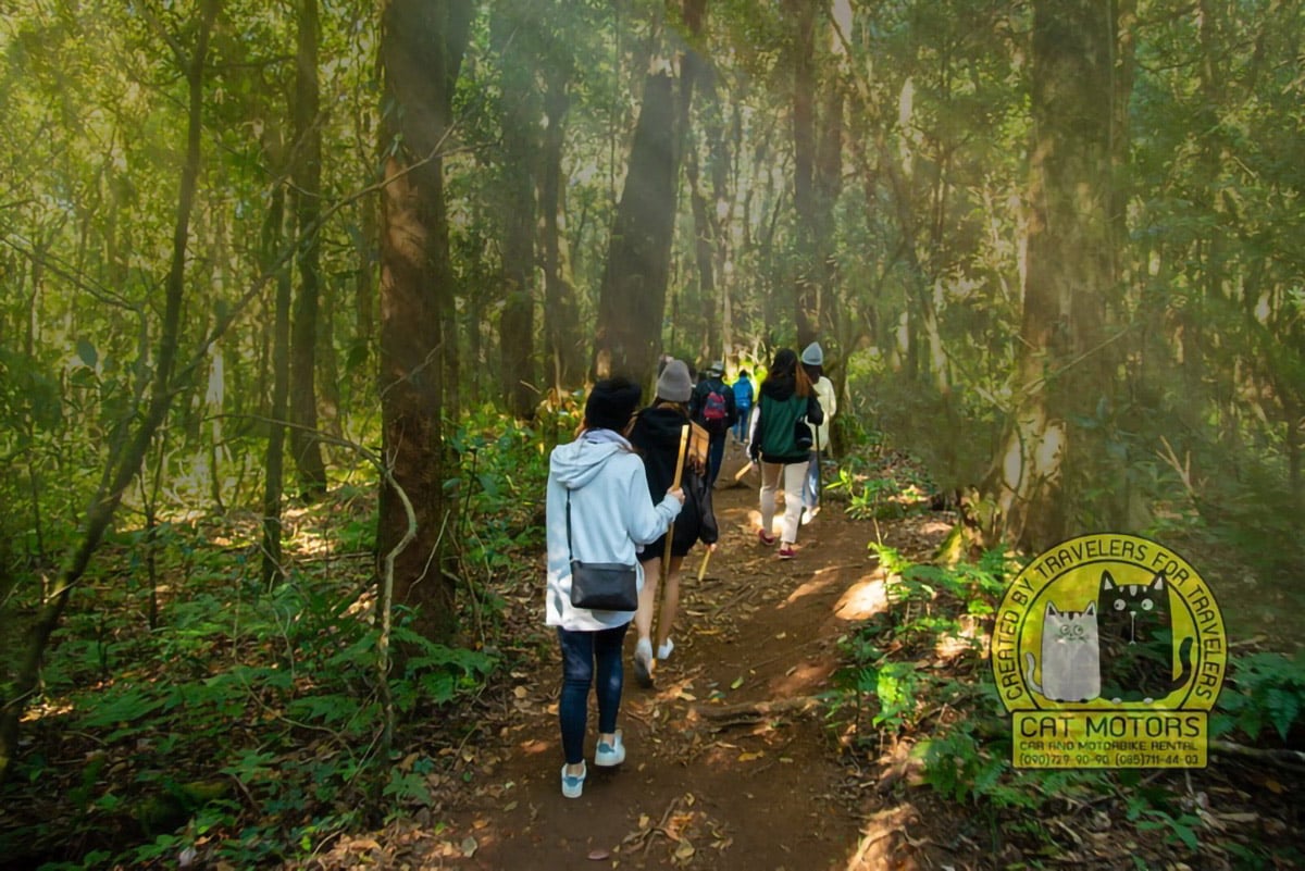
The great height of the Doi Inthanon peak and its lush green forests and rivers and waterfalls make for phenomenal trekking and hiking paradise the likes of which have never been seen in Thailand. The ones that must be experienced are Kew Mae Pan Nature Trail and Ang Ka Nature Trail. You can undertake the nature trails or hike only with an experienced guide by paying 200 baht.
Climbing to Doi Inthanon
I’d always suspected climbing Thailand’s highest mountain was going to be easy. However, I didn’t think it would be easy. Evidently, about 200 other tourists also thought the same thing 🙂
Nevertheless, despite jostling for my turn to be photographed beneath the Thai High-point sign, the trip to the summit of Doi Inthanon is still a worthwhile and pleasant one-day excursion from nearby Chiang Mai, especially as there are a number of other interesting attractions in the vicinity of the summit.
– Roland
Kew Mae Pan Nature Trail
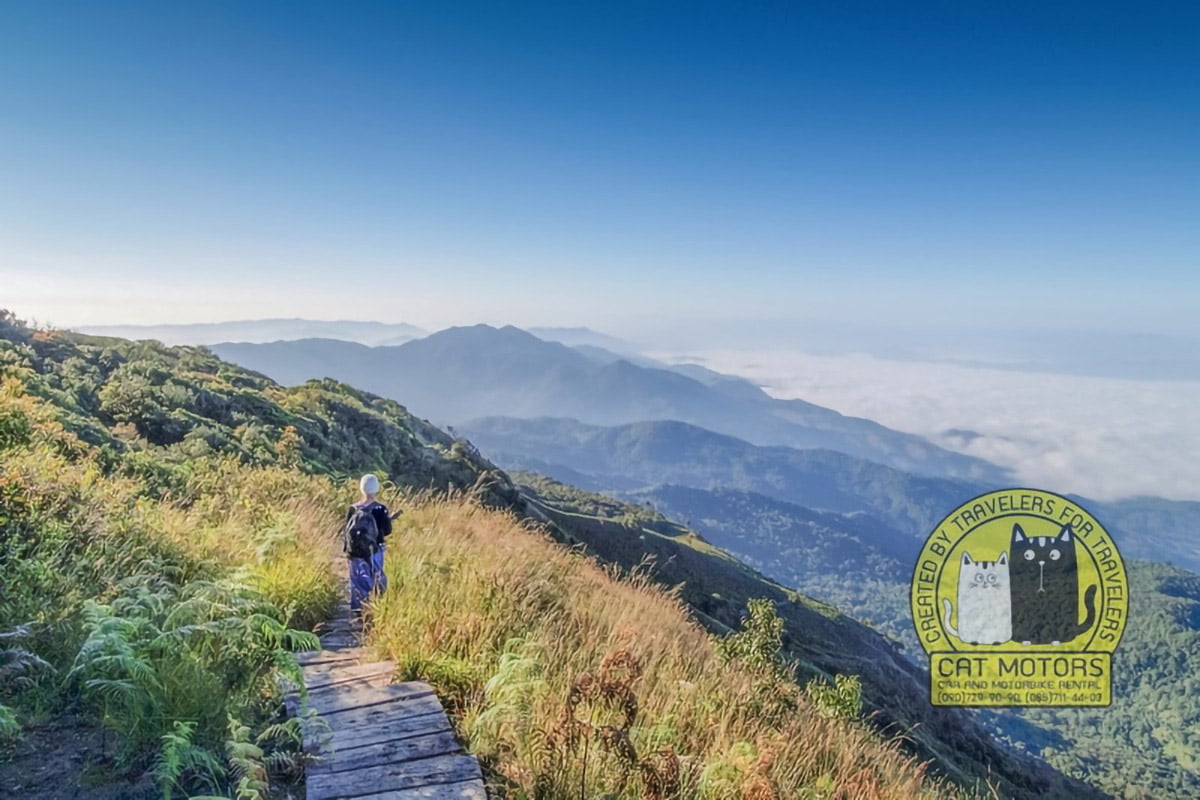
This is the most famous nature trail covering a distance of about 3 Km. The trail takes you through a kaleidoscope of greenery and trees and rivers and waterfalls dotted with glimpses of the superb blue sky and the floating clouds atop and the serene beauty of the slopes of the mountains and valleys below. The lush green forest area spattered with various tree species and most visible in the first few hundred meters of the trail gives way to the path along the ridge of the mountain offering grand views of the hills through clearing as you move into the middle part of your trail. The trail closes during the June-October rainy season.
Mobile Network: AIS, TRUE
Kew Mae Pan Trail Map
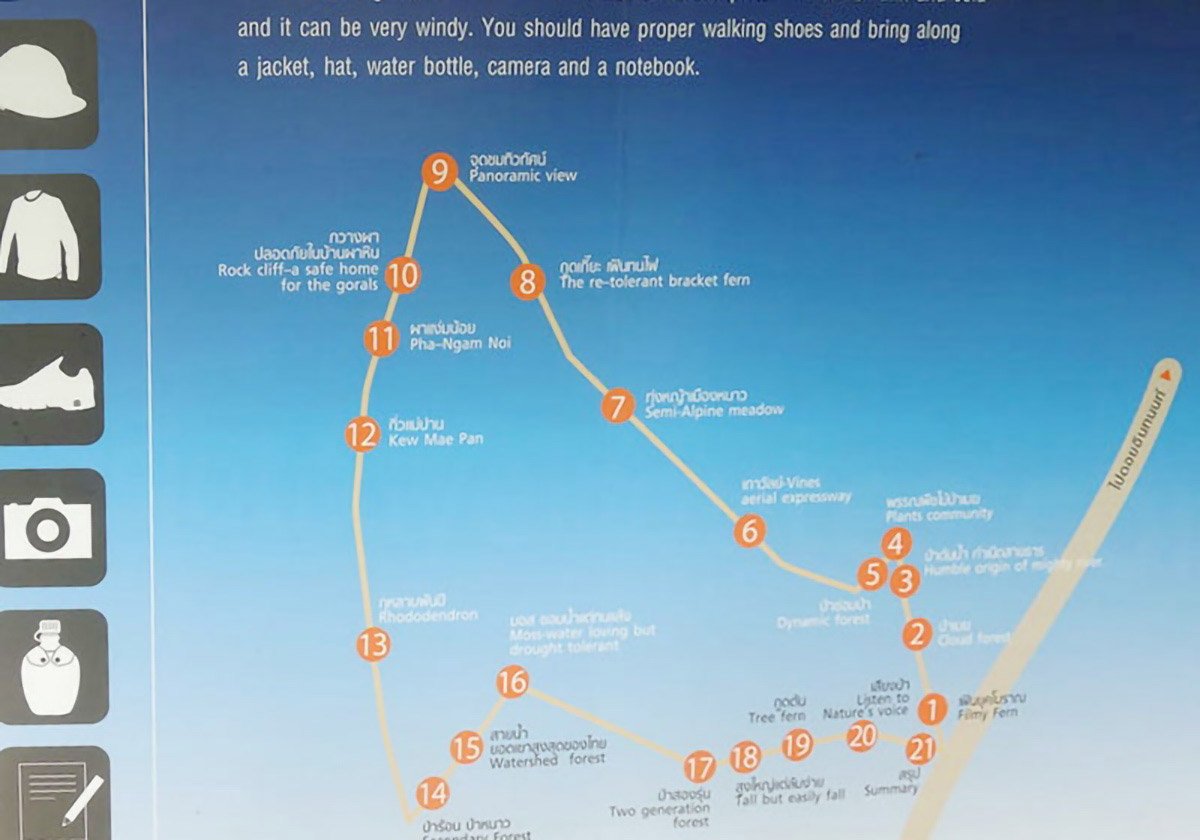
Kew Mae Pan weather
The weather at the top of the mountain is very relaxed throughout the year, and it can reach freezing points often during the cold season. Cold weather clothing is a necessity. Further, the weather can turn misty and cloudy often obscuring the views. The weather would be unbearable during the May-September high rainy season.
Kew Mae Pan Viewpoint
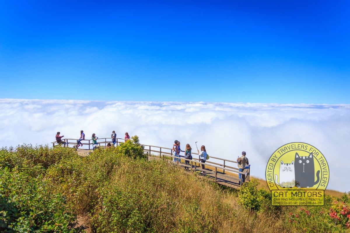
On a bright day, the view from the Kew Mae Pan Viewpoint is simply breathtaking as it spreads over a vast area allowing sightings of mountain views covered with a mist or drifting cluster of clouds. The sunrise is the scene worth seeing. Secondly, a couple of visits during different seasons would show the stark difference between green during the rainy season the golden brown in the dry season.
Ang Ka Nature Trail
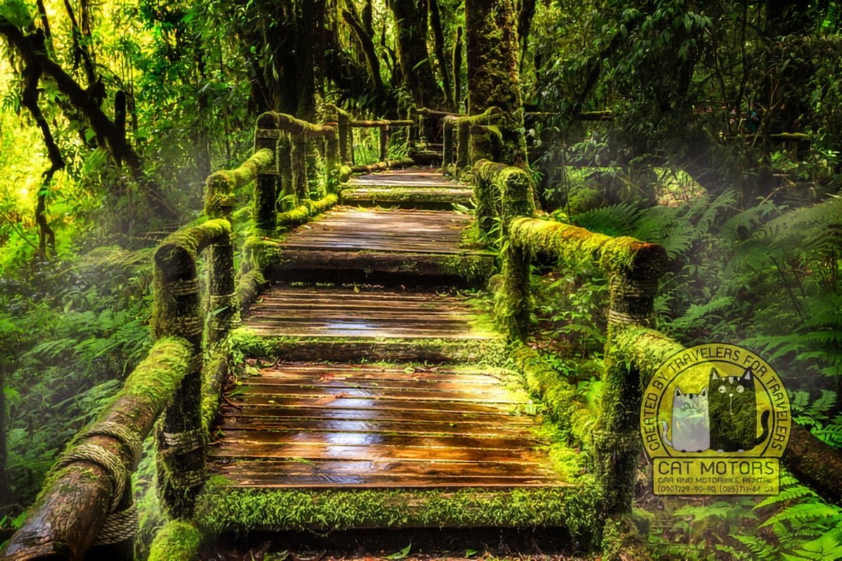
This is a short, but intense 30-minute trail at the top of the mountain at the height of 2500 meters above sea level. Here you can take amazing photos of forest thickets and paths covered with moss.
All the nature trails are a rich repository of animal, bird, and plant species. If you are lucky, you can spot flowering red rhododendrons or white orchids. You will find trees such as oaks and black plum. You can feast upon large flying beetles including the purple ones as well as some rare butterflies. For bird watchers, you can probably sight the green-tailed sunbird or the Ashy-throated warbler.
Mobile Network: AIS, TRUE, DTAC
Baan Mae Klang Luang Village
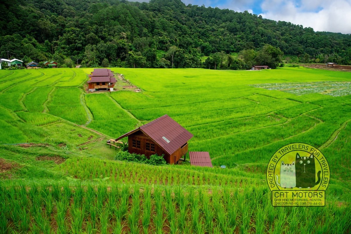
Baan Mae Klang Luang is a Karen village inhabited by hill tribe, migrated to Chiang Mai from Burma during the 18th century. It is famous because it is the model village promoting ecotourism in Thailand. This village is perfect for a variety of activities that interest connoisseurs of photography, bird watching, trekking, and hiking. The unique thing about this village is that all ecotourism activities come under the responsibility of the hill tribe.
Tourists can get a first-hand experience of staying in the village by checking in to one of the home-stay facilities offered by the Karen hill tribe. Besides the village experience, tourists can enjoy their pursuits by exploring the region surrounding the village. The picturesque mountain slopes merging with the rice fields is a photographer’s dream landscape, where the effect of the unity of nature with man is created.
The specialty of the village is the coffee that is a feast for the taste buds. Its brew extracted from manually grinding beans gives a taste so unique that it appears difficult to find something better elsewhere.
The highlight of the village is the Pha Dok Siew waterfall
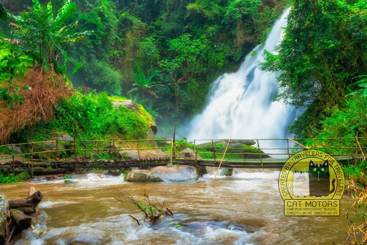
Waterfalls, which boasts ten different falls level with one more beautiful than the other. You can also learn a lot about coffee plantations and flower growing.
The Royal Agricultural Station Inthanon
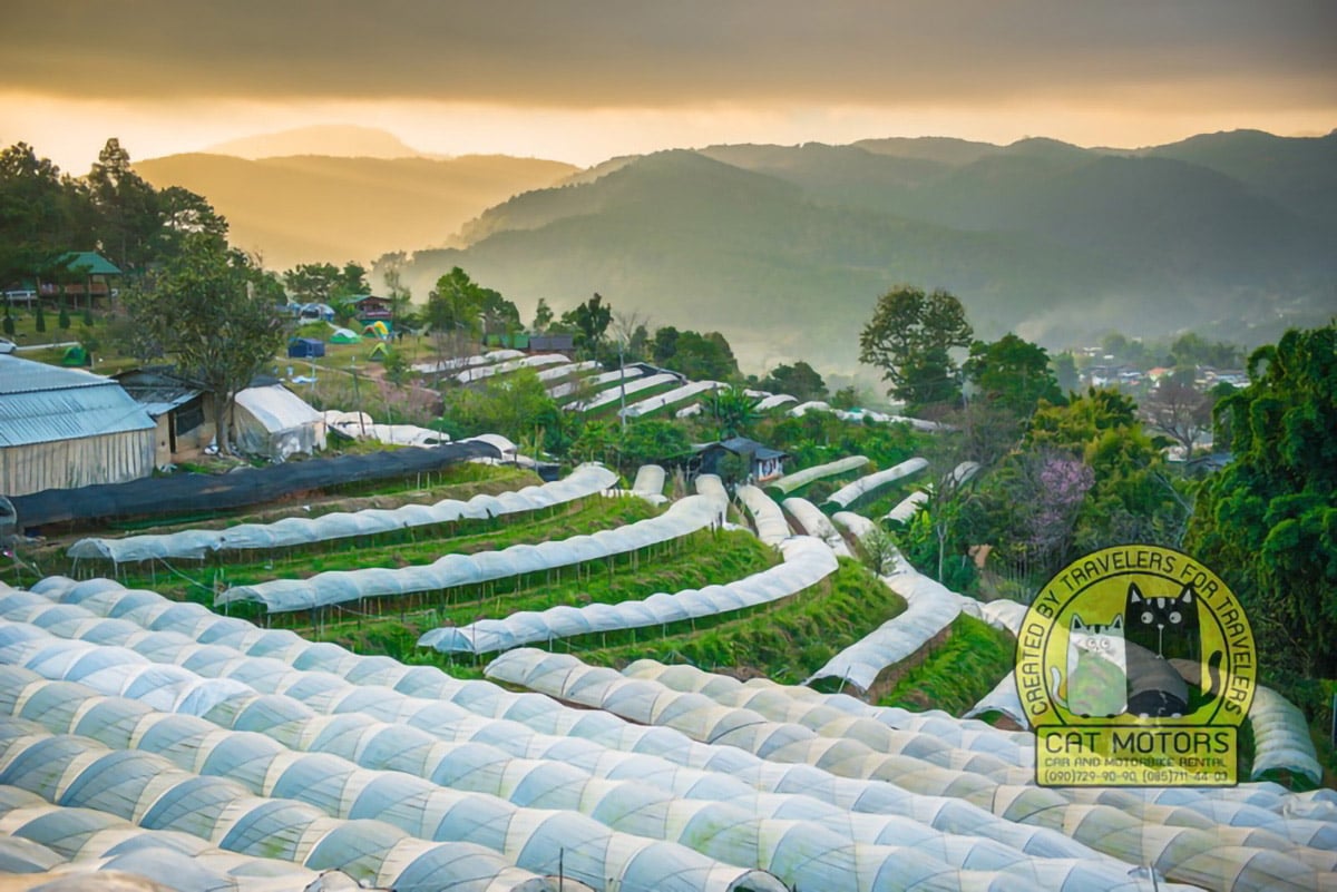
The Royal Agricultural Station Inthanon is a progressive step by the kingdom to improve the life of Thai tribal people. The primary objective was to divert the people from growing opium to growing other crops suitable for the tribes and the conditions in the area.
The station helps the people to use better cultivation methods, preserve water systems, conserve forests, be self-reliant, and protect animals. A station is also a great place for tourists as there are a number of activities to interest them – cultural, natural and agricultural tours as well as vintage flower gardens.
Elephant Park
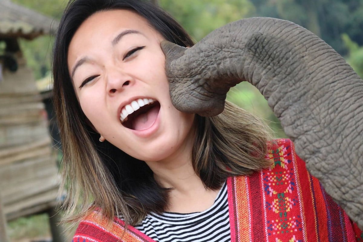
The elephant park is a unique one because the elephants stay in their natural habitat without any fetters on the banks of the Mae Klang River. The elephants don’t show off. Visitors can enjoy the elephants by interacting with them subtly. They can feed them or even give them a mud bath. The Asian elephant is an endangered species and preserving them is the number one priority in this sanctuary.
The elephants, rescued elephants mostly, receive medical treatment including medicines, food, and shelter. Besides being an elephant sanctuary, the park takes up other social causes such as promoting organic farming and teaching the English language to local people to enable them to secure career to promoting the local environment.
Doi Inthanon Weather Forecast
You can find out the weather forecast from the Meteoblue informer. In our opinion and in our experience this weather prediction service shows the most accurate data.
Travel Tips
Visiting Doi Inthanon National Park is an enriching experience, but it can be challenging to explore all its wonders. Here are some tips to help you make the most of your trip:
- Start Early for Day Trippers: If camping isn’t your thing, it’s wise to start your visit early and plan to leave before sunset, as the park primarily offers camping tents for accommodation.
- Camping Experience: If you enjoy camping, consider arriving in the morning. You can tour a portion of the park, stay overnight in a tent, and then finish your exploration the next day before returning in the evening.
- Carry Local Currency: Make sure to have enough local currency for your needs in the area.
- Dress for Cool Weather: The weather tends to be cooler, so bringing winter clothes is advisable.
- Best Season to Visit: The ideal time for a visit is from December to March, during the cool season.
- Comfortable Trekking Shoes: Opt for comfortable shoes that are suitable for hiking and trekking along the nature trails.
- Pack Snacks and Water: Food options may be limited, so it’s a good idea to bring along some snacks and plenty of water.
- Sun Protection: On sunny days, don’t forget to pack caps and sun lotion.
- Map and Fully Charged Phone: Keep the area map on your mobile device and ensure your phone is fully charged before embarking on your trip.
- Enjoy the View: Remember, the pinnacle of your visit to Doi Inthanon is the summit of Thailand’s highest mountain, offering stunning panoramic views and a refreshingly cool climate. With these tips, your trip will be not only enjoyable but also memorable.
Remember, the highlight of Doi Inthanon is reaching the peak of Thailand’s highest mountain, where you’re treated to breathtaking panoramic views and a refreshingly cool climate. With these tips, your visit is sure to be unforgettable, offering both natural beauty and a unique glimpse into Thailand’s high-altitude landscapes.
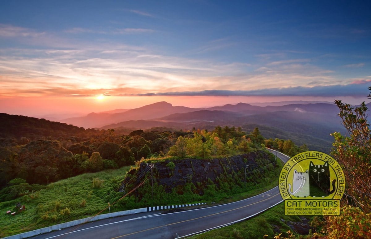
Doi Inthanon holds Thailand’s highest point at 2,565 meters. The road climbs past Wachirathan and Sirithan waterfalls, through checkpoints collecting park fees, to twin pagodas built for the king and queen with gardens blooming year-round. The summit itself sits in cloud forest where temperatures drop to single digits in cool season. Ang Ka boardwalk leads through moss-draped trees found nowhere else in the country. The descent passes Karen villages selling strawberries and coffee from roadside stalls.
Rent a motorbike in Chiang Mai with enough power for 50 kilometers of continuous climbing. Cat Motors provides bikes that maintain speed on gradients without overheating and offer engine braking essential for the long descent. Fill the tank before entering the park since the single station inside charges premium prices. Start early enough to reach the summit before afternoon clouds obscure the views, then take the waterfalls slowly on the way down.
Quick Facts About Doi Inthanon
Geographical Significance
- Location: Chiang Mai Province, Northern Thailand
- Elevation: 2,565 meters (8,415 feet)
- Terrain: Part of the Himalayan mountain range, Doi Inthanon is characterized by rugged terrain and diverse ecological zones. The mountain is known for its cool climate, contrasting starkly with the typically tropical weather of Thailand.
Flora and Fauna
- Biodiversity: The mountain is home to a rich variety of flora and fauna. Over 300 bird species, various mammals, and countless insect species thrive here.
- Flora: Dense evergreen forests cover the lower slopes, transitioning into mixed deciduous and then montane forests as you ascend. The summit is notable for its sphagnum bog, a rare sight in the tropics.
Cultural and Historical Context
- Historical Background: Named after King Inthawichayanon, one of the last kings of Chiang Mai, who was passionate about preserving the forests in the northern regions of Thailand.
- Local Communities: Several hill tribes, including the Hmong and Karen, reside in the park, maintaining their unique cultural identities and traditional ways of life.
Attractions and Activities
- Nature Trails: Doi Inthanon National Park offers numerous trails, ranging from easy walks to challenging hikes, allowing visitors to explore the rich biodiversity.
- Waterfalls: Majestic waterfalls like Mae Klang, Wachirathan, and Mae Ya are popular stops.
- Summit: The highest point is marked by a stupa (pagoda) dedicated to King Inthawichayanon.
- Royal Chedis: Two beautiful chedis, dedicated to King Bhumibol Adulyadej and Queen Sirikit, offer panoramic views and are surrounded by beautifully landscaped gardens.
- Bird Watching: Recognized as one of Thailand’s premier birdwatching destinations.
Practical Information
- Best Time to Visit: The best time to visit is from November to February when the weather is cooler and the scenery is lush.
- Accommodations: Various options are available, from camping sites to comfortable bungalows.
- Accessibility: Easily accessible by road, it’s about a 2-hour drive from Chiang Mai city.
Conservation Efforts
- Status: Part of the Doi Inthanon National Park, which is under the administration of the Thai government’s Department of National Parks, Wildlife and Plant Conservation.
- Challenges: The park faces challenges such as deforestation and the impacts of tourism.
In summary, Doi Inthanon is not only a natural wonder but also a cultural treasure, offering a unique blend of ecological diversity, historical depth, and cultural richness. It remains a must-visit destination for those exploring Northern Thailand, providing a serene escape into nature and a fascinating glimpse into the region’s heritage.
Pros And Cons
Pros of Traveling to Doi Inthanon
- Natural Beauty and Biodiversity: The mountain’s diverse ecosystems offer stunning landscapes, ranging from lush forests to rare high-altitude bogs. It’s a paradise for nature enthusiasts and photographers.
- Cultural Experience: The area is rich in cultural heritage, including the presence of hill tribes like the Hmong and Karen, providing an opportunity to learn about their unique traditions and lifestyles.
- Cooler Climate: The altitude of Doi Inthanon offers a refreshing break from Thailand’s typically hot and humid climate, especially appealing during the hot season.
- Outdoor Activities: With numerous trails, it’s a haven for hikers and bird watchers. The waterfalls, gardens, and viewpoints offer plenty of activities for all fitness levels.
- Historical Significance: The park is dotted with important historical and religious sites, including the two chedis dedicated to the Thai monarchy, enhancing the cultural depth of your visit.
- Accessibility: Easily accessible from Chiang Mai, it makes for a convenient day trip or a longer stay, with various accommodation options.
Cons of Traveling to Doi Inthanon
- Crowds: Being a popular tourist destination, it can get crowded, especially during peak seasons (November to February), which might affect the tranquility of the experience.
- Weather Variability: The weather can be unpredictable. Sudden rain and fog, while adding to the mystique, can obstruct views and make hiking challenging.
- Limited Nightlife and Urban Attractions: For those seeking a vibrant nightlife or urban attractions, Doi Inthanon might feel too remote and quiet.
- Conservation Concerns: Increased tourism has put pressure on the local environment. Visitors need to be mindful of their impact on the fragile ecosystems.
- Physical Demands: Some trails and activities can be physically demanding. It’s less suitable for those with mobility issues or who prefer more leisurely travel experiences.
- Cultural Sensitivity: Interacting with local hill tribes requires sensitivity towards their cultural norms and traditions. It’s important to respect their way of life and privacy.
Video Review
Doi Inthanon National Park Trekking
Disaster Strikes at the Highest Point in Thailand
FAQ
As we are a motorcycle rental company in Chiang Mai, of course we recommend that you go there by motorcycle first, provided that you have a motorcycle driving license and enough experience to drive on Thai roads.
If you want to go there on your own, you first need to arrive at the outer side of the southern gate of the Old City, called Chiang Mai Gate, from where the yellow songthaew to Chom Thong City depart regularly. The fare is 30-40 baht. Then, when you arrive in Chom Thong, you need to change to another songthaew which will take you to the Doi Inthanon summit for an additional 80 baht. The time you will spend for the trip one way, taking into account the change of transport, can take 4-5 hours.
Oh, yes! In our opinion, you should definitely visit Doi Intanon! The relaxing atmosphere of this reserve, its climate, mountain waterfalls, beautiful views from the top of the mountain to the surrounding hills, forests and plains will give you a peaceful and unforgettable experience that will remain a beautiful memory for many years. Do you want to be sure of the sincerity of our words? Just do it!
The importance of Doi Intanon can be viewed from several angles, both ecologically and in terms of attracting travelers.
First of all, Doi Intanon plays an important ecological role in the region, since the national park was created to prevent the logging of local forests, which have a direct impact on the natural groundwater, their interaction with the lithosphere and the earth’s atmosphere, on the phenomena and processes occurring in these waters, and, as a consequence, on the local flora and fauna.
Unfortunately, due to constant poaching and habitat changes, most of the large mammals such as elephants, tigers, and gaurs were exterminated in the park several decades ago. Nevertheless, it was because Doi Intanon National Park was established that the locals succeeded in preserving not only the natural resources, but also the favorable ecological environment here.
Secondly, thanks to all the above, this place is very popular with tourists. Because Doi Intanon is not only the highest mountain in Thailand and one of the coldest places in the country, which is already attractive enough for local and foreign tourists to visit this place, but thanks to the pristine nature preserved in this reserve you can also find rare species of plants, rare reptiles, and over 500 most diverse bird species, some of which within Southeast Asia are found only on Doi Intanon.
Doi Inthanon National Park is located in northern Thailand, approximately 2 hours from Chiang Mai.
Doi Inthanon is a national park because it is home to a wide variety of flora and fauna, including rare and endangered species. It is also home to the highest peak in Thailand, Doi Inthanon, which stands at 2,565 meters above sea level. The park is also known for its spectacular waterfalls, caves, and other natural attractions. The park is also a popular destination for hikers, birdwatchers, and nature lovers.
Doi Inthanon National Park covers an area of 482 square kilometers (186 square miles).
No, Doi Inthanon is not part of the Himalayas. It is located in northern Thailand and is the highest mountain in the country.
No, Doi Inthanon does not have snow. However, it can get quite cold at the summit. Sometimes there’s frost in the morning. On these days, lines of cars with locals come here to see this unusual wonder of nature in Thailand.
Sometimes people ask me, how long does it take to climb to the summit of Doi Intanon? I will disappoint you, but the highest mountain in Thailand is not a climb. A good quality two-lane road, equally accessible by car and motorcycle, takes you from the foot of the mountain all the way to the top, where the parking lot is located.
To begin with, every year Doi Intanon National Park is closed to tourists from May 1st to July 30th. This is the rainy season and there can be floods, landslides, rockslides, and falling trees.
The best time to travel to Doi Intanon is from early November to late February. The surrounding vegetation during this time is lush green, the weather is very refreshing, the waterfalls are full of water, and the temperature at the top of the mountain can drop to 0 degrees Celsius which is unusual for Thailand.
From early March to late April the local vegetation looks wilted and withered, because March and April are the hottest months in Chiang Mai province. Fires burn in many places, causing smog that makes it impossible to see anything around. If you ascend to Doi Intanon during this time, from the viewpoint you will probably see nothing but smog. Above you will have a blue-blue sky and a gray-gray blanket of smoke below.
From early August to late October is not a bad time to visit this place, but it may rain infrequently during this time, which may be uncomfortable for some tourists. Nevertheless, these months are not very hot during the day and not very cold at night. This time is great for camping enthusiasts.
- Author: Krit Sorenser
- Updated: February 2, 2026
- 2 Comments




2 Comments
The actual summit is twofold. First, after a short walk up a flight of stairs, there is a large wooden The Highest Spot in Thailand sign. I guess that this is the first actual marker of the summit means everyone wants their photo taken beneath this sign. We had to wait in line to have our photo taken. I do wonder why this sign is here. It is apparent (well for me anyway) that this wasn’t the highest point, as there is a path that continues right behind the sign.
Anyway, a little further along is a shrine, and from here, there is a wooden walkway that leads into the forest (Angka Nature Trail – ed.). I guess the first sign might be enough for those who are too lazy to continue to walk. However, 20-30 meters along this walkway is another sign which is also the highest point in Thailand. There is an actual survey marker here, and given that this marker sits on a concrete block on top of a wooden platform, I guess this is the high point.
Again, we had to wait our turn to get our photo taken. Unfortunately, this spoils the ‘summit’ a little, as it’s really getting your photo taken and immediately getting out of the way for the next group of people who want their photo taken. It would have been nice to have enjoyed being here without the urgency to hurry up. But, as we were there in the middle of the day, I guess we couldn’t expect much else. Earlier in the day (or in the rain), I’m sure it is a better and more peaceful time to actually enjoy the summit.
Nevertheless, this wooden pathway continues through the forest and eventually comes out at a small ranger hut and a nearby souvenir shop. Here you can buy a range of bits and bobs about being on the highest point in Thailand (hats, t-shirts, magnets, etc.). There is also a sign that displays the day’s minimum/maximum temperature (2-12C for us). And, of course, more lining up to get your photo taken (although not as bad this time).
It’s amusing to people-watch here for a moment, as many Thai and (I guess) other tourists are very warmly dressed, given the cool temperature. However, as I’m sure many locals don’t own warm clothes (why would you be in a country with such warm weather all year round), watching people decked out in ski gear and other sub-zero clothing was amusing.
A journey beyond the bustling Chiang Mai, a place where you might stumble upon the tranquil embrace of nature herself – the Doi Inthanon National Park. The realm is ruled by Thailand’s highest peak, the mountain that lends its name to the park, an unspoiled jewel where every meandering trail uncovers a scene from a painter’s dream – the mighty Wachirathan waterfall, the lush greenery of the Pha Dok Siew Nature trail, and the surreal spectacle of the King and Queen Pagodas, perched majestically upon the mountain summit. For the thrill-seekers, a motorbike ride from Chiang Mai to Doi Inthanon is a story unto itself, filled with breathtaking vistas and exhilarating turns.
Embarking on an expedition in the national park offers more than just a feast for the eyes. The call of the trails in Doi Inthanon echoes in the hearts of the most adventurous of souls. The park, with trails of varying difficulty levels, is a promised land for both novices and seasoned hikers alike. The Kew Mae Pan and Ang Ka nature trails, cradled amidst the verdant arms of nature, offer an unforgettable communion with the wilderness. And for those inclined to spend a night under the canopy of a billion stars, the Inthanon Mountain Camp is a haven that beckons.
A pilgrimage to the ethereal Doi Inthanon Pagoda, also known as the Twin Pagodas, is a must for any visitor. These architectural marvels, sitting atop the park and offering panoramic vistas, are resplendent reminders of the Thai monarchy. If the lure of coffee stirs your soul, a sojourn to the Doi Inthanon Coffee Plantation should be on your itinerary. Here, you not only get to savor the finest Thai coffee but also witness the journey of these aromatic beans from plant to cup.
The beauty of Doi Inthanon is not confined to its natural wonders alone. An exploration of local communities, like Ban Mae Klang Luang and the Inthanon Royal Project Research Station, offers you an invaluable glimpse into the local culture and conservation efforts. As you chart out your voyage, remember that the park is at its most welcoming between November and February when the weather is cool and dry. However, a visit in January, when temperatures may even flirt with snowfall, can weave a tale that’s not only extraordinary but also delightfully incongruous – snow in Thailand! In the grand scheme of things, whether you choose to tread the trails on your own or opt for a guided tour from Chiang Mai, Doi Inthanon promises an experience that’s as enlightening as it is exhilarating.