The Mae Hong Son Loop is a 600-kilometer circuit through the mountains of Northern Thailand, starting and ending in Chiang Mai, and widely considered the best motorbike road trip in Southeast Asia. It passes through Pai, Mae Hong Son, and either Mae Sariang or Mae Chaem on the return, depending on which fork a rider takes south of Khun Yuam. The route contains 1,864 catalogued curves between Chiang Mai and Mae Hong Son town alone. Nobody knows who counted them or how, but the number has become official enough to appear on a certificate that the Mae Hong Son Chamber of Commerce hands out to anyone who completes the ride, for 60 baht and a cup of locally grown coffee.

Most riders who come to Northern Thailand hear about this loop first. It is the famous one, the one that appears in every motorcycle travel blog about Southeast Asia, in every hostel common room in Chiang Mai where someone with sunburned arms is tracing a finger across a laminated map and planning tomorrow. The Mae Hong Son Loop has been the defining motorcycle ride of Northern Thailand for twenty years, and its reputation is not inflated. The mountains are real, the curves are relentless, and the province that gives the loop its name remains one of the most forested and least visited in the country, despite all the blog posts and YouTube videos and Instagram reels that have accumulated around it.
Contents
show
Basic Route Information
Chiang Mai to Pai: 135 km.
Pai to Mae Hong Son: 110 km.
Mae Hong Son to Khun Yuam: 70 km.
Khun Yuam to Mae Sariang: 95 km.
Mae Sariang to Chiang Mai via Doi Inthanon: 200 km.
The scenic shortcut from Khun Yuam to Mae Chaem via Route 4009 and 1263 saves about 60 km and skips Mae Sariang entirely, but adds some of the finest riding on the loop. Total distance on the main route: approximately 600 km. With detours to Ban Rak Thai, Mae Surin Waterfall, and Doi Inthanon summit, the total reaches 780-800 km.
Since the roads are winding throughout, average speeds on the curved sections run 30-40 km/h. This is not highway distance. A 100-km mountain stretch can take three hours with stops and still feel rushed.
What to Expect on the Route
Pai, the halfway point on the northern leg, has been famous long enough to have its own mythology: the hippie town, the backpacker town, the town that used to be quiet before the tour buses came. All of that is partly true and partly outdated. Pai is crowded in December, half-empty in July, and finding places to stay without booking ahead can be difficult in peak season, but at any time of year it sits in a valley so beautiful that its reputation, whatever version you have heard, undersells the setting. The mountains encircle the town like the walls of a bowl, the Pai River cuts through the middle, and at sunset the light turns the valley into something that makes people reach for their phones and then put them down again because the screen cannot hold what the eyes are seeing.
But the loop is not really about Pai. It is about the 500 kilometers that come after, when the tour buses turn around and the road gets emptier and the mountains close in. Mae Hong Son province is the most forested in Thailand, more than 80 percent tree cover, and the province capital sits in a valley so prone to morning mist that its Thai name translates loosely as “the city of three mists.” The temples there are Burmese, not Lanna, built by Shan migrants from across the Myanmar border. Their pointed roofs and gilded spires rise from the edge of a lake that reflects them at night, and the whole scene has the quality of a postcard that someone forgot to color-correct because the reality was already too vivid. South of Mae Hong Son, the road drops through forest and hot springs and a Japanese war museum in a town so small that most riders pass through without stopping. The final leg, whether through Mae Sariang or the shorter cut through Mae Chaem, delivers riders to the western slope of Doi Inthanon, the highest mountain in Thailand, where the temperature drops fifteen degrees, the waterfalls hit granite with enough force to throw mist across the parking lot, and the cloud forest at the summit contains orchids and ferns that exist nowhere else in the country.
The route described below covers the full loop in four days at a riding pace that allows proper stops without the kind of exhaustion that turns the final day into a survival exercise. The loop is rideable on a motorbike, scooter, or by car, though renting a motorbike in Chiang Mai and driving it yourself remains the way most travellers experience the route. Five days is better: it allows a full morning in Pai and enough time to reach Ban Rak Thai, the Chinese village on the Myanmar border, without rushing. Six days, with an extra night inside Doi Inthanon National Park, is the luxury version, and on a motorcycle through these mountains, luxury is measured not in thread count but in the number of curves you can take slowly enough to notice the forest canopy overhead, the smell of pine and wild ginger, the way the temperature changes with every hundred meters of elevation gain.
This guide describes the loop counterclockwise: Chiang Mai north to Pai, west to Mae Hong Son, south to Mae Sariang, east back to Chiang Mai. The alternative is clockwise, heading south on Route 108 first. Both directions cover the same ground, but the riding experience is different. Counterclockwise puts the hardest mountain roads — the 762 curves of Route 1095 and the high passes between Pai and Mae Hong Son — in the first two days, when the rider is fresh and alert. The final day on Route 108, wide and gentle, arrives when the body has absorbed four days of mountain riding and wants an easy run home. Clockwise does the opposite: it starts with the flat, forgiving 108 as a warm-up and saves the mountain curves for the end, which suits riders who want to build confidence before the serious terrain. Either direction works. This guide uses counterclockwise because Pai is a better first overnight than last, and the climb to Doi Inthanon fits more naturally into the return leg.
Before You Ride
Before you commit to the daily legs of the Mae Hong Son Loop, make sure you have a bike that fits both your experience and the terrain: tight corners, steep descents, and long mountain sections. For most riders, a 150–160cc scooter such as the Honda Click 160i or Yamaha NMAX 155 is enough. Those who prefer engine braking on steep descents do well on the Honda Wave 125 semi-automatic. Riders who want more power and comfort on long mountain days often choose the Honda CB300R, Honda Forza 350, Honda ADV350, or Honda NX500. If you need a bike for the trip, you can rent a motorbike in Chiang Mai from us before starting the loop. Medical insurance is included with every rental and no passport deposit is required.
Distances between fuel stations can reach 40-50 km on mountain stretches, particularly between Pai and Mae Hong Son and on Route 4009. Fill up in every town. Carry the right documents: a passport copy and a valid driving licence. An International Driving Permit is strongly recommended. Checkpoints are common in the north, and the wrong licence can create problems with insurance after an accident. Ride only in daylight. Many incidents on this route happen because riders rush the schedule or continue after dark on roads with no lighting and no margin for error.
Depart each day before 8:00 am. The mountain sections between towns take longer than the distances suggest, and arriving after dark on roads with no lighting and no margin for error is how most incidents on this route happen.
If you plan to drive the Mae Hong Son Loop by car, the same route applies but the experience is different. A car handles the winding roads comfortably and carries luggage without strapping bags to the frame, but it removes the wind, the temperature shifts, and the physical connection with the road that makes the loop famous among motorcyclists. Car rental in Chiang Mai starts at roughly 800-1,200 baht per day for a compact sedan or small SUV. Petrol stations appear in every town and the mountain stretches between them rarely exceed 50 km. The loop is entirely paved and passable by any standard car in dry season. During monsoon months, check road conditions before departing as landslides can occasionally block sections.
How Safe is Mae Hong Son Loop?
In terms of crime, this route is no different from any other place in Thailand. Traveling along Mae Hong Son Loop, you will constantly meet friendly people who will try to help you even if there is a language barrier. However, this journey can be dangerous in terms of road safety, as Thailand is the absolute leader among other countries in the world in the number of deaths on the roads involving motorcyclists.
Ride only in daylight. Fog and rain can arrive fast on higher sections. Wear a proper helmet and keep extra distance on downhill corners. Many incidents happen because riders rush the schedule.

Best Time to Ride the Mae Hong Son Loop
The Mae Hong Son Loop exists because of what it looks like. Strip the panoramas, the layered ridgelines, the valley mist at sunrise, and what remains is 600 kilometers of asphalt and a sore back. So the question of when to ride is not really about weather. It is about whether the mountains will be visible when the rider arrives at the viewpoint, pulls over, and looks.
November through early February, they will be. Daytime temperatures along the route sit between 25 and 30 degrees, dropping to 12 or 15 at altitude after dark. The air is dry and clean, visibility stretches to the horizon, and the mountain roads are at their safest: no wet patches on blind corners, no fog pooling in valleys at midday, no landslide debris from overnight rains. Mornings in Mae Hong Son town produce the famous three-mist phenomenon, layers of fog stacked in the valley below Doi Kong Mu, and sunrise from any elevated point on the loop shows the mountains in their full depth. This is the window that matters.
November is the quietest of the good months. The rains have just ended, the forest is at its greenest, and the waterfalls run at full volume. Wildflowers cover the hillsides around Doi Mae U-Kho near Khun Yuam: the Bua Thong bloom, a two-week eruption of bright yellow Mexican sunflowers, typically peaks in the last week of November and draws Thai tourists by the busload to a hillside that, for the other fifty weeks of the year, nobody visits. Guesthouses along the loop have availability. Roads are empty. Pai has not yet filled with its December crowds.
December and January are peak season. Temperatures drop further. Nights on Doi Inthanon can reach 4 or 5 degrees, cold enough for frost on the summit grass, and Thai families drive up from Bangkok specifically to see their breath in the air, which for people who live in a country where the annual low is 25 degrees counts as a genuine novelty. The Hmong and Karen vendors along Route 1009 sell seasonal strawberries, passion fruit, and macadamia nuts from the Royal Project farms. Riding conditions are the best of the year: clear skies, cool air, dry tarmac. The trade-off is numbers. Pai fills up. Guesthouses in Mae Hong Son raise their rates. Thai domestic tourists arrive in volume around the New Year holidays, and booking accommodation in advance stops being a suggestion and becomes a requirement.
Late February is transitional. The days grow hotter, the landscape dries out, and toward the end of the month the first haze may appear on the horizon. Some years it stays manageable into early March. Other years the smoke arrives by mid-February. There is no fixed date, because the smoke does not follow a calendar. It follows a match.
From late February through April, Northern Thailand enters burning season. Farmers burn crop stubble after the harvest, forest fires spread through the dry undergrowth, and smoke blankets the mountains for weeks at a time. The cause is agricultural and forestry burning compounded by atmospheric conditions that trap particulates in the mountain valleys. The same bowl-shaped geography that produces Mae Hong Son’s morning mist also holds smoke in place when there is no wind or rain to disperse it. Chiang Mai regularly records AQI readings above 200 during March and April, with spikes above 400 on bad days, numbers that occasionally earn the city the distinction of worst air quality on the planet, an award nobody wants. On the loop, the effect is not subtle. The panoramic views that define the ride disappear behind grey-brown haze. Mountain ridges that were visible at fifty kilometers in December vanish at two or three. The air irritates eyes, throat, and lungs. Riders returning from the Doi Kong Mu viewpoint in March find that the lake below, the temples, the town itself have been replaced by a flat expanse of brown nothing. The loop is still physically rideable during burning season, but the experience, the thing that makes this particular 600 kilometers worth riding instead of any other 600 kilometers, is gone. Riders with asthma or other respiratory conditions should avoid the north entirely during this period. Everyone else should check real-time AQI data before committing to February or March dates.
The monsoon, roughly June through October, presents different problems. Rain falls most afternoons, sometimes in bursts heavy enough to reduce visibility on mountain curves to thirty meters. The roads remain paved and passable, but wet tarmac on steep descents demands slower speeds and longer braking distances, and fallen debris, branches, small rocks, occasional mudslides, can appear around any corner without warning. The compensations are real. The forest is intensely green, the waterfalls are at their most dramatic, the air is clean, and the tourist infrastructure along the loop is nearly empty. Experienced riders who carry proper rain gear and accept that some afternoons will mean pulling over under a petrol station awning and waiting can have an excellent trip in the monsoon. Inexperienced riders should not attempt the mountain sections in heavy rain. The Kew Mae Pan Nature Trail on Doi Inthanon closes from June through October for annual forest recovery, and some unpaved detour roads, including the track to Mae Surin Waterfall and the final steep stretch to Ban Rak Thai, become significantly harder when wet.
November: green, quiet, full waterfalls, Bua Thong sunflower bloom (late Nov). December–January: coolest, clearest, driest, peak crowds, book ahead. February: warming, smoke risk rising. March–April: burning season, hot, smoky, not recommended. May: transitional, first rains, still hot. June–October: monsoon, lush and empty. Coldest point on the loop: Doi Inthanon summit, 4–5°C on winter nights. Hottest: lowland stretches near Chiang Mai and Mae Sariang, 38–40°C in April.
Day 1: Chiang Mai to Pai
Distance: approximately 135 km via Route 1095. Riding time: 5-7 hours with stops. Route: Highway 107 north to Mae Malai junction, Route 1095 west to Pai, with a detour to Route 3009 for the Erotic Garden. Highlights: Erotic Garden, Mok Fa Waterfall, Memorial Bridge, Pai Canyon, Land Split, Kho Ku So Bamboo Bridge, Coffee In Love, Sai Ngam Hot Springs, White Buddha sunset.
The Mae Hong Son Loop begins the way most great motorcycle journeys do: by leaving. Highway 107 north out of Chiang Mai is a four-lane corridor of 7-Eleven stops, car dealerships, and construction dust, the kind of road that exists to be endured rather than enjoyed. The goal is Mae Malai junction, roughly 35 km north, where Route 1095 branches west into the mountains. Fill up at the Shell station just past the junction. The next reliable fuel is in Pai, 100 km of curves away, and while small village pumps dot the route, they keep unpredictable hours.
Depart Chiang Mai before 8:00am. The ride to Pai takes 5-7 hours depending on stops, and arriving by early afternoon leaves time for Sai Ngam Hot Springs before sunset. Route 1095 has over 762 documented curves between Mae Malai and Pai. Most of the road is in good condition with fresh tarmac, but watch for gravel patches on blind corners, particularly during or just after the rainy season.
Erotic Garden
Before joining Route 1095, there is a detour worth the extra 30 minutes. From Highway 107 in the Mae Rim district, a turn onto Route 3009 leads to the Chiang Mai Erotic Garden. An alternative approach is to turn from Highway 107 onto Route 1096 toward Tiger Kingdom and follow signs from there. The garden sits on a two-rai property surrounded by rice paddies and backed by the ridgeline of Doi Suthep.

The garden is the creation of Katai Kamminga, a woman from Ubon Ratchathani married to an Australian archaeologist, who in 2014 decided to transform her farmhouse grounds into what she calls the first erotic garden in Southeast Asia. The result is part sculpture park, part botanical collection: landscaped hills shaped into the curves of hips and breasts, phallic sundials, cement penis fountains, and artworks by students from Chiang Mai University’s fine arts department. Katai herself leads every tour, speaking for 45 minutes with the confidence of someone who has spent a decade explaining erotica to confused tourists and disapproving police officers.
The place works because it connects to something real. The palad khik, a penis-shaped amulet associated with the Hindu deity Shiva, is one of the most common protective charms in Thai folk religion. Market vendors in Chiang Mai sell them by the basketful, taxi drivers hang them from rearview mirrors, and construction workers bury them under foundations. The garden’s giant palad khik standing in rows on the lawn are playful, but the tradition behind them is centuries old and entirely serious. Thailand’s relationship with fertility art has never carried the embarrassment that Western visitors sometimes project onto it.
Route 3009, Mae Rim district. Open 10:00-17:00, closed Monday. Entrance: 300 baht including a complimentary drink at the teahouse. Guided tour approximately 45 minutes. The garden is small enough that the tour is the entire experience.
Mok Fa Waterfall
Route 1095 announces its character within the first ten minutes. The road climbs immediately into forested mountains, the temperature drops by several degrees, and the curves begin. They do not stop. The first major stop is Mok Fa Waterfall, roughly 50 km from Chiang Mai (about 10 km after joining Route 1095), inside the northern boundary of Doi Suthep-Pui National Park.

The waterfall is a single curtain of water dropping 60 meters into a natural pool, framed by forest dense enough that the spray carries the green smell of wet leaves. A 300-meter walk from the parking lot leads to the base, where the mist soaks everything within 20 meters. Swimmers wade into the pool at the bottom; the water is cold enough to make grown men gasp. Behind the main falls, a side trail climbs to the Mok Fa Cave, home to a colony of bats and a vantage point that finally allows the full 60 meters to fit into a single photograph. The cave gets morning light through its entrance, throwing beams across the rock when conditions are right.
National park entrance: 200-300 baht for foreigners (prices change). Motorcycle parking 20 baht. Open 08:00-16:00. Budget 30-45 minutes. The path to the waterfall is short but can be slippery. Bring shoes that grip wet rock.
Memorial Bridge
After Mok Fa, Route 1095 continues its sequence of climbing, turning, and descending through mountain passes. The road surface improves and deteriorates in sections; fresh tarmac gives way to patches where the asphalt has crumbled, then returns to smooth riding. Army checkpoints appear occasionally. Slow down, remove sunglasses, and show your face. They wave motorcycles through without stopping unless something looks wrong.

About 9 km before Pai, the Memorial Bridge appears on the left: a narrow steel structure spanning the Pai River, painted in rust-red and designed for a single lane of traffic. The bridge was built during World War II by the Imperial Japanese Army as part of the supply route connecting Chiang Mai to the Burmese border. Japanese soldiers and conscripted local labor constructed the original road through these mountains, the same road that became Route 1095. The bridge survived the war and now carries foot traffic and the occasional motorbike that ignores the weight limit sign.
The historical connection runs deeper than this single bridge. On Day 3, the route passes through Khun Yuam, where the Thai-Japan Friendship Memorial Hall preserves uniforms, weapons, photographs, and personal effects of Japanese soldiers who retreated through Mae Hong Son province in 1945. The bridge is the first piece of that story, and knowing it changes the crossing from a photo stop into something worth a minute of thought about who built this road and why.
Signed from Route 1095, approximately 9 km south of Pai. Free entry. A small parking area and a few drink vendors on the east bank. Budget 10-15 minutes. The bridge photographs best in morning light when the river reflects the structure from below.
Pai Canyon (Kong Lan)
About a kilometer past the Memorial Bridge, still on Route 1095, a parking area on the left marks Pai Canyon, known locally as Kong Lan. The name translates to “monitor lizard trail” in the local dialect, which gives a more accurate picture of the place than “canyon” does. This is not a grand geological formation but a series of narrow ridges of orange-red clay, eroded over centuries by wind and rain into fins that drop 30 to 40 meters on either side. The walking paths along the ridge tops are sometimes less than a meter wide with no railings, no ropes, and no barriers of any kind.

The canyon attracts two kinds of visitors: those who walk the ridges with careful steps and a healthy respect for gravity, and those who pose for photographs on the edges with the confidence of people who believe falling is something that happens to others. Accidents occur here regularly. The clay becomes lethally slick when wet. Visiting during rain is not adventurous; it is plain stupid. In dry conditions, the ridges are manageable for anyone with reasonable balance and shoes that grip.
The views from the top reward the mild vertigo. The Pai valley spreads below in greens and browns, rice paddies and forest, with the town itself visible in the distance. Sunset from the canyon is the standard recommendation, but riders arriving from Chiang Mai will pass this point in the early afternoon, and the light at that hour is equally good without the crowds that gather at dusk. For sunset, consider returning from Pai in the evening, or choosing the White Buddha viewpoint instead.
Route 1095, approximately 8 km south of Pai town. Free entry. Open at all hours but avoid after dark and during rain. Budget 20-40 minutes. Wear sturdy shoes. The ridges are not suitable for small children, anyone unsteady on their feet, or anyone in flip-flops.
Kho Ku So Bamboo Bridge
About three kilometers past the canyon, a smaller road branches right from Route 1095, signed for Pam Bok Waterfall and the Bamboo Bridge. The road passes two minor stops first: the Pai Land Split at roughly 3-4 km, a crack in a farmer’s field opened by underground thermal activity in 2008, worth a glance but not a special trip, and Pam Bok Waterfall at the 6 km mark, small and skippable after Mok Fa.
The road’s real destination is Kho Ku So Bamboo Bridge, 8 km from the turnoff. This is a long bamboo footbridge stretching across rice paddies, rebuilt every year after the rainy season destroys it. The annual reconstruction is part of the local Buddhist tradition: villagers and monks rebuild the bridge together as a merit-making activity, and the structure that results each year is slightly different from the one before. In the early morning, monks in orange robes cross the bridge on their alms rounds, and the combination of the bamboo, the paddies, and the robes against the mist makes this one of the most photographed scenes in Pai.

Riders arriving in the afternoon will miss the monks but still get the bridge, the paddies, and the quiet. Those wanting the full experience can return early the next morning before departing for Mae Hong Son, though that competes with the sunrise at Yun Lai Viewpoint on the other side of town.
The turnoff from Route 1095 is signed for Pam Bok and Bamboo Bridge, approximately 6-7 km south of Pai (about 3 km north of the canyon). Turn right when coming from Chiang Mai. Kho Ku So Bamboo Bridge: 8 km from the turnoff, entrance 30 baht. Budget 1-1.5 hours for the round trip. After the bridge, return the same way to Route 1095 and continue north to Coffee In Love.
Coffee In Love
Back on Route 1095, about 3 km before Pai town, a yellow house decorated with hearts and a parking lot full of rental scooters marks Coffee In Love. The cafe owes its existence, and Pai owes much of its tourism economy, to two films shot three years apart.

In 2009, the Thai film “Pai in Love” used this cafe and the surrounding valley as locations, presenting Pai as a romantic escape from Bangkok. Before that film, the town was known primarily to backpackers who heard about it from other backpackers, and to Thai families from Chiang Mai who came for the cool weather. “Pai in Love” changed the audience. It was popular enough domestically to redirect streams of Thai couples north, filling guesthouses that had previously survived on dreadlocked Europeans and gap-year Australians.
Three years later, the Chinese comedy “Lost in Thailand” (2012) became the first Chinese film to cross the one billion yuan mark at the domestic box office, earning 1.26 billion yuan and becoming the highest-grossing Chinese film in history at that time. Scenes filmed at Coffee In Love and elsewhere in Pai played on screens across China, and the effect was immediate. Chinese tourist arrivals in Pai multiplied. Guesthouse signs appeared in Mandarin. Menus added Chinese translations. These two films, one Thai and one Chinese, did more for Pai’s economy than any government tourism campaign, and Coffee In Love became the physical monument to that transformation.
The coffee is adequate. The views of the valley are good. The real reason to stop is to understand how a farming town of a few thousand people became an international destination through the accidental power of cinema, and to notice that the heart-shaped decorations and selfie frames are sun-bleached and chipped at the edges but still standing, still photographed every ten minutes.
Route 1095, approximately 3 km south of Pai. Open daily. Coffee 60-120 baht. Free to enter the grounds. Budget 15-20 minutes unless lingering over coffee.
Pai Town and Check-In
Pai itself is small enough to cross on a scooter in five minutes, but large enough in reputation to confuse first-time visitors expecting either the quiet backpacker hamlet of 2005 or the fully developed resort town that some online descriptions suggest. The reality is somewhere between. The main street has guesthouses, laundry shops, tattoo studios, Thai massage parlors, and enough restaurants to eat somewhere different for a week. The Walking Street night market operates every evening along the central road, selling the standard northern Thai mix of pad thai, khao soi, grilled meats, fruit shakes, and handicrafts. Accommodation runs from 300-baht fan rooms to 3,000-baht boutique resorts along the river.
Check in, drop bags, change out of riding gear. The afternoon is not over.
Sai Ngam Hot Springs
The hot springs sit about 15-17 km north of Pai. From town, ride north on Route 1095 toward Mae Hong Son for about 11 km, then watch for a blue sign pointing right toward Sai Ngam. The turnoff leads to a checkpoint for the Lum Nam Pai Wildlife Sanctuary, where the entrance fee is collected, and then 4 km of steep, winding road climbing through forest to the springs themselves.

Sai Ngam is not the closer or more famous Tha Pai Hot Springs, which sits 8 km south of town, charges 300 baht, and offers pools hot enough at 80°C to boil eggs in. Sai Ngam is something different: a natural warm river in a jungle valley, dammed to create bathing pools of crystal-clear water at roughly 34°C. The water has no sulfur smell, which surprises visitors accustomed to the rotten-egg atmosphere of most geothermal sites. The forest canopy closes overhead. Red dragonflies hover above the surface. The effect is closer to bathing in a jungle river than sitting in a commercial hot spring.
There are two windows for visiting. The first is the afternoon of arrival, after checking into Pai and before sunset. The advantage is practical: soaking in the afternoon leaves the evening for drying off, and the ride to Mae Hong Son the next day starts without damp clothes or wet riding gear. The second window is the morning of Day 2, on the way out of Pai toward Mae Hong Son. The springs sit 11 km north on Route 1095, directly on the route, which makes them a natural first stop rather than a detour. The tradeoff is time: an hour or two at the springs pushes the arrival in Mae Hong Son later into the afternoon, and the road ahead is long, mountainous, and not one to rush through in fading light. Riders who departed Chiang Mai early and arrived in Pai with energy to spare should take the afternoon option. Those who arrived exhausted, or who want to catch sunrise at Yun Lai Viewpoint before leaving, can fold the springs into the morning departure instead.
The road to the springs is steep enough that small scooters with two riders occasionally struggle on the climbs. A 125cc bike with a single rider handles it without issue. A heavier motorcycle has no problems at all.
Mo Paeng Waterfall
Riders who prefer a different kind of water, or who would rather stay closer to town than ride 15 km north and back, have an alternative. Mo Paeng Waterfall sits 8 km northwest of Pai center, signed from the main road. The waterfall itself is modest, but the attraction is a long, smooth rock face over which water flows at a gradient gentle enough to ride down on your back into a pool below. Locals and tourists launch themselves from the top with the enthusiasm of children on a water park slide, except the surface is natural stone and the consequences of a bad line include bruised tailbones and scraped shoulders.

The pool at the bottom is deep enough to absorb the landing. The water is cool rather than warm, which makes Mo Paeng a different experience from Sai Ngam but no less refreshing after a morning of curves and engine heat. A few vendors sell drinks and snacks at the entrance. The whole thing takes less than thirty minutes unless the sliding becomes addictive, which it does for some people. Mo Paeng does the same job as the hot springs: time in water, surrounded by jungle, before the afternoon is gone.
8 km northwest of Pai center, signed. Entrance: 100 baht for foreigners, 50 baht for Thais (free before 2021; fee introduced by local landowners). Open 08:00-18:00. Budget 20-40 minutes. Bring swimwear or clothes that can get wet, as the slide soaks everything. The rock surface is smooth but not frictionless; a rash guard or long-sleeved shirt reduces scraping. The access road is paved.
Sunset: White Buddha or the Canyon
Back in Pai by late afternoon, two options compete for the last light of the day. Wat Phra That Mae Yen, commonly called the White Buddha, sits on a hill about 1 km east of town. A staircase of 353 steps climbs from the base to the temple grounds, where a large white seated Buddha faces west across the valley. The sunset from here is the better of the two options: the elevation is higher, the view wider, and the Buddha itself, white against an orange sky, creates a scene worth the climb. Note: a fire damaged parts of the temple in early 2025, and renovation scaffolding may still be present. The views remain regardless.

The alternative is to return to Pai Canyon, 8 km south on 1095. Riders who stopped at the canyon on their way in will have seen it in afternoon light; the sunset version adds long shadows across the clay ridges and a different quality of color across the valley. The canyon at sunset draws more crowds than the Buddha, which is counterintuitive given that the Buddha has a wider view and safer footing.
White Buddha (Wat Phra That Mae Yen): 1 km east of town center, signed. 353 steps to the top. Free entry. Budget 45-60 minutes including the climb and time at the top. Bring water. The steps are steep but manageable. Pai Canyon: 8 km south on Route 1095, same location visited earlier in the day. Free. Budget 30-40 minutes for a sunset visit.
Evening: Walking Street
Pai’s Walking Street operates every evening from roughly 17:00 until 22:00, occupying the central road through town. The market is smaller than Chiang Mai’s Sunday Walking Street but denser in proportion to the town’s size. Food stalls sell khao soi, pad thai, grilled pork skewers, mango sticky rice, rotis, and fruit shakes at prices that have crept up over the years but remain lower than Chiang Mai’s tourist areas. A full dinner with drinks rarely exceeds 200 baht.

The crowd is a mix of Thai domestic tourists, Chinese tour groups, European backpackers, and digital nomads who came for a week and stayed for a month. Live music drifts from several bars. The atmosphere is relaxed in the way that small towns with more bars than banks tend to be. For those too tired after the ride for a market walk, every guesthouse in town can point to a nearby restaurant, and most of them will be adequate.
Walking Street: daily 17:00-22:00 approximately, central Pai. No entrance fee. Khao soi 50-80 baht, fruit shakes 30-50 baht, grilled skewers 20-40 baht.
Riders with five or six days can split the loop differently. Huai Nam Dang National Park stretches along Route 1095 between Chiang Mai and Pai, covering over 1,200 square kilometers of mountain terrain. Every rider on the counterclockwise loop passes through it on Day 1 without necessarily knowing: the park entrance sits roughly 65 km from Mae Malai, about two thirds of the way to Pai. The Doi Kiew Lom viewpoint described on Day 2 also sits inside the park’s boundary, further west.
For a five-day loop, the simplest adjustment is to stop at Huai Nam Dang on Day 1 instead of pushing through to Pai. The park headquarters occupy a mountain ridge where the national park service rents tents with sleeping bags and mats for 300 baht. There is no food at the campsite, so stock up along Route 1095 before arriving. The reason to stay is the sunrise: on clear mornings, the view east looks directly at Doi Chiang Dao, the third-highest mountain in Thailand, rising above a valley filled with white fog that locals call the sea of clouds. The park entrance fee of 300 baht for foreigners covers all attractions inside the park for 24 hours. The next morning, ride the remaining 40 km west to Pai, arriving fresh and early enough to see the town before the afternoon crowds.
Day 2: Pai to Mae Hong Son
Distance: approximately 110 km via Route 1095 (direct). Riding time: 3-5 hours with stops. Route: Route 1095 north from Pai through Pang Mapha district to Mae Hong Son. Highlights: Yun Lai Viewpoint, Santichon Village, Doi Kiew Lom, Tham Lod Cave, Ban Ja Bo, Tham Pla Fish Cave, Doi Kong Mu sunset, lakeside temples at night.
The tour buses turn around in Pai. Almost everything north of here belongs to the motorcycles, the minivans carrying locals between towns, and the occasional pickup truck loaded with produce and chickens. Route 1095 continues from Pai toward Mae Hong Son for another 110 km, and the character of the road changes. The curves remain, over a thousand more of them, but the traffic thins, the villages shrink, and the forest closes in tighter on both sides. Fill up in Pai before leaving. The next reliable fuel is in Pang Mapha, roughly halfway, and after that in Mae Hong Son itself.
Depart Pai by 09:00-09:30 at the latest if planning to stop at Tham Lod Cave and still reach Mae Hong Son for sunset at Doi Kong Mu. Riders who want sunrise at Yun Lai need to wake before 06:00 and plan accordingly. The road from Pai to Mae Hong Son is in good condition but narrower than the Chiang Mai-Pai section, with fewer overtaking opportunities and more blind corners. Fuel up in Pai.
Yun Lai Viewpoint
Yun Lai sits 4 km west and uphill from Pai center, at the top of a narrow road that climbs through forest before opening onto a cleared hilltop with a parking area, a wooden terrace, and the kind of view that makes people reach for adjectives they do not normally use. On clear mornings the Pai basin fills with mist that moves slowly between the ridgelines, and the mountains beyond layer themselves in shades of blue that lighten toward the horizon until the farthest peaks are barely distinguishable from the sky. The effect lasts roughly from dawn until 07:30, when the sun burns the mist off and the valley returns to ordinary green farmland and the magic is over.

A Chinese-operated cafe at the top sells fried mantou, steamed wheat buns deep-fried until golden and served with a dish of condensed milk for dipping, alongside pots of Chinese tea. The combination is simple enough to seem like an afterthought until the first bite: crisp outside, soft inside, the sweetened milk cutting through the oil. It has become the signature Yun Lai experience, the thing people mention when they describe the morning, and the setting does the rest. The best mornings are in December and January, when temperatures drop low enough to produce thick fog and the mist fills the valley completely, but any clear morning between November and March delivers a version worth the early alarm. During rainy season the viewpoint is a gamble: some mornings produce dramatic cloud formations, others produce nothing but wet shoes and a wasted alarm.
The crowd at Yun Lai is overwhelmingly Chinese and Thai tourists, many of whom arrived in Pai the night before specifically for this sunrise. The terrace can feel crowded by 06:45. Arriving before 06:30 secures a spot at the railing and enough quiet to hear the roosters in the valley below before the selfie sticks rise.
4 km west of Pai center, signed. Follow the road uphill past Santichon Village. Entrance: 20 baht. Open from early morning. Arrive before 06:30 for the best light and the fewest people. The cafe serves coffee (40-60 baht) and simple Yunnan breakfast items. The road is paved but steep; a scooter handles it fine in dry conditions. Budget 30-45 minutes.
Santichon Village
Directly below Yun Lai, on the same road, sits Santichon, a settlement of Yunnan Chinese families who crossed into Thailand as civilian refugees in the decades following the Chinese Civil War. These were not the KMT soldiers who established Ban Rak Thai further north on the loop, the ones who fought a proxy war for the CIA and grew opium to fund it. The Santichon families were farmers and traders who drifted south through Laos and Myanmar and settled in the hills west of Pai, growing tea and vegetables and keeping to themselves until tourism found them.

The village has leaned into its heritage with a frankness that borders on theme park. Clay walls in the Yunnan style line the main path. A teahouse serves Yunnan oolong. Vendors sell steamed buns, Yunnan noodle soup, and sesame pancakes. A shooting gallery offers crossbows at balloons. Signs in Chinese outnumber signs in Thai. The commercial surface is thick enough that visitors expecting an untouched ethnic village will be disappointed, but the food is genuine, and a breakfast of Yunnan noodle soup with pork or a plate of steamed bao here costs less than the coffee at Yun Lai above. The noodle soup, in particular, is worth the stop: a clear pork broth with hand-pulled noodles, pickled mustard greens, and a chili paste that builds heat slowly and does not let go.
The broader story of Yunnan Chinese communities in northern Thailand runs through the entire Mae Hong Son Loop. Ban Rak Thai, which sits as a detour from Mae Hong Son, tells the military chapter. Santichon tells the civilian one. Both are real communities where people live, not museums, and both have made the pragmatic calculation that selling noodles and tea to tourists is more reliable than the alternatives available to ethnic minorities in the hills of northern Thailand.
Below Yun Lai Viewpoint, on the same road, signed from Pai center. Free to walk around. Noodle soup 40-60 baht, steamed buns 10-20 baht each, tea 30-50 baht. The crossbow shooting gallery charges 50 baht for five bolts. Budget 30-45 minutes, longer if eating breakfast here. Combine with Yun Lai by visiting the viewpoint first, then stopping in the village on the way down. After breakfast, return to Pai center, collect bags, check out, and ride north on Route 1095.
Doi Kiew Lom Viewpoint
About an hour north of Pai, at the border of Pang Mapha district, Route 1095 reaches its highest point and Doi Kiew Lom Viewpoint appears on the roadside at what is officially marked as Curve 681. The viewpoint is not a destination in itself so much as a natural pause in the riding. The road has been climbing steadily, the air has cooled, and suddenly the forest opens on both sides to reveal a panorama of layered mountain ridges stretching in every direction. On clear days the view extends far enough to make the surrounding peaks, which seemed huge from the road below, reveal themselves as the front row of ranges stretching to the horizon. On overcast days the clouds sit at eye level and the viewpoint becomes something else entirely: standing inside a cloud, watching it move, feeling the moisture on exposed skin.

A handful of stalls sell roasted sweet potatoes, boiled eggs, tiger peanuts grown in the local hills, and coffee in paper cups. Lisu hill tribe children sometimes approach visitors for photos, a small fee expected. The toilets exist in theory and should be approached with low expectations. The whole stop takes ten minutes unless the view or the sweet potatoes demand more, and the descent on the other side drops toward Pang Mapha and the cave country below.
On Route 1095, approximately 40-50 km north of Pai, at the boundary of Pang Mapha district. Free entry. Stalls sell snacks and coffee. Open during daylight hours. Budget 10-15 minutes. The viewpoint has parking on both sides of the road; the left side (heading toward Mae Hong Son) generally offers the wider view.
Tham Lod Cave
From the Doi Kiew Lom descent, Route 1095 drops into Pang Mapha, the small town also known by its old name Sop Pong. At the town entrance, a signed right turn leads 9 km north to Tham Lod, one of the most impressive caves in Thailand and arguably the single best detour on the entire Mae Hong Son Loop. The cave is a 1,666-meter limestone system through which the Nam Lang River flows, and the only way through it is by bamboo raft, poled by a local Shan guide carrying a gas lantern, because the cave has no electric lighting and probably never will.

The cave divides into three chambers. The Column Cave comes first, its name earned by stalactites and stalagmites that have fused into pillars exceeding 20 meters in height. The Doll Cave follows, named for a prehistoric wall painting of a deer, an arrow, and a sun, estimated at 2,000 to 9,000 years old depending on which archaeologist you ask. The Coffin Cave is the deepest and the strangest: hollowed-out teak logs used as burial coffins by the ancient Lawa people, placed on raised wooden platforms inside the cave and left there for millennia. Chester Gorman, an American archaeologist, excavated Tham Lod in the 1960s and found stone tools, charred bones, and evidence of some of the earliest plant domestication in Southeast Asia, including legumes, gourds, and betel nuts. The cave is not just beautiful. It is one of the oldest continuously known human habitation sites in the region. Some travellers know it as Nam Lod Cave, the name used on older maps and in caving literature.
The bamboo raft ride through the cave is the centerpiece. The river is shallow enough in dry season that the raft barely floats, and the guide poles it forward with the quiet efficiency of someone who has done this several thousand times. The lantern throws shadows across the formations and the only sounds are water dripping from the ceiling and the guide’s pole touching the riverbed. Visitors who time their exit for late afternoon, around 17:00-18:00, can watch the daily spectacle of thousands of swifts and bats streaming out of the cave mouth against the fading sky, the swifts going in as the bats come out, neither species colliding despite crossing paths in the thousands.
The detour to Tham Lod takes 2-3 hours including the drive and the cave tour. It is the single stop on Day 2 most worth protecting in the schedule. Riders who skip everything else on this day should not skip this.
Signed from Route 1095 at Pang Mapha (Sop Pong), 9 km north on a paved road. Open 08:00-17:00. A local guide is mandatory and costs 150 baht per group (up to 3 people). The guide carries a gas lantern; there is no electric lighting inside. Bamboo raft: 400 baht per group. A full visit to all three caves with guide and raft runs roughly 600 baht for a group of three, or about 550-600 baht for a solo visitor. Prices have fluctuated in recent years, so expect some variation. Budget 1.5-2 hours for the cave tour plus 30 minutes for the drive each way. Cave Lodge, a guesthouse near the cave entrance, serves good food including pizza from homemade dough and Shan curries. Cash only at the cave.
Ban Ja Bo
From the Tham Lod turnoff, a short ride further along Route 1095 brings a left turn onto Route 1226, and 4 km up a ridgeline road sits Ban Ja Bo, a village of the Black Lahu hill tribe that has become famous in Thailand for one thing: a noodle shop where diners sit on the floor, dangle their legs over the edge of a wooden platform, and eat a bowl of pork noodle soup while staring into a valley so deep that the clouds drift below their feet.

The village itself is small. Two lines of houses along a mountain ridge, a couple of coffee shops, one iconic noodle restaurant, and the kind of quiet that comes from living at 900 meters above sea level with no cell signal and no reason to hurry. The noodle shop, formally called “Noodle Shop Ban Ja Bo,” keeps its menu deliberately simple: pork noodle soup with broth, or pork noodles without broth. Fried dumplings on the side. Coffee or tea to finish. The soup costs 30-40 baht. The view is free, and it is the view that draws the crowds. On weekends and holidays, Thai tourists queue for the floor seats at the edge. On weekday mornings, the place is nearly empty and the valley belongs to whoever arrived first.
The Black Lahu people who live here arrived from nearby Ban Huai Yao roughly fifty years ago, fleeing malaria in the lower valley for the windy ridgetop where mosquitoes could not follow. The village was named after its headman, Ja Bo. Like many hill tribe communities in northern Thailand, Ban Ja Bo once cultivated opium poppies. That chapter closed decades ago with the help of Thai-German development projects and royal agricultural initiatives that replaced the poppies with coffee and vegetables. The Dekdoi Coffee shop at the edge of the village serves the local product, and it is good enough to justify ordering a second cup.
Turn left from Route 1095 onto Route 1226, approximately 4 km to the village. The road is paved but steep. Noodle soup: 30-40 baht. Coffee at Dekdoi Coffee: 40-60 baht. No entrance fee to the village. Budget 30-60 minutes. The noodle shop opens around 07:00 and closes by 16:00. For riders on a tight schedule, Ban Ja Bo can be combined with Tham Lod in a single Pang Mapha stop, adding about an hour to the detour. Overnight homestays are available (100-300 baht) for those who want the sunrise over the sea of clouds, but this requires an extra night outside the standard loop itinerary.
Tham Mae Lana Cave
For those with time and appetite for serious caving, Tham Mae Lana sits in the same karst landscape near Pang Mapha. This is not a tourist cave. It is a 12-kilometer underground system with an active river, no lighting, no walkways, and no margin for error. Exploration requires a guide from the village of Mae Lana, 4 km of walking to the entrance, and between 4 and 8 hours underground depending on the route chosen. The cave was first explored by Australian expeditions in the 1980s, and researchers believe it has significant potential for further discovery. The stream inside is home to eyeless, colorless fish adapted to permanent darkness.

This is a stop for a specific kind of traveler: the kind who owns a headlamp and does not mind crawling. For everyone else, Tham Lod provides the cave experience without the risk of getting lost underground for the better part of a day.
4 km from Ban Mae Lana village, Pang Mapha district. Guide required (hire in the village). Tour options range from 500 baht for a short visit to 1,500 baht for the full 12-km, 8-hour expedition. Not suitable for casual visitors, children, or anyone uncomfortable in confined dark spaces. The road to the village is narrow and steep.
Pang Mapha Viewpoint
Back on Route 1095 heading south toward Mae Hong Son, another roadside viewpoint appears on the stretch past Pang Mapha town. This one sits lower than Doi Kiew Lom but offers a different angle: the valley spreads wide below, Route 1095 visible as a thin grey ribbon switchbacking down the opposite mountainside, and the forested ridges stacking southward toward Mae Hong Son in layers that fade from green to blue to grey. Coffee stalls, roasted sweet potatoes, grilled sausages, and a four-person swing that Thai tourists queue for. The view is worth the five minutes it takes to drink a coffee. The swing is worth whatever it is worth to each individual.

The viewpoint also sells hill tribe handicrafts from the Lisu and Lahu communities in the surrounding hills. The scarves and woven bags are reasonably priced and more likely to have been made locally than anything sold in Pai or Chiang Mai.
On Route 1095 between Pang Mapha town and Mae Hong Son, roadside. Free entry. Coffee and snacks at stalls. Budget 10-15 minutes. The viewpoint has parking on both sides of the road.
Tham Pla Fish Cave
After Pang Mapha, Route 1095 continues its descent and climb through forested mountains for another 50-odd km before approaching Mae Hong Son. About 17 km before town, a signed turnoff leads to Tham Pla, the Fish Cave, inside the Tham Pla-Namtok Pha Suea National Park. The name is literal: this is a water-filled limestone cave where thousands of soro brook carp congregate in a crystal-clear pool at the cave’s mouth, fed by a cold underground spring. The fish grow up to a meter long, and locals consider them sacred, protected by a Hindu rishi spirit whose statue stands near the entrance. Visitors buy bags of fruit and vegetables at the park gate and feed them to the carp, which approach with the confident hunger of creatures who have never been refused a meal.

A 450-meter path from the parking area crosses a suspension bridge over a stream and continues through shaded parkland to the cave. The walk is flat and easy. Monkeys inhabit the trees along the path and occasionally make their presence known to visitors carrying food. The cave itself is small and partially submerged; no one enters it. The attraction is the fish, the forest, and the twenty minutes of quiet walking through old-growth trees after hours of riding. The national park ticket also covers Pha Suea Waterfall, located further up the road toward the Myanmar border, but that waterfall belongs to a different day and a different detour.
Signed from Route 1095, approximately 17 km north of Mae Hong Son. Tham Pla-Namtok Pha Suea National Park entrance: 100 baht for foreigners, 20 baht for Thais. Open 08:00-18:00. Fish food available at the entrance (10-20 baht per bag). Budget 30-45 minutes including the walk to the cave and back. The park ticket is valid for Pha Suea Waterfall on the same day. Parking available.
Su Tong Pae Bamboo Bridge
About 10 km before Mae Hong Son, a signed right turn off Route 1095 leads 3 km to Su Tong Pae, a 500-meter bamboo bridge that was the original, the one that inspired Kho Ku So near Pai. Where Kho Ku So is longer at 815 meters and built across open paddies, Su Tong Pae crosses rice fields and the Mae Sa Nga stream before climbing to Wat Tham Poo Sa Ma temple on a forested hill at the far end. The walk takes five to seven minutes each way.

The bridge exists because of a logistics problem. The monks at Wat Tham Poo Sa Ma had no dry path to the village of Kung Mai Sak below, and every monsoon the paddies flooded and cut them off from their morning alms round. In 2012, a local landowner donated the land, villagers supplied bamboo and teak piles, and the bridge went up in two months and twelve days. The name Su Tong Pae means “successful prayer” in Tai Yai, the Shan language spoken by roughly half of Mae Hong Son’s population, and the bridge has become a place where locals cross while making a wish. The temple at the far end is small and worth the walk up the hill. The whole stop, bridge both ways and temple, takes about thirty minutes.
Su Tong Pae Bamboo Bridge: from Route 1095, turn right at the signed junction about 10 km before Mae Hong Son (when coming from Pai), then 3 km to the bridge. Free. Budget 20-30 minutes including the walk to the temple and back. Parking and a small drinks stand at the trailhead.
Mae Hong Son Town
Mae Hong Son announces itself quietly. The road drops out of the mountains, the forest gives way to rice paddies, and a small town appears in a valley surrounded by peaks on all sides. The province capital has roughly 10,000 residents, a single-runway airport, and a pace of life that makes Pai feel like a metropolis. The Thai name translates loosely as “the city of three mists,” and the description is accurate at least two mornings out of three between November and February, when fog fills the valley so completely that the mountains disappear and the town disappears entirely and reappears as the fog thins.
The architecture here is Burmese, not Lanna. The temples have pointed, multi-tiered roofs instead of the sweeping curves of Chiang Mai’s wats. The population is roughly half Tai Yai (Shan), descended from migrants who crossed the border from Myanmar over generations, and their influence is visible in the food, the temples, the language spoken in the market, and the annual Poy Sang Long festival in March or April, when young boys are dressed as princes and paraded through town before ordination as novice monks. Mae Hong Son is closer culturally to the Shan State of Myanmar than to Bangkok, and it feels that way.
The night market near Chong Kham Lake serves street food until late: Shan noodle soup, grilled sausages, sticky rice with mango, and the pork curry that Mae Hong Son locals consider superior to Chiang Mai’s version.
Check in, drop bags, and sort two things before dark: the certificate while the office is still open, then the hill before the sun drops.
Mae Hong Son Loop Certificate
For riders who care about such things, the Mae Hong Son Chamber of Commerce issues a certificate confirming completion of the 1,864 curves between Chiang Mai and Mae Hong Son.

The certificate costs 60 baht, comes with a cup of locally grown coffee, and serves no practical purpose whatsoever except to prove to yourself and to anyone who asks that you rode every one of those curves and arrived on the other side. The office is a two-minute ride from Nong Chong Kham Lake, opposite the Mae Hong Son Tourism Business Association. Bring your motorcycle for a photo if you want one.
Mae Hong Son Chamber of Commerce: opposite Mae Hong Son Tourism Business Association, a few minutes from Nong Chong Kham Lake. 60 baht including coffee. Open during business hours (check locally, typically 08:30-16:30 on weekdays). The certificate is in Thai and English.
Sunset: Doi Kong Mu
Wat Phra That Doi Kong Mu sits on the hill west of town at 1,300 meters, overlooking the entire valley. Two Shan-style chedis, erected in 1860 and 1872, stand at the summit, and the temple compound has the worn dignity of a place that has watched over the town for more than 160 years. The road to the top is paved, rideable in minutes, and the view at sunset justifies the brief detour from any evening plan.

From the temple terrace, Mae Hong Son spreads below in miniature: the lake, the twin temples, the market, the airport runway, the rice paddies fading into forest, and the mountains beyond turning purple and then black as the light goes. On clear evenings the sky performs the full spectrum, from gold to orange to the particular shade of pink that exists for about four minutes and then is gone. The temple itself is quiet at this hour. A few monks, a few locals, a few travelers who checked the sunset time before coming. The wind at the top carries the cool of the mountains, and after a day of riding through heat and curves and caves, the silence up here is the best part of the day.
Wat Phra That Doi Kong Mu: west of town center, signed. Rideable by motorcycle to the top. Free entry. Check sunset time at timeanddate.com for Mae Hong Son coordinates (19.2998, 97.9601). Arrive 20-30 minutes before sunset for the best light. Budget 30-45 minutes. The road down is steep and unlit; ride carefully after dark.
Wat Chong Klang and Wat Chong Kham
Back in town, the twin temples of Wat Chong Klang and Wat Chong Kham sit side by side on the southern shore of Nong Chong Kham Lake, and the reason to visit them at night rather than during the day is simple: when the temples are lit up after dark, their reflection on the lake surface creates the single most photographed scene in Mae Hong Son. The white and gold chedis, the green tiered roofs, the still water doubling everything, the mountains behind reduced to dark silhouettes. It is the image on every postcard, every tourism poster, every blog post about the Mae Hong Son Loop, and it looks exactly like that in person, which is rare for a place that has been photographed a million times.

The temples are worth more than their reflection. Wat Chong Kham is the older of the two, built in 1827 by Tai Yai artisans during the rule of Mae Hong Son’s first governor. A fire in 1970 destroyed much of the original wooden structure, and what stands today is largely reconstruction, though the metalwork fretwork that the Tai Yai are known for has survived. Wat Chong Klang, next door, was built between 1867 and 1871 as an offering to Burmese monks visiting for an abbot’s funeral. Inside its viharn, a wicker Buddha sits on the altar, and the walls display 200 glass paintings from Mandalay depicting the Jataka tales, the stories of the Buddha’s previous lives. A small museum behind the paintings holds 150-year-old wooden figurines from Myanmar, carved to illustrate the stages of Buddhist philosophy from suffering to enlightenment. The figurines are rough-carved and old, and they hold attention longer than more polished work in bigger museums.
A small night market operates near the lake during high season, selling food and handicrafts. The lakeside restaurants serve northern Thai and Shan dishes. Dinner here, facing the lit temples across the water, is the natural end to Day 2.
Wat Chong Klang and Wat Chong Kham: southern shore of Nong Chong Kham Lake, central Mae Hong Son. Open daily during daylight hours (approximately 06:00-18:00) for interior visits. Temple grounds and lake area accessible at all hours. Free entry, donations appreciated. The night reflection is best photographed from the north shore of the lake, looking south. A small night market operates nearby during high season (November-February).
Outskirts of Mae Hong Son: Things To Do (+4 hours on the way)
Pha Suea Waterfall

The Pha Suea Waterfall is, by far, Thailand’s most beautiful. It flows from the Burmese river of Mae Sa-nga. The fall has six levels and flows year-round. It is about 26 km from Mae Hong Son and is one of Thailand’s most visited falls.
Ban Rak Thai (Mae Aw)

Ban Rak Thai is a small Chinese mountain village near the town of Mae Hong Son. The village was built by soldiers of the 93rd Division of the Kuomintang Army who fought against the army of the Communist Party of China during the Mao Revolution and were forced to retreat first to Burma and then to Thailand.
The village is famous for its lake, tea plantations, authentic Chinese food, souvenirs, and conservative Yunnan culture. The mountain village is nestled around a lake, around which it is nice to stroll.
Pang Tong Royal Forest Park Project 2 (Pang Oung)

Pang Tong Under Royal Forest Park (also known as Pang Oung) is a large park with tall trees. The trees are planted in parallel lines which makes it very appealing to the eye. The plantation park is also adjacent to a pristine lake. If you are really lucky, you will see the occasional swan among the ducks on the water. The Pang Ung is a very popular camping spot at the Mae Hong Son loop during the winters and is a very well endorsed place for other adventure activities.
Nai Soi Long Neck Karen Village

Nai Soi is a karen hill tribe village that is about 20km from Mae Hong Son town. The village is famous because it is close to a Thailand refugee camp. The village is predominantly occupied by the Long Neck Hill Tribe and the occasionally accepted refugee. Nai Soi, over the years, has become a very popular tourist destination because it is a safe environment in which tourists can interact with tribal people to get a deeper understanding of the life they live.
Day 3: Mae Hong Son to Mae Sariang (The Road Remembers)
Distance: approximately 162 km via Route 108 (direct). Riding time: 3-4 hours without stops, 5-6 hours with stops and detours. Route: Route 108 south from Mae Hong Son through Khun Yuam to Mae Sariang. Optional detour via Route 1263 to Mae Surin Waterfall and Doi Mae U-Kho adds approximately 50 km. Highlights: Pha Bong Hot Spring, Pha Bong Viewpoint, Khun Yuam and the Thai-Japan Friendship Museum, Mae Surin Waterfall, Doi Mae U-Kho sunflower fields (November only), Mae Sariang riverside town and Shan temples.
The first two days climbed into the mountains. Today descends out of them. Route 108 south from Mae Hong Son is wider, smoother, more gently curved, and almost eerily empty compared to the tourist traffic between Chiang Mai and Pai. Rice paddies replace dense forest. Villages are larger, flatter, more evidently places where people farm and trade rather than cater to travelers. The scenery is not dramatic in the way that Route 1095 is dramatic. Nobody puts this stretch on a motorcycle calendar. But the road is wide enough to relax the grip on the handlebars, the curves are gentle enough to take in the scenery, and the absence of oncoming tour buses makes the riding feel like an entirely different activity from the previous two days. This is Shan and Karen country, and by the third day the traveler is as far from Bangkok’s cultural gravity as it is possible to get while still technically being in Thailand.
Depart Mae Hong Son by 09:00-10:00. Route 108 south is well-maintained and less demanding than Route 1095. Fuel up in Mae Hong Son. The next reliable station is in Khun Yuam, roughly 65 km south. Some villages have small pumps, but availability is not guaranteed, especially for 91 octane.
The Morning in Mae Hong Son
Protect the morning before leaving. Riders who arrived late the previous evening and went straight to Doi Kong Mu for sunset may not have seen the lakeside temples in daylight, and the morning is when they are best. Nong Chong Kham Lake at 06:30 is a different place from the one photographed at night. The mist sits on the water. Monks in saffron robes walk through the temple grounds on their alms rounds. The reflections of Wat Chong Klang and Wat Chong Kham appear on the water’s surface with a sharpness that increases as the sun rises above the eastern hills and the mist burns off. A woman feeds catfish from the footbridge. Two monks cross the temple grounds in silence. The scene is the same one on every postcard of Mae Hong Son, except the postcards do not include the catfish or the monks or the cool air on bare arms.
The morning market near the lake opens early, before 07:00, and sells food that belongs more to Shan State than to Thailand. Look for khao soi Shan, which is not the coconut-milk version served in Chiang Mai but a lighter, tomato-based noodle soup with a clearer broth, less rich, more tart, and arguably better for a stomach that has been eating tourist food for two days. Deep-fried Shan tofu, made from chickpeas rather than soy, is another morning market staple: golden blocks with a crisp shell and a soft, nutty interior, served with a tamarind chili dip. There is also the chickpea porridge with Burmese noodles, the thing that locals eat standing up in two minutes and visitors eat sitting down, spoon paused halfway, trying to identify the spices. Eat well. The next proper meal is in Khun Yuam, and the road between here and there, while beautiful, does not have a restaurant worth stopping for.
Pha Bong Hot Spring
Ten kilometers south of Mae Hong Son, a sign on the right side of Route 108 points to Pha Bong Hot Spring, a modest compound managed by the local subdistrict administration that does exactly what it advertises and nothing more. The hot spring itself is a cement-rimmed pool fed by mineral water that rises from the earth at 89-92 degrees Celsius and cools to a bearable 40-42 degrees in the bathing pools. There is a communal swimming pool, a row of private bathing rooms in wooden huts, a foot-soaking area, and a handful of trees providing shade. The sulphur smell is present but mild, noticeable on skin and clothing for an hour or two after leaving. The mineral content leaves skin feeling oddly smooth, like the water itself has a texture.

The setting does most of the work. Mountains rise behind the compound, steam drifts through the trees in the cool morning air, and the whole place has the unhurried atmosphere of a local facility where foreigners are welcome but clearly not the point. The communal pool costs 20 baht. Private rooms, equipped with a tub and basic soap and shampoo, run 150-200 baht per hour. Massage is available for around 150 baht per hour. Local women sell lotions and creams made from the mineral water at small stalls near the entrance, and their sales technique is gentle enough to be ignored without awkwardness or accepted without buyer’s remorse. The products are pleasant enough, though the real product is the thirty minutes of hot water applied to muscles that have spent two days absorbing motorcycle vibration and mountain curves. Riders who have been telling themselves they feel fine will discover, upon submerging, that their lower back and shoulders have been clenched since Pai and only now start to let go.
10 km south of Mae Hong Son on Route 108, signed on the right. Communal pool: 20 baht. Private bath: 150-200 baht per hour. Massage: approximately 150 baht per hour. Open daily 07:00-19:00. Budget 30-60 minutes. Bring a towel and swimwear. Camping: 100 baht per tent.
Pha Bong Viewpoint
A few kilometers further south, the road climbs briefly and a viewpoint materializes at the roadside with the characteristic furniture of every Thai mountain viewpoint: coffee stalls, plastic chairs, bags of roasted cashews, dried mango in cellophane, and a view that justifies all of it. The valley opens wide below, forested ridges layer themselves southward in progressively lighter shades of green and blue, and on clear mornings the mist still fills the lower valleys in white patches.

After two days of riding through narrow mountain corridors where the forest pressed in on both sides and the view was always the next blind curve, the sudden width of this valley is the first time the horizon appears at a distance that requires squinting.
On Route 108, approximately 17 km south of Mae Hong Son. Free. Coffee and snacks at stalls. Budget 10-15 minutes.
Khun Yuam and the Thai-Japan Friendship Museum
Khun Yuam appears 65 km south of Mae Hong Son, a quiet district capital on a one-street highway that most loop riders pass through without stopping longer than it takes to fill a tank. The town sits at the junction where Route 108 continues south toward Mae Sariang and Route 1263 branches east toward Mae Chaem and the sunflower fields of Doi Mae U-Kho. There is fuel, food, an ATM, a few hardware shops selling things that farmers need, and the specific atmosphere of a small Thai town where the pace of commerce is set by agriculture rather than tourism. A dog sleeps in the middle of the road. Nobody honks.

At the northern end of town, on the west side of Route 108 opposite Wat Muay Tor, an improbably good museum sits in a building that was rebuilt in 2013 with Japanese funding and looks too modern and well-maintained for its surroundings. This is the Thai-Japan Friendship Memorial Hall, and it exists because Khun Yuam’s recent history is considerably more complicated than its sleepy present suggests.
During the Second World War, Khun Yuam was one of the Japanese Imperial Army’s most important forward bases in Thailand. The army established a supply and communications center here, built roads and bridges across the northwest mountains, operated the largest military hospital in the country, and used the town as a rest station for troops moving between Thailand and Burma. The strategic logic was the same as the Bridge on the River Kwai in Kanchanaburi, minus the fame: a supply corridor through Southeast Asian jungle to support the Burma campaign. The reason Khun Yuam is not as well known as Kanchanaburi is that the labor was local rather than POW, and the suffering, while real, produced no Hollywood film.
When Japan surrendered in August 1945, many soldiers could not return home immediately. Some stayed in Khun Yuam. Some married local women and adopted Shan names and Thai customs. Some never left at all. The last Japanese soldier known to have settled permanently in Khun Yuam died in 2000, fifty-five years after the war ended, having lived long enough to see the museum being planned but not to see it completed. A ten-minute film with English subtitles opens the visit and sets the historical context. The exhibition halls display over a thousand items left behind by the garrison: weapons, surgical tools, canteens, helmets, uniforms, photographs, field radios, and the small personal objects that soldiers carry when they know they may not return. A rusted field surgeon’s kit. A mess tin dented in a shape that suggests it was dropped rather than struck. Letters that were written but not sent.
The museum does not dwell on Japanese wartime atrocities, which is the kind of diplomatic omission that Japanese-funded memorials tend to make. But the objects are eloquent without editorial assistance. A second-floor room covers Karen and Hmong material culture: weaving looms, silver jewelry, ceremonial headdresses, and photographs of communities that live in the surrounding hills. The museum is air-conditioned, which at midday is itself a reason to stop.
Thai-Japan Friendship Memorial Hall: northern end of Khun Yuam on Route 108, west side of the road, opposite Wat Muay Tor. Entrance: 50-100 baht (prices vary). Open 08:00-16:30 daily, though hours are not always strictly observed. A 10-minute film with English subtitles plays on request. Budget 30-45 minutes. Khun Yuam has fuel, ATMs, and a handful of simple restaurants for lunch. The town is roughly the midpoint of the day’s ride.
Mae Surin Waterfall (Detour)
From Khun Yuam, Route 1263 heads east into the mountains and, after approximately 25 km of narrow, paved road, reaches Namtok Mae Surin National Park, home to one of Thailand’s tallest single-tier waterfalls. The claimed height ranges from 100 to 180 meters depending on who measured, but the precise number matters less than the effect: a single column of white water falling off a cliff face into a gorge lined with evergreen forest, disappearing into mist and trees at the bottom in a way that makes the drop look even longer than it is.

The upper viewpoint is a short walk from the parking area and provides a distant but dramatic perspective across the gorge. The falls appear as a silver line against the green cliff face, framed by forested mountains on both sides, and the roar of the water reaches the viewpoint as a low, continuous rumble that is felt in the chest more than heard in the ears. A trail descends to the base of the falls, but it is steep, rough, and takes approximately two hours each way over terrain that would embarrass most hikers, let alone riders in motorcycle boots. For anyone on the standard four-day loop, the upper viewpoint is the realistic option.
The detour adds about 50 km round trip and roughly 90 minutes if limiting the visit to the viewpoint. The national park entrance fee is 200 baht for foreigners. The park itself, established in 1981, covers nearly 400 square kilometers of mountainous terrain up to 1,685 meters, with Karen and Hmong villages along the lower sections of the road. The waterfall is at its most powerful during and just after the rainy season, roughly July through October, but the access road is at its worst then. In the driest months, March through May, the falls slow to a trickle. The sweet spot is November to January: enough water to be worth seeing, dry enough roads to be safe.
From Khun Yuam, take Route 1263 east approximately 25 km. Entrance: 200 baht for foreigners, 40 baht for Thai nationals. Open 08:00-16:30. The upper viewpoint is a short walk from parking. The trail to the base of the falls takes approximately 2 hours each way. Budget 90 minutes minimum for the round-trip detour including a brief viewpoint stop. Best November-January. The road is paved but narrow.
Doi Mae U-Kho and the Sunflower Fields
On the same road, approximately 12-15 km from Khun Yuam and before the national park entrance, the slopes of Doi Mae U-Kho present one of northern Thailand’s more improbable seasonal spectacles. For roughly two weeks in late November, the hillsides erupt with Bua Thong, Mexican sunflowers that are not sunflowers in the botanical sense but look enough like them to have earned the name. The flowers are smaller, wilder, and a more vivid orange-yellow than garden sunflowers, and they grow in dense carpets that turn the entire hillside a solid, unbroken bright yellow that looks artificial from a distance and only gets more improbable the closer you walk.

Thai tourists come in large numbers during this narrow window, and the hillside fills with photographers, families, couples, food vendors, and the general atmosphere of a festival that happens to take place on a mountainside rather than in a field. Trails wind through the flowers, and walking through shoulder-height blooms with mountains on all sides is genuinely striking, even for riders who came only because it was on the way and expected to stay five minutes. Outside of November, Doi Mae U-Kho is a green, unremarkable hillside with no reason to stop.
The sunflower fields and the waterfall can be combined in a single detour from Khun Yuam, but doing both properly will add 2-3 hours to the day and should be planned accordingly. If forced to choose, the flowers in November take priority: they last only two weeks and cannot be seen at any other time, whereas the waterfall operates year-round.
Doi Mae U-Kho: Route 1263, approximately 12-15 km east of Khun Yuam. The Bua Thong bloom occurs in late November, lasting roughly two weeks. Free to visit. Thai tourists in high numbers during bloom season. Outside November, not worth the detour. Can be combined with Mae Surin Waterfall on the same road.
Khun Yuam to Mae Sariang (or the Mae Chaem Shortcut)
At Khun Yuam, riders face a routing decision. Route 108 continues south 97 km to Mae Sariang, the standard loop. Route 1263 heads east toward Mae Chaem and from there directly to Chiang Mai, cutting a full day but bypassing Mae Sariang and the Doi Inthanon option on Day 4. Most riders take the longer way. The loop earns its name by completing the circle.
South of Khun Yuam the road character changes for the last time. The curves are gentle, the surface wide and smooth, the traffic lighter than anything since Chiang Mai. The landscape shifts from mountain forest to teak, bamboo, and rice paddies. The road passes through small towns where wooden shophouses have deep eaves, Shan-style temples carry ornate multi-tiered roofs, and market stalls sell curries that would be at home in the Shan State. Route 108 through this section follows, in part, the alignment of roads that the Japanese Imperial Army built in the 1940s as a supply corridor to Burma, and many of the soldiers whose belongings fill the museum in Khun Yuam are buried somewhere beneath or alongside what is now a two-lane highway. Nothing visible remains of the wartime version, but the route through the valleys was chosen by military engineers, not highway planners, and the logic of the terrain still shows.
Mae Sariang
Mae Sariang appears at the end of the day’s ride: 162 km from Mae Hong Son, roughly 196 km from Chiang Mai, sitting on the Yuam River in a valley surrounded by mountains that are lower and gentler than the ranges to the north. The town itself holds perhaps 5,000 people, the district considerably more, and the pace of life makes Mae Hong Son look metropolitan. Until 1908, Mae Sariang was actually the administrative capital of Mae Hong Son province before the seat moved north. The demotion seems to have suited the town. Dogs sleep in the main road. Shopkeepers sit on plastic chairs outside their shops reading newspapers. The loudest sound at midday is a rooster.

The Shan, or Tai Yai, are the dominant ethnic group, and their presence shapes the town’s character more visibly here than in Mae Hong Son. Women in traditional Shan dress still appear at the temples; the architecture mixes Shan, Burmese, and Lanna styles; and a sizable Muslim community adds another layer, with a mosque within walking distance of the Buddhist temples and halal food sold alongside Buddhist offerings in the market.

Two temples are worth visiting without making a special expedition. Wat Jong Sung, originally constructed by Shan monks and lay people in 1838, was damaged by fire and rebuilt in 1896. The temple has slender Shan-style chedis and wooden monastic buildings built from teak that has darkened to near-black with age and climate. The buildings are not grand. They are functional, old, and beautiful in the way that old working things become beautiful: worn floor planks, timber joints slightly settled, a patina that cannot be faked. It sits directly adjacent to Wat Si Bunruang, originally called Chong Mak Kaeng after a large tamarind tree on the compound, and renamed in 1887. The temple shows Burmese architectural influences alongside the Shan: an ornate exterior of orange and yellow, multi-tiered roof work, and interior murals where the colours have softened but the figures are still legible. Both temples are located just off the main street and can be visited together in twenty minutes, or an hour if the visitor sits in the courtyard and watches the monks go about their business without paying attention to the occasional foreigner.

The Yuam River runs through the western edge of town, and the riverbank in the evening is where Mae Sariang does its socializing. Families walk, children play, food vendors set up on the road, and the sunset behind the western mountains turns the river orange for about fifteen minutes before everything goes blue. The town has a walking street market on Wednesdays, smaller and far less polished than Pai’s weekend market but priced for locals rather than tourists. The morning market, which opens around 05:00-06:00 on Saritphon Road, is the better food experience: Khao Som, a Shan rice salad; khanom chin nam ngiao, fermented rice noodles with a spicy meat sauce; deep-fried Shan tofu with chili paste; sai ua sausages that taste different from the Chiang Mai version because the Shan spice mix is gentler, less aggressively herbal; and the various preparations of river fish from the Yuam and, more distantly, the Salween.
Accommodation is cheap. A clean private room with air conditioning and hot water runs 400-800 baht. The riverside guesthouses are the best value. Inthira, an old teak-housed restaurant on the road into town, serves Thai and Shan dishes at reasonable prices with an English menu. Ching Ching Cafe on Langpanich Road is where younger locals drink beer and Thai whisky in the evening; it is a wooden shack on the sidewalk, and the noodle soup from the stall next door costs 40 baht and tastes like something that has been simmered since morning.

Mae Sariang is also the gateway to the Salween River, one of the last major undammed rivers in Southeast Asia, running south along the Thai-Myanmar border. Boat trips to Mae Sam Laep, a Karen settlement 45 km away on the border, and trekking in Salawin National Park (722 square km of teak and Asian redwood) can be arranged through guesthouses, but these require an extra day or two. For riders on the four-day loop, Mae Sariang is the last overnight before Chiang Mai.
Mae Sariang: 162 km from Mae Hong Son, roughly 196 km from Chiang Mai. Accommodation: 400-800 baht for a clean private room. Riverside guesthouses offer the best value. Fuel, ATMs, 7-Eleven, a small hospital, and a police station are all present. Morning market: opens 05:00-06:00 on Saritphon Road, selling Shan food. Walking street market: Wednesdays. Wat Jong Sung (1838/rebuilt 1896) and Wat Si Bunruang (renamed 1887) are on the main street. The town has several restaurants with English menus. Mae Sariang is the last overnight stop before Day 4’s return to Chiang Mai via Route 108.
Day 4: Get Back to Chiang Mai
Mae Sariang to Chiang Mai
Distance: approximately 200 km via Route 108, plus 48 km each way for the Doi Inthanon summit. Riding time: 4-5 hours without stops, 7-9 hours with Doi Inthanon and waterfalls. Route: Route 108 east from Mae Sariang through Hot district to the Route 1009 junction at Chom Thong, then Route 1009 south into Doi Inthanon National Park, returning to Route 108 north to Chiang Mai. Highlights: Op Luang National Park gorge, Wat Phra That Si Chom Thong, Mae Ya Waterfall, Wachirathan Waterfall, Royal Twin Pagodas, Kew Mae Pan Nature Trail, Doi Inthanon summit, Ganesha Himal Museum.
The final day of the loop is the longest and, if the weather cooperates, the most varied. It begins in the Yuam River valley at 200 meters above sea level and climbs, by the afternoon, to 2,565 meters at the summit of Doi Inthanon, the highest point in Thailand. The temperature difference between Mae Sariang at breakfast and the summit at midday can be twenty degrees. Pack a fleece or light jacket in a place where it can be reached without unpacking the bike. Riders who have spent three days in shorts and sandals will be standing at the summit in a cold wind, arms crossed, watching Thai tourists in down jackets take selfies beside the elevation marker.
Depart Mae Sariang by 07:00-08:00 at the latest. This is a long day with a major national park that deserves at least three hours. Fuel up in Mae Sariang. The next reliable station is in Hot district, roughly 100 km east. Route 108 is well-maintained throughout, with gentle curves and good visibility — easier than anything on the previous three days. The real riding challenge today is time management, not terrain.
The Road to Hot
Route 108 east out of Mae Sariang tracks the Yuam River through a valley that widens gradually over the first thirty kilometers, then enters a stretch of low forested hills where the road straightens and the riding requires almost nothing of the rider except forward motion. This is the part of the loop that nobody photographs. The jungle-covered mountains of Day 2 and the Shan valleys of Day 3 have given way to mixed deciduous forest, teak plantations, and the occasional longan orchard. Traffic is sparse: a few pickup trucks, a songthaew with passengers sitting on benches in the back, a group of schoolchildren on a single Honda Wave. The curves are gentle, the surface wide, and after three days of mountain roads where every blind corner demanded full attention, the body loosens on the bike in a way that is noticeable in the shoulders and wrists.
The town of Hot appears roughly 100 km from Mae Sariang and serves as the district hub between the mountains and Chiang Mai. It is not a tourist town. There is fuel, there is a market, there is a 7-Eleven, and there is a roundabout where Route 108 continues north toward Chom Thong and Chiang Mai. Hot is the refueling point, both for the motorcycle and for the rider, and the noodle stalls near the market serve kuay tiew reua at prices that reflect the absence of tourists. Fill the tank here. Doi Inthanon is 45 km north and the park stations inside charge premium rates.
Op Luang National Park
Between Mae Sariang and Hot, roughly 17 km south of the Hot roundabout, Route 108 passes directly through Op Luang National Park. The park entrance is right on the highway, which means stopping requires nothing more than pulling off the road. Most riders on the loop pass through without knowing it is there, which is a waste, because Op Luang contains one of the more unusual geological features in Northern Thailand: a 300-meter gorge carved by the Mae Chaem River through solid granite, with vertical walls rising 30 meters on both sides and sections where the gap narrows to less than two meters.
A footbridge crosses the gorge and a marked trail of 2.3 km loops through the forest along the riverbank. The rock formations are layered and water-smoothed, the color of pale rust and grey, and in the dry season the Mae Chaem flows clear enough to see the riverbed. Prehistoric paintings have been found on cliff faces within the park, and archaeological excavations have uncovered stone tools and jewelry carbon-dated to approximately 28,000 years ago. The trail is flat, shaded, and can be walked in forty minutes. There is a park restaurant, a toilet block, and camping areas for those who want to break the loop into five days instead of four.
The park covers 553 square kilometers and shares its northern boundary with Doi Inthanon National Park. Both sit on the Thanon Thong Chai Range, the same mountain system that riders have been crossing since Day 2. The geology that created the cave systems around Tham Lod and Tham Mae Lana to the north continues here in different form: the limestone has given way to granite, and the water has cut down rather than through.
Op Luang National Park: on Route 108, approximately 17 km south of Hot. Entrance: 200 baht for foreigners, 40 baht for Thai nationals. Open 06:00-18:00. The gorge trail is a 2.3 km loop, mostly flat. Budget 30-45 minutes. Worth the stop if departing early enough from Mae Sariang. The park is also spelled Ob Luang on some signs and maps.
Wat Phra That Si Chom Thong
From Hot, Route 108 runs 28 km north to the small town of Chom Thong, where the turn onto Route 1009 marks the beginning of the climb into Doi Inthanon National Park. Before turning, there is a temple on the left side of the highway that justifies a fifteen-minute stop, even on a day when time is tight.

Wat Phra That Si Chom Thong Worawihan was built in the mid-1400s and is one of the most venerated Buddhist sites in Northern Thailand. The reason is a relic: a fragment said to be from the right side of the Buddha’s skull, found in 1452 and described in temple records as smooth, the size of a jujube seed, and the color of dried medlar flowers. At most Thai temples, relics are kept inside a chedi. Here the relic is housed in a small mondop on the roof of the main viharn, a two-storey building with a cruciform floor plan and a facade decorated in blue and gold Lanna woodcarving that has been maintained with enough care to look original rather than restored.
Inside the viharn, the teak pillars supporting the roof are carved with ornamental figures that reward close inspection. A large gilded Ku, a Buddha throne carved with mythological creatures, dominates the central hall. Smaller viharns on the temple grounds contain hundreds of bronze Buddha images of various ages and styles, arranged on shelves with the casual density of a collection that has been growing for five centuries. The golden chedi in the courtyard, the oldest surviving structure, dates to approximately 1450. A Bodhi tree in the compound has been standing long enough to need wooden supports propping up its branches, and during the annual Hae Mai Kham Bothi ceremony, villagers bring carved wooden poles to hold it up, a ritual that treats the tree as something alive and worthy of physical assistance.
The temple is also home to the Northern Insight Meditation Center, established in 1991, which teaches vipassana in English and Thai. Retreats run from a few days to several weeks. For riders on the loop, this is a place to observe rather than participate, but the meditation center means the temple grounds are unusually quiet for a major Thai wat. The monks move with the particular slowness of people who are practicing awareness of movement itself.
Wat Phra That Si Chom Thong: on Route 108 in Chom Thong town, left side heading north, roughly 58 km from Hot. Free admission. Open 06:00-17:00. Budget 15-30 minutes. The temple is associated with people born in the Year of the Rat. The turn onto Route 1009 for Doi Inthanon is at the Chom Thong junction, well signed.
Mae Ya Waterfall
From Chom Thong, Route 1009 heads south toward Doi Inthanon. A signed turn to the left roughly 14 km from the junction leads to Mae Ya Waterfall, which sits on a separate access road within the national park boundary but at a different entrance from the main Doi Inthanon attractions. One ticket covers both entrances, so keep the receipt.

Mae Ya is 260 meters tall. The statistic does not prepare for the scale. The water falls over a wide, tiered rock face in a series of cascades that spread across roughly 100 meters of cliff, each tier catching and redirecting the flow so that the waterfall appears more like a natural staircase of white water against dark stone. The main viewable tier, accessible from the base, is 40-50 meters high and 100 meters wide. A 600-meter trail from the parking area leads to the base over mostly flat ground. The mist from the falls is gentle, nothing like the drenching at Wachirathan, and the pool at the base is swimmable in the dry season, though the water is cold enough that most people wade to their knees and stop. Unlike Wachirathan, which overwhelms with noise and spray, Mae Ya rewards standing still. The longer the visitor looks, the more the eye follows individual streams of water down the rock face, each finding its own path through channels worn smooth over centuries.
Mae Ya is at its fullest during and just after the rainy season, when the entire rock face runs white. In March through May the flow thins, but the tiered structure remains impressive even at low water. Early morning visits avoid the tour groups that arrive by midday.
Mae Ya Waterfall: signed turn from Route 1009, approximately 14 km south of Chom Thong. Doi Inthanon National Park entrance fee: 300 baht for foreign adults, 150 baht for children. Motorcycle parking: 20 baht. The 600-meter trail to the base is flat and easy. Budget 30-45 minutes. Keep the park receipt for the main Doi Inthanon entrance.
Wachirathan Waterfall
Back on Route 1009, the road begins its climb into the national park. The elevation gain is steady, the temperature drops by a degree every few kilometers, and the forest transitions from lowland deciduous to mixed evergreen as the altitude increases. About 21 km from the Chom Thong junction, a signed parking area on the left leads to Wachirathan Waterfall.

Wachirathan is the opposite of Mae Ya: a single concentrated drop of roughly 70 meters into a granite pool, hitting the rock with enough force to throw spray 30 meters in every direction. The Thai name translates as Diamond Creek, because the spray catches sunlight and fractures it into millions of points that look, if one is willing to accept the comparison, like airborne gemstones. On sunny mornings, double rainbows appear in the mist with regularity that makes them almost ordinary. Swimming in the pool is not permitted, for reasons that become obvious when standing at the viewing platform: the force of the falling water creates currents in the pool that would hold a swimmer under. The platform itself, 20 meters from the base, is close enough that cameras, sunglasses, and anything electronic should be put away or protected. The spray is not mist. It is water, in the form of very small, very fast droplets, and it soaks everything within range in under a minute.
A network of short trails around Wachirathan offers different vantage points, including one above the falls that gives a view of the water gathering speed before the drop. The parking area has vendors selling fried bananas, corn on the cob, and hot coffee, all of which taste better at 900 meters elevation in cool air than they would at sea level.
Wachirathan Waterfall: Route 1009, approximately 21 km from Chom Thong junction. Covered by the Doi Inthanon National Park ticket. Open 06:00-17:00. Budget 20-30 minutes. Expect to get wet. Protect electronics. Rainbows appear on sunny mornings.
Royal Twin Pagodas (Phra Mahathat Naphamethanidon and Naphapholphumisiri)
The road continues climbing. At approximately kilometer 41, a side road branches to the two chedis that appear in every photograph of Doi Inthanon: the Royal Twin Pagodas, built in 1987 and 1992 to honor the 60th birthdays of King Bhumibol Adulyadej (Rama IX) and Queen Sirikit. The pagodas sit at roughly 2,100 meters elevation, which puts them inside the cloud layer on many mornings and at the edge of it on clear afternoons.

The structures themselves are modern: purple-brown stone with gold spires, surrounded by terraced gardens planted with flowers that bloom in rotation throughout the year. The architecture is a deliberate blend of Lanna and contemporary Thai styles, symmetrical and monumental without being heavy. They face each other across a garden that connects them, the King’s pagoda on one side, the Queen’s on the other, each containing a Buddha image and interior murals depicting the respective royal’s life and works. Outside, on clear days, the viewing terraces offer a panorama of the valley far below, where the forested ridges of the Thanon Thong Chai Range layer themselves into the distance. On cloudy days, the pagodas stand in white mist and the viewing platforms look out onto nothing but shifting grey. Both conditions are worth seeing. The mist version, where the gold spires emerge from the cloud as if suspended in air, is the one that Thai visitors specifically come for at sunrise.
There is a small garden between the two pagodas that is well-maintained enough to suggest a permanent staff of gardeners, and the flowers — hydrangeas, impatiens, orchids — grow with the density that cool mountain air and abundant moisture produce. A cafe near the parking area sells coffee and hot chocolate that is not decorative: at 2,100 meters, the hot drink is functional.
Royal Twin Pagodas: signed turn from Route 1009, approximately km 41. Separate entrance fee: 100 baht per person, not included in the national park ticket. Open 06:00-16:00. Budget 30-45 minutes. If purchasing a ticket at 16:00, access extends until 09:00 the next morning, enabling both sunset and sunrise visits for those staying overnight in the park. The cafe serves hot drinks worth buying.
Kew Mae Pan Nature Trail
A few kilometers further up the road, at approximately kilometer 42, the parking area for the Kew Mae Pan Viewpoint marks the start of the best hiking trail in the park. The Kew Mae Pan Nature Trail is a 3-kilometer loop through montane cloud forest and open grassland at 2,300 meters elevation. It takes roughly two hours at a relaxed pace, and a Hmong guide is mandatory — not as a formality, but because the Hmong community manages the trail, and the guide fee of 200 baht (shared among a group) goes directly to the village.
The trail passes through dense forest where moss covers every surface, then opens onto exposed ridgelines with views that, on clear mornings, extend across the entire western range toward the Myanmar border. The grassland sections are the reward: wide, open, silent except for wind, with the valley visible hundreds of meters below. Serow, the goat-like mountain antelope, inhabit the cliffs along the trail but are rarely seen. What is reliably seen is the cloud forest itself — ferns, orchids, rhododendrons, and the particular quality of filtered light that comes through canopy dripping with moisture. Birders come to Doi Inthanon specifically for this trail, which hosts species found nowhere else in Thailand.
For riders on the four-day loop, the trail requires honest time management. Two hours on foot plus travel time means committing three hours to this stop alone. Anyone who started late from Mae Sariang should skip it. Anyone who departed by 07:00 can fit it in and still reach Chiang Mai before dark. The viewpoint at the parking area, even without walking the trail, gives a wide panorama of the mountains below and is worth the five-minute stop.
Kew Mae Pan Nature Trail: parking at approximately km 42 on Route 1009. The trail is closed June through October for annual forest recovery. Hmong guide: 200 baht per group. Trail length: 3 km loop, approximately 2 hours. Wear shoes with grip. The temperature at 2,300 meters can be 10-15°C even in the dry season. The viewpoint at the parking area is accessible without a guide and free.
Doi Inthanon, Highest Mountain in Thailand
Route 1009 ends at kilometer 48, at an elevation of 2,565 meters. This is the summit of Doi Inthanon, the highest point in Thailand. The road goes all the way to the top, which means arriving is anticlimactic in the mountaineering sense but perfectly suited to motorcyclists who have already spent four days climbing mountains by other means. A parking area, a cafe, a few vendors selling knit hats and gloves, and a stone marker inscribed with the elevation. No panoramic view — the summit is forested and the surrounding trees block the horizon. The view was at Kew Mae Pan, three kilometers back down the road. What the summit provides is temperature. On a morning in December or January, it can be 5°C at the top while Chiang Mai sits at 20°C and the lowlands bake at 35°C. Thai tourists come here to see their own breath, which many of them have never done.

Near the summit, two short nature trails offer a compressed version of the cloud forest experience for those who skipped Kew Mae Pan. The Ang Ka Nature Trail is a 360-meter boardwalk through sphagnum bog and mossy forest that feels, on a foggy morning, like walking through the set of a film about another planet. Every branch, every root, every rock surface is covered in a thick layer of green moss and lichen. The air is wet and cold and smells of decomposing leaves and earth. Ferns grow at head height. The forest is so dense that the boardwalk feels enclosed, tunnel-like, and the silence is total except for birdsong and dripping water. The loop takes fifteen minutes and is accessible to anyone who can walk on a flat wooden surface.
The mountain is named after King Inthawichayanon, the last king of Chiang Mai before the Lanna kingdom was formally absorbed into Siam in the late 1800s. He was reportedly so concerned about the forests of Northern Thailand that he requested his remains be placed on the mountain after death. A small stupa near the summit holds his ashes. The national park was established in 1972 and covers 482 square kilometers. The road to the summit was completed in the 1970s and has been steadily improved since. The park hosts around 400 bird species, including green-tailed sunbirds, chestnut-tailed minla, and several species of laughingthrush that exist in Thailand only on this mountain.
Doi Inthanon Summit: end of Route 1009, km 48. Covered by the national park ticket. The summit marker and cafe are a short walk from parking. Ang Ka Nature Trail: 360 meters, flat boardwalk, 15 minutes. Wear warm clothing. The descent from the summit to the Chom Thong junction takes roughly 45 minutes by motorcycle. From Chom Thong, Chiang Mai is 57 km north on Route 108, approximately 1-1.5 hours depending on traffic approaching the city.
Arriving in Chiang Mai
The final 57 km from Chom Thong to Chiang Mai on Route 108 is the reverse of the landscape that loop riders who went counterclockwise left behind on Day 1: flat lowland, four-lane road, increasing traffic, the suburbs of a city of 130,000 people (and a metro area of over a million) assembling themselves around the highway in the form of car dealerships, petrol stations, home improvement stores, and the particular sprawl that Northern Thai cities produce when they grow outward along highways. Riders arriving early can detour to the Ganesha Himal Museum in Doi Lo district, 5 km off Route 108, a private collection of hundreds of Ganesh figures from across Southeast Asia, free to enter and open until 17:00. After three days in Mae Hong Son province, where the largest town held 5,000 people and the loudest sound was a rooster, the return to traffic signals and shopping malls produces a specific kind of reentry.
The Mae Hong Son Loop is 600 km on the odometer. With detours to Ban Rak Thai, Mae Surin Waterfall, and Doi Inthanon, it reaches 780-800 km. The certificate from the Mae Hong Son Chamber of Commerce, available at the provincial hall for 60 baht, certifies completion of 1,864 curves. The number on the body — the one that registers in the lower back, the wrists, the forearms, and the particular tiredness behind the eyes that comes from four days of sustained attention on mountain roads — is higher. A massage in Chiang Mai costs 200-300 baht for two hours. After this ride, it is not a luxury. It is maintenance.
Mae Hong Son Loop Google Map
Download our mini-guide with geo-coordinates in .pdf format. If your mobile network suddenly goes down in the mountains, you can use the information in this file to find POIs without the internet. You can also download a Mae Hong Son google map (offline version) of this route to use offline if there is no internet along the way.


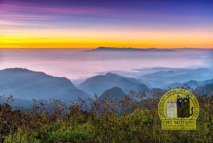
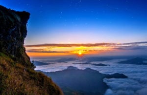
22 Comments
We are a couple traveling from through Thailand and are interested in traveling the Mae Hong Son Loop next week. I have plenty of experience on an automatic scooter/motorbike back home and have been driving in Thailand thus far on our trip, with my partner on the back. My partner has some scooter experience but we’d like to rent a scooter to travel around Chiang Mai to get her more comfortable before setting off on the Mae Hong Son loop. Fully appreciating your disclosure about not renting to first time riders I wanted to ask if getting 3-4 days of practice in Chiang Mai prior to renting from your would be appropriate for experience, assuming we couldn’t rent through you for that period. Alternatively, I suppose we could do a single scooter with her on back, but I suspect that even the larger scooters wouldn’t have sufficient room for even a small bag for our trip. We appreciate any feedback. Thank you!
Hi Bryan!!! I don’t think 3-4 days in Chiang Mai is enough for a novice traveler who has never ridden a motorcycle before to travel the Mae Hong Son Loop. Because of the large number of turns and the traffic patterns in Thailand, it will be dangerous and tiring. However, if you have a huge bag, you can leave it at our office, taking only the essentials on the trip. It is free of charge.
Hello! I’m planning to ride the Mae Hong Son loop and Chiang Rai. I will probably rent a 110cc motorcycle.
My question: Are there gas stations on the way to Mae Hong Son?
Hi, Asrul! Along these routes you can easily find gas stations. But keep in mind that some sections may pass through forests without settlements, and therefore without refueling stations. Sometimes, you can go 30-40 kilometers and meet no one. Therefore, it is better not to allow the gasoline in the fuel tank to run out, especially after you turn off Route 107 onto Route 1095. Also, you can find gas stations on Google Map and the Sigyc App. On the way from Chian Mai to Mae Hong Son there are 29 big gas stations where you can not only fill up your bike, but also buy food, coffee or tea and a variety of snacks to eat at the store (7-Eleven or other).
There are also many village “gas stations” which are the most common 200-liter barrels of gasoline with a hose sticking out of them, but I think you’ll have trouble finding them because they are located inside the villages and not on the roadway. So, I don’t mention them.
If you want to rent a motorbike with automatic transmission, I advise you to rent a motorcycle that has an engine capacity of at least 125cc. As an automatic scooter with 110cc engine capacity will have difficulties in some places, as these roads are very hilly, and the automatic transmission (variator) has its own peculiarities when riding. If you want to rent a bike with 110cc engine, then it should be a motorbike with a manual gear, or semi-automatic transmission.
Hi, Cat Motors Team! Will it be possible to complete the loop in 3 days, skipping some of the destination? Will I miss much if I complete the loop on car instead of bike?
Hi, Han. The Mae Hong Son loop is equally suitable for motorbike and car alike. Sure, you can ride this route in three days if you do not visit Ban Rak Thai and Mae Surin Waterfall. In that case, your itinerary could be as follows:
Day 1: Chiang Mai to Pai.
Day 2: Pai to Mae Hong Son.
Day 3 (you will need to wake up early because you will have to cover about 300 kilometers in a day): Mae Hong Son – Doi Intanon – Chiang Mai
Alternatively, you can skip the sunset at Mae Hong Son and skip visiting the outskirts of MHS (check clause 3.2), in which case you can spend the night in Khun Yuam or Mae Chaem. Then the third day will be less tiring.
Hi Cat Motors Team,
We are couple traveling to Chiang Mai for the second time end of this June. We are interested travelling Mae Hong Son loop by a motor bike for 5 days. We have rented motor bikes many times in Thailand in various location over the last 8 years. Thinking about renting a comfortable motor bike this time as it will be long distance ride.
My question is, We never visited Thailand in June before and is it hard to drive up in Northern Thailand by bike in June considering its rainy season?
We have some big luggages and is it possible to leave them somewhere safe in your shop?
What sort of motor bike you recommend for us two? ( We like comfort rather than speed), I will be driving and I have experience both manual and automatic gear system.
Looking forward to hear from you soon.
Thank you.
Upul G
Namaste, Upul! Although June is considered the rainy season in Chiang Mai, it rains mostly at night, and it rarely rains heavily during the day. So, I don’t think rainy weather can make you uncomfortable. Nevertheless, driving a two-wheeled vehicle on a wet road requires the necessary skills.
We recommend the Honda Wave 125cc semi-auto or the Honda PCX 150cc with rear drum brake if you want to travel together on the one bike. The fact is that this route has steep descents and climbs in some places, and these models of bikes will be the best choice for two people. But if you want to rent two motorbikes, a Honda Click 125cc or Yamaha GT 125cc would also work for you.
And, of course, you can drop your bag in our back room for a few days. It’s free.
If you prefer big bikes, I would recommend Mr. Mechanic or C&P Big Bikes rentals.
Hi,
Is the road to Ban Rak Thai and Pang Ung properly paved?
I have been to Pai and Mae Hong Son before, but this trip will be targeted at Ban Rak Thai and Pang Ung.
So will only be driving from MHS to Ban Rak Thai, stay 1 night then drive to Pang Ung and stay 1 night before returning to MHS.
I am traveling solo, not sure if there is any difficulty driving a car over there, I have driven to Mae Kampung before.
Thank you and looking forward for your advise 🙂
Yeah, the road has excellent pavement, and you can get there without any problems either by car, motorcycle or bicycle.
Hi, do you know where we can find a paper map by GT Rider about the loop? We are already in Chiang Mai.
Hi, Anna! Do you mean this map?
You can purchase this map at the following stores and rentals:
Mr Mechanic
Rental Shop #1
Rental Shop #2
Rental Shop #3
X-Centre (Mae Rim)
C&P Big Bike Rental
Joe’s Bike Team
On The Road Books
Bookzone
Lost Bookstore
Surawong Book Centre
Oh my good, thank you!! 🤩 With your help, I was able to find it today, thank you so much for the detailed answer 🥰
Hi! Good Day to you. What do u mean direct route and scenic route?
Hi, Helen! A direct route is when you drive only on the main road and see the sights along the way. A scenic route is when you leave the main road for 2-8 hours on adjacent roads to see sights not only along the main road, but also others.
Guys,
I just wanted to thank you for a honest online information for people who are travelling on this route. We are riding it now and it saves so much time while planning.
Thanks!
Thank you for your kind words, Pranas! Have an amazing trip!
Hi, Cat Motors
Thank you for this detailed and informative guide on the Mae Hong Son Loop! I’m planning a 3-5 day family trip and debating whether I should include Mae Sariang in my itinerary. Since I won’t be visiting during the wild sunflower (Bua Tong) bloom, do you think it’s still worth stopping there? Or would it be better to take the route back via Doi Inthanon National Park instead? If you were in my position, which route would you choose?
Additionally, we’re planning to rent a car with a driver for the trip. Do you think hiring a guide would be necessary, or would a knowledgeable driver be enough for navigating and exploring the area?
Looking forward to your advice—thank you in advance! 😊
Hello! Thank you for your feedback, we’re glad that our Mae Hong Son Loop guide was helpful! Regarding Mae Sariang – this town has its own atmosphere, but if you have limited time, then the route through Doi Inthanon might be more interesting. Along the way, you can visit famous waterfalls, royal pagodas, and enjoy magnificent views from Thailand’s highest point. Outside of the Bua Tong flowering season, Mae Sariang doesn’t have many outstanding attractions, so if you’re more interested in nature and beautiful landscapes, I would recommend the route through Doi Inthanon. About the guide – if you have an experienced driver who is familiar with the route, that will likely be sufficient. Many places have information plaques, and the main attractions don’t require accompaniment. However, if you want a deeper immersion into the region’s history and culture, then a guide can make the trip even more interesting.
What an amazing post. I have been there twice but only for Pai and Mae Hong Son. I got realized that there is loop when I rent a bike last year. Planning to do for the next visit. The scenery and road is amazing and excited meantime dangerous as written above. I was a witness of three accidents while driving the course. Not only dose the road itself dangerous but also weather is changing crazily. You can experience burning son and pouring within an hour. Fogs are regular customer. If you plan to do with bike, skills are mandatory and would be better to be ready with every circumstance. Hope you had a great trip and experience. Good luck
we are planning to do the Loop on motorcycles over Songkran this year. We are experience bikers and rode in Phuket during Songkran previously…
other than being splashed by water , is there any other concerns (like business closure, heavier traffic) rriding the MHS loop over Songkran?
Riding the Mae Hong Son Loop during Songkran is definitely doable, but there are a few things to keep in mind besides getting splashed. Traffic will be heavier, especially with locals heading home for the holidays, and there’s a higher risk of drunk drivers, so extra caution is needed. Water throwing happens mostly in towns like Pai and Mae Hong Son, but you might still get hit on the road—sometimes with ice-cold water, which can be a shock. If it hits your visor at speed, it can be blinding, so slowing down near villages is a good idea.
Many small businesses and local repair shops may close, though bigger gas stations and 7-Eleven will stay open. Hotels in tourist spots book out fast, so better to reserve in advance. Expect more police checkpoints checking for drunk driving, helmets, and licenses. April is also hot and dry, so staying hydrated is key. The ride can be amazing, but best to avoid riding at night and stay extra alert in busy areas. If you plan ahead and ride defensively, it should be a great trip!